Marine life

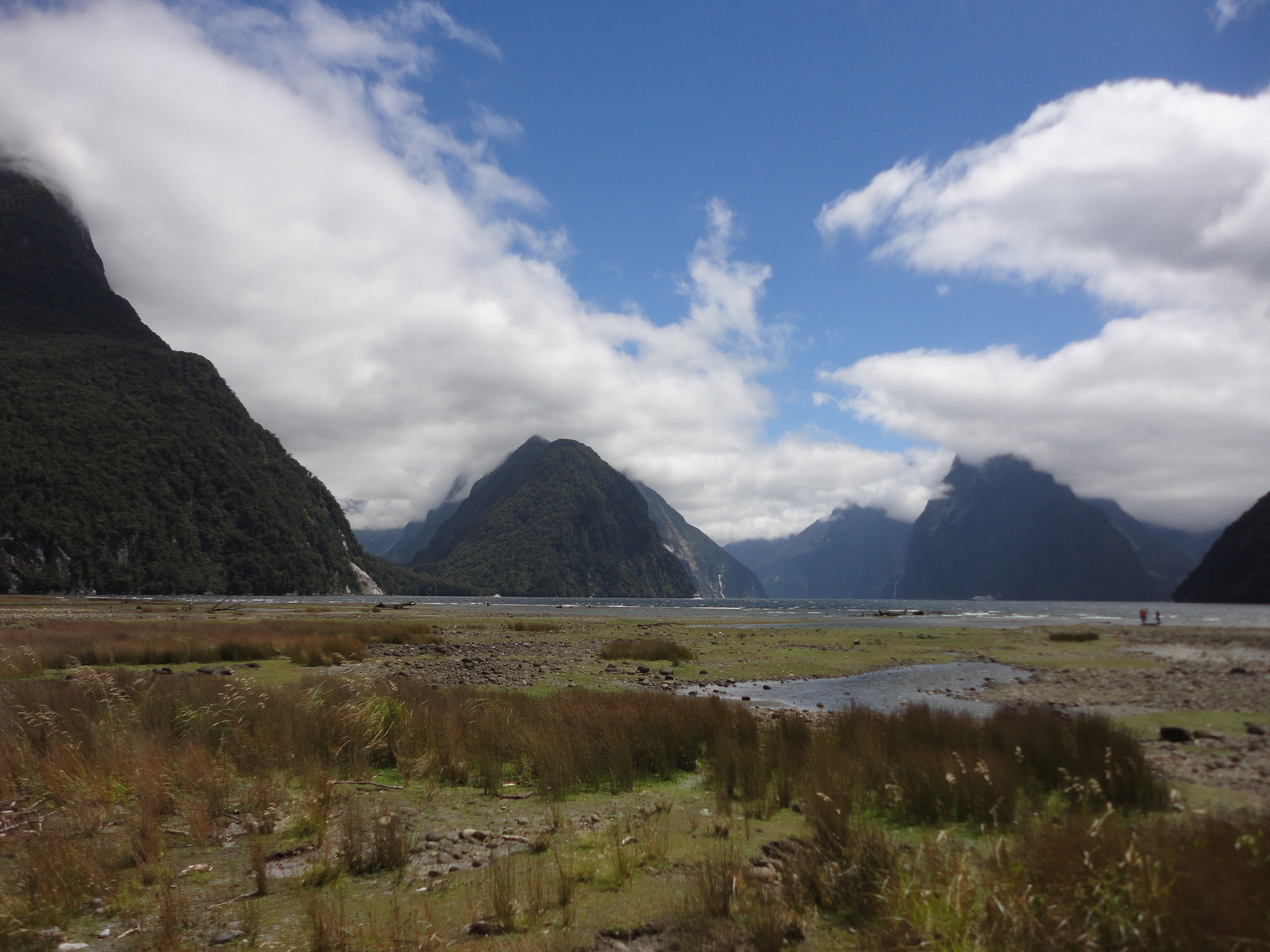
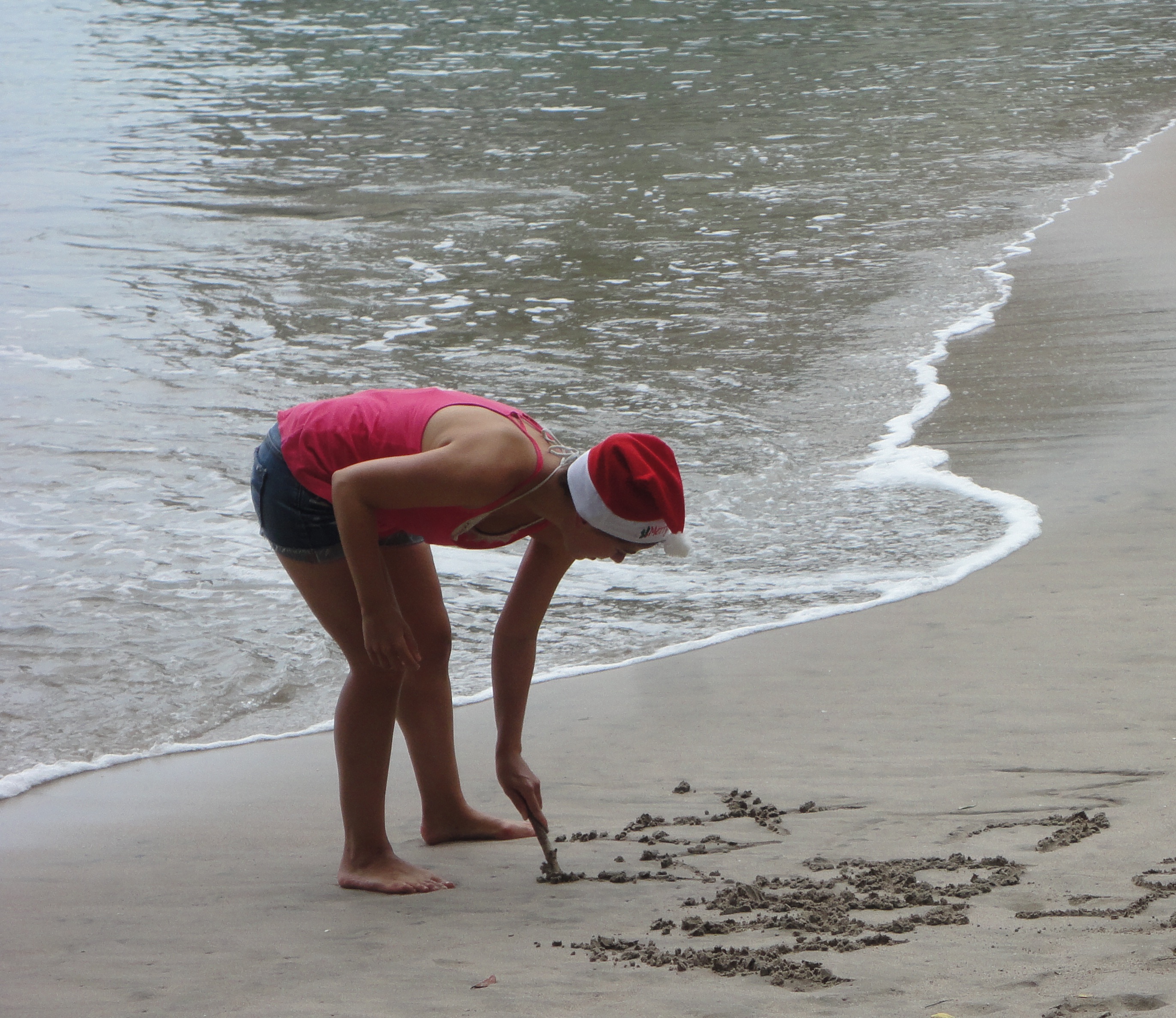
Kaikoura is well known for whale watching. They have migratory as well as resident whales making it an ideal location year round. There is a deep trench very close to the coast where the whales go diving for food. 

The bay of Kaikoura
The bay of Kaikoura

That’s where the tour operator took us. They have several (fast) boats, all equipped with listening devices to make out where the whale has surfaced. Soon enough we were racing to the detected location. Marielle had never been whale watching before, so she was very excited. It is pretty cool watching such an enormous animal from up close and even better when they show their tail once they are going back down. My highlight of that tour was not the whale but the Hector’s dolphins close to the shore. Of course I have seen dolphins before in Australia, but these ones here were much more playful and jumped out of the water.

A Hector's Dolphin jumping out of the water
A Hector’s Dolphin jumping out of the water

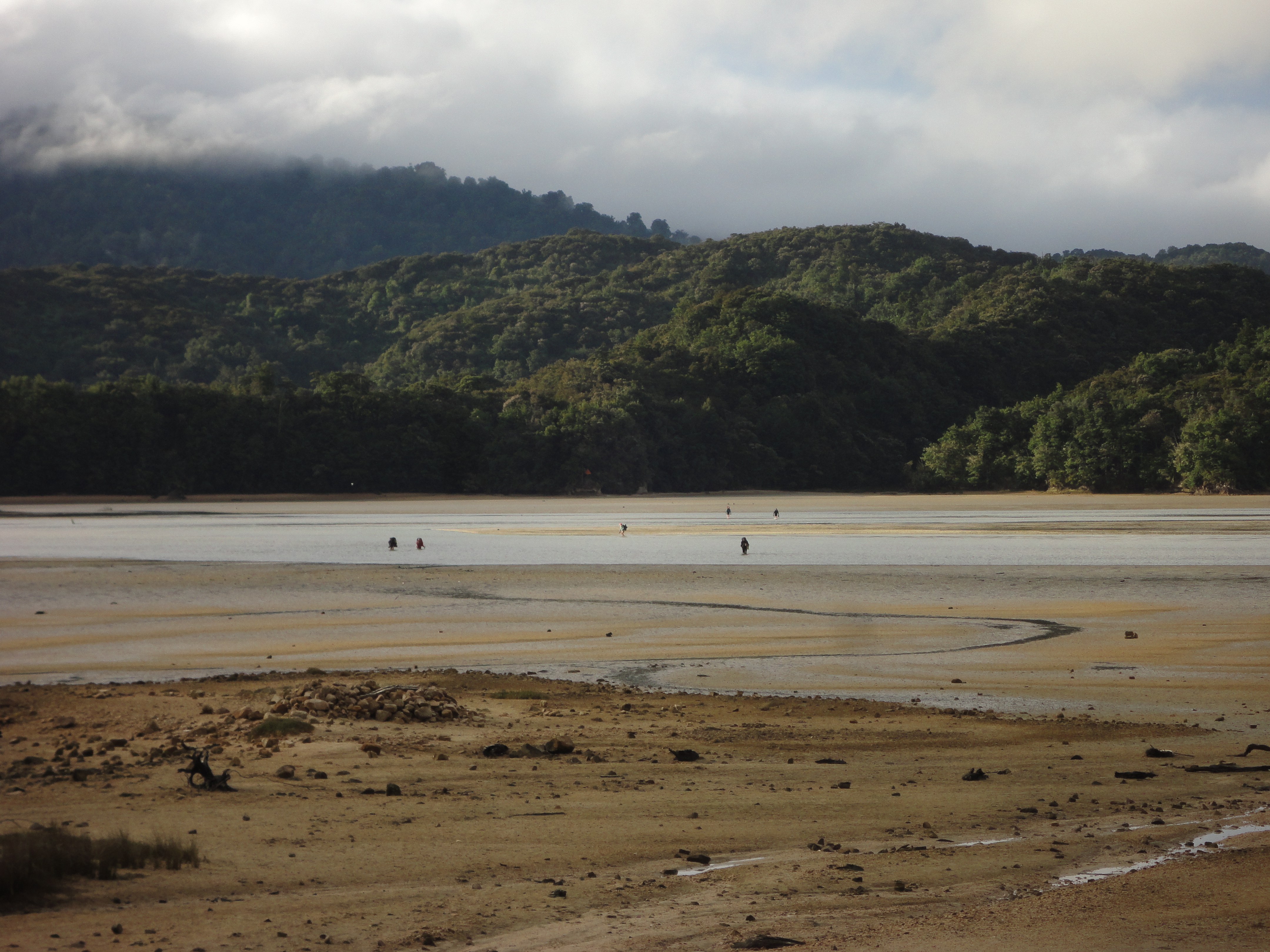
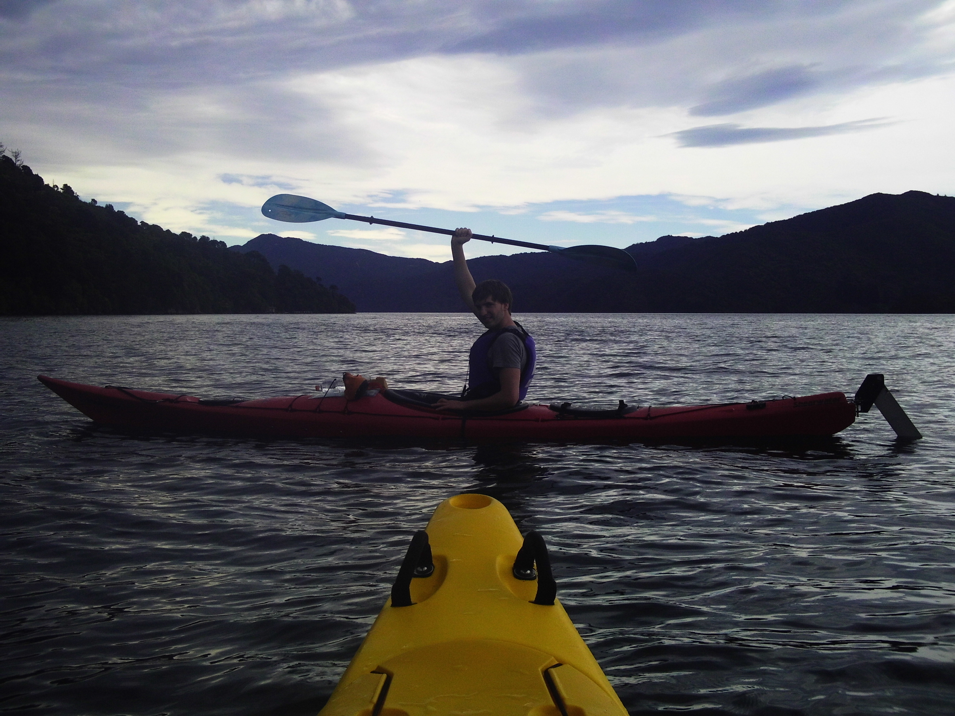
Further north, in the Marlborough Sounds, we went out for another day of kayaking while my parents hiked part of the Queen Charlotte Track. We paddled to a small peninsula, which is supposed to be a bird sanctuary. The pest and predator proof fence, keeping possums, rats, goats and other unwanted animals out, has only been errected last year. The birds still need to recognize it as a safe place as there were not many around. The dolphins that live in the Sounds didn’t show up either, but it was still a great day out on the water.

Kayaking in Queen Charlotte Sound, part of the Marlborough Sounds

The next day we took the ferry back to the north island. Unfortunately we didn’t have the time to spend another night in Wellington, so we just had a quick look at this great city. This time the weather was also quite nice so that we could enjoy a short walk along the artsy Cuba Street on our way to Te Papa. 

Wellingtons artsy waterfront

Te Papa is a national museum for nearly everything. It’s very large and impossible to visit in one day, let alone one hour that we had. So we picked the “Awesome forces” exhibition on volcanos, earthquakes and other natural forces. They even had a tiny house to experience an earthquake (scale 1:50). We also had a glance at “Mountains to sea”, where they have a colossal squid (5m), which is believed to be only half the size of a fully grown animal.

One of New Zealands finest museums - Te Papa
One of New Zealands finest museums – Te Papa

Rise and fall on the south island

Further south we spend one day exploring the famous Milford Sound. The best way to do that is by kayak instead of taking a bigger boat. Before we got the kayaks into the water we had to endure a massive attack by sandflies, which take a bite at every piece of skin they can make out. Surprisingly, once on the water there were almost none.

Presenting the new fashion styles (also helpful with sandflies)

The weather for that was almost perfect as we didn’t have any of the more than 7000mm of rainfall they get here every year (in comparison, Hamburg has about 800mm). However, the almost vertical mountains that rise up to 1600m from the sea were not visible for most of the tour. We learned  that the shape of the valley indicates glacial activity rather than the work of a river, making it a wrongly named fiord. Once the clouds were parting around midday it was quite an impressive sight.

The majestic Milford Sound

On our way to Christchurch we stopped by the Moeraki Boulders, large round rocks with a diameter of up to two meters. They formed around small rocks or shells over a few million years. They have been exposed at the beach by erosion of the soil surrounding them.

Marielle and the Moeraki Boulders

Christchurch itself is very fascinating. It started out with getting lost in all the one-ways that have been installed since the publication of our map in 2010. This is mostly due to the two large earthquakes (in 2010 and 2011) close to the city. Afterwards, about 80% of the buildings downtown were considered to be instable. Some of those buildings have been taken down already, others are still surrounded by construction fences or are being torn down right now. The new spaces are used e.g. for parking lots (there are quite a few of them around, definitely more spaces available than cars). The construction works are responsible for the one way streets as all the equipment is blocking one side of the street.

The badly damaged Christchurch cathedral

But the people of Auckland have been very resilient, giving the city a spirit of hope instead of emptiness. One area has been used to set up a bunch of shops, stores and eateries in standard shipping containers. Additionally they have a great exhibition on the two earthquakes in a small new museum. The spiral of the cathedral completely collapsed after the second earthquake and the main building was also badly damaged. Therefore, a new (temporary) cathedral was built for the services to continue. All in all it’s quite impressive to watch the city rise again.

Re:START - the container concept in downtown Christchurch
Re:START – the container concept in downtown Christchurch

Hiking the Able Tasman Track

From Wellington Tim, Marielle and I traveled to the Able Tasman National Park (located on the south island) by boat, bus and hitchhiking. It is not far in distance but it took most of the day to get there. At the park we met Daniela and Manuel, who were also spending a bit of time there.

Hitchhiking to Marahau, the beginning of the Able Tasman Track

We stayed the night at the Tinline campsite and set off the next morning. This time we realized how heavy our backpacks really were – we had to carry everything for the next two days with us. Tim and I have done trips like this before, but it was the first multi-day-hike for Marielle. Luckily we only had to cover four hours that day.

Tinline Bay
Tinline Bay

We spent the afternoon relaxing at the beach. I turned into a pregnant woman while Tim was buried in a short sarcophagus and Marielle was crawling around as a crab. Afterwards we jumped into the water to wash off the sand, but we didn’t stay very long because it was quite cold.

His Highness Pharao Tim the Short

The following day was our longest hike. We had to book the campgrounds in advance and we were a bit late on that so most of them were already fully booked. We took the closest one still available, which was still more than 30km away. In the end we found out that the rangers are quite flexible and will allow you to stay at other campgrounds. It’s not a big problem because all campgrounds are quite large for the maximum number of people allowed at that location.

It's not all about beaches on the coastal track
It’s not all about beaches on the coastal track

On the last part of the hike there is a big tidal inlet that needs to be crossed. We arrived early in the afternoon an were hoping to cross it around 7pm, two hours before low tide as suggested online (it’s safe to do so at low tide +/-2 hours). On the other side were people waiting as well, who started the first attempt around that time and were waist-deep in the water. When we went an hour later it was only knee-deep. We kept walking for two more hours before reaching Totaranui campsite when all the light was gone.

Watching people get into waist-deep water at the Awaroa tidal crossing

After a short night we set out early to meet my parents in Wainui Bay. It worked quite well and they arrived at the parking lot at exactly the same time as we did.

Sunrise at Totaranui

Parents and siblings

My youngest brother Tim, who went to New Zealand for one year of highschool, and my parents showed up for new year’s eve. Tim’s original idea was spending the day in Sydney to watch the fireworks over the harbor. Due to different reasons this didn’t work out. Maybe it was better this way, because I heard that you need to spend the whole day to secure a good spot at the harbor. This may be doable under normal conditions but probably not after a 30 hour flight.

Viewing the city from above
Viewing the city from above – on top of the Sky Tower on New Year’s Day

Instead we climbed Mount Eden along with hundreds of others to have a good overview of the city. At midnight there were fireworks from the Sky Tower which were small but quite nice. The private fireworks were really small and stayed below the height of the surrounding houses and definitely not as much as in Germany. It was also very quiet, despite the number of people, because drinking in public is not allowed.

Watching the fireworks from Mount Eden

After having a look at Auckland the next day we headed south, where we met up with Tim’s hostfamily from 2008/09. They are very nice and we’ll meet them again when we get back to the north island.

Two of New Zealand's "Three Sisters"
Two of New Zealand’s “Three Sisters”

On our way to New Plymouth we had a look at the Three Sisters. This time they are part of a rugged coastline just a few kilometers north of the city and not as touristy as the ones in the Blue Mountains. Also, only two sisters are remaining since one of them collapsed a few years ago.

Majestic Mount Taranaki towers above the clouds

If the weather is good you’ll get a glimpse of the picturesque Mount Taranaki close to New Plymouth. During our half day hike in wind and rain at the north face of Mount Taranaki we did not see anything above us. Later that day we got to see it from a distant.

Christmas and Dooms-Day

On my last day in Auckland I had to try out one of my birthday gifts – a day of surfing. Kevin, who already joined in for the bungee jumping earlier, was up for trying it as well. We spend the whole morning and afternoon at Piha Beach, where we got private lessons on how to ride on a surf board (up to eight people are in these lessons, but this day there was no one else).

Riding the surf at Piha Beach

Then, once again I got a very cool (early) Christmas present – Marielle arrived in Auckland on the 23rd of December. Instead of showing her Auckland and its surroundings we went straight to the Coromandel peninsula. It’s a nice area to the east of Auckland and supposedly all the people from Auckland go there over Christmas and New Year’s. Luckily that was not the case, or at least it didn’t feel like it.

Merry Xmas! Everyone loves to wear santa's hat on Christmas Day...
Merry Xmas! Everyone loves to wear santa’s hat on Christmas Day…

After three days we went to Taupo, a city in the centre of the north island. It’s one of the extreme sports capitals in New Zealand, but we didn’t come for that. On the contrary, we took a relaxing (electro-powered) sailing boat trip to the not-so-ancient Maori carvings. They are still very impressive, but not as much as they would be if they were a few hundred years old. The carvings, more than 10m in height, were made by local artists in the late 1970s.

The Maori carvings at Lake Taupo

Then we wanted to tackle New Zealands most famous day hike, the Tongariro Alpine Crossing. We met two more Germans, Rainer and Karin, and set out for the hike. It’s quite a long hike, but it’s very nice if you try to blend out the hundreds of people that are doing the hike with you. Actually, we found out that if you start around 10am, most of the tourists will be ahead of you, so it’s much better to go a little later. The only problem is the parking situation at the start and finish of the trail. I expected a parking lot similar to those at ski resorts, but these ones had only enough lots for about 20 cars… All the 150 other cars parked in places where it was not allowed to park.

Hiking with Marielle, Rainer and Karin (and a ton of other tourists) next to Mt. Ngauruhoe, known as Mt. Doom from Lord of the Rings