After returning from the “Colca Canyon”, we still had the evening to explore the busy streets of Arequipa. While Bastian and I were waiting for Madalina, who involuntarily got a two hour guitar lesson from her roommate, we were having a look at the different happenings around the central square: There was a small gathering for “Earth hour”, which was not really effective, as all the lights of the city remained on and their candles were constantly extinguished by the wind.
The organizers of “Earth hour” in Arequipa had problems with the wind
And then there was a march of the soccer fans of the local team, shouting and lighting fireworks as if it was a match day, which it wasn’t. We couldn’t find out what they were celebrating, but it surely was fascinating. When they were gone, Madalina finally arrived and we went for some Chinese food and afterwards for Peruvian drinks, like “Pisco Sour” and “Chilcano”, at a French restaurant.
The fans of the “FBC Melgar” were celebrating with flags and fireworksTasting the Peruvian national drinks “Pisco Sour” and “Chilcano” (photo by Bastian Waldhof)
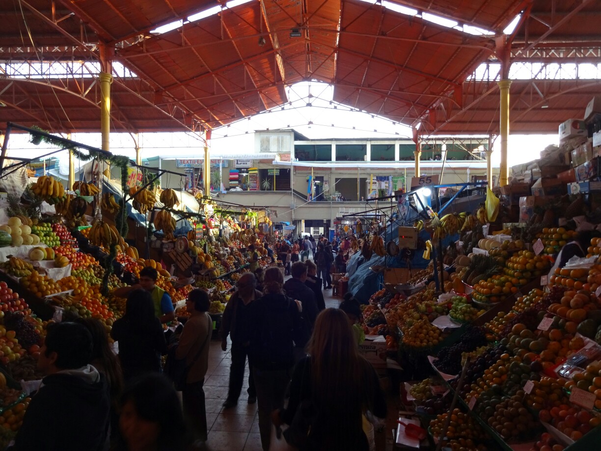
The next day we had planned to go on a free walking tour, but the guides seemed to be a bit unorganized, as none of them showed up. Instead, we went to the market for a second breakfast. The freshly made juices are just amazing and with a free refill it’s the perfect fruit serving for the day. And we also got to try the “Queso helado”, which is not actually frozen cheese but homemade ice-cream with cinnamon, a desert that Arequipa is famous for.
The fruits for our juice came straight from the marketMadalina and Bastian wanted to try “Queso helado”
In the afternoon we tried to join a different free walking tour. This time it worked and we discovered the northern part of the city, which we hadn’t seen before. After a quick stop at the “Mundo Alpaca”, a museum for alpacas and alpaca products, we continued across the river to the viewpoint of Yanahuara. It lies a bit elevated and allows for a good view over Peru’s second biggest city.
Arequipa as seen from the viewpoint of YanahuaraThe richly decorated outside of the “Iglesia de Yanahuara”
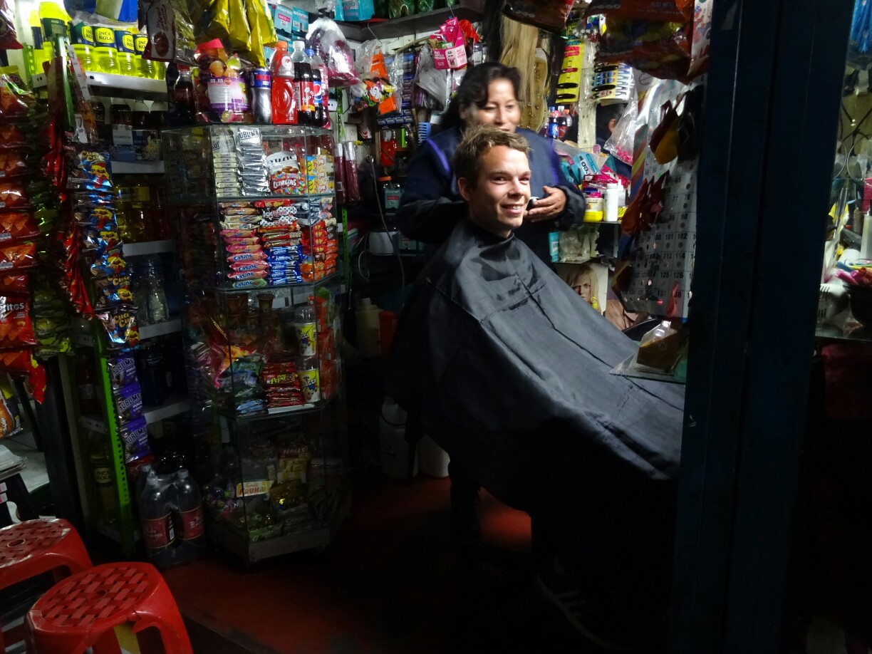
Last but not least we wanted to check the quality of Peruvian hairdressers – Madalina and Bastian wanted to get a haircut, while I could use a beard trimming. Although most hairdressers are closed on Sundays, we did manage to find some open ones. They were hidden in a little passage and were cornerstore and hairdresser in one. Madalina and Bastian gave it a try, but I was a bit more skeptical and decided to go for the men’s hairdresser a few houses down the road. While Bastian and I were happy with the result, Madalina wasn’t, although it looked perfectly fine to us.
Hairdresser or cornerstone? Both is possible in PeruGetting ready for Canada (photo by Bastian Waldhof)
Afterwards it was time to part: Madalina and Bastian took a bus to the coast and I was headed for the airport. I had decided to fly back to Lima to avoid any problems with flooded roads, like friends had experienced on that route a few days earlier. And even with an hours delay it was still much faster, as it also saved me the 17-hour bus ride, which it would have been otherwise.
Bastian and I arrived in Arequipa, Peru, in the late afternoon and decided to go on a tour to the “Colca Canyon”, which would start the next day. The canyon is the second deepest canyon in the world and is located a few hours north-west of Arequipa. Without much sleep we got picked up at 3 a.m. the next morning. After driving all around town to pick up the other people, the bus took us to Chivay for some breakfast.
Looking down into the “Colca Canyon”
Not too far down the road we stopped at the “Cruz del Condor”, the condor’s cross, a popular spot for watching these majestic birds. But that day we could only see tourists, not condors at this viewpoint. As our tour guide Jean-Carlos explained, most condors migrate to the ocean during the rainy season to feed on the placentas of seals and sea lions, after they gave birth to their offspring.
No condors were to be seen at the “Condor’s Cross”Watching for condors with Madalina and Bastian
Close to Cabanaconde we started our descend. We seemed to be the last group for that day and soon we were all alone. Not far down the trail we paused, as we had seen large birds circling below us. As they got a little closer, we could make out the distinctive white coloring on top of their wings, telling us that they were condors. It was an awesome feeling to see four of those majestic birds all on our own as they seemed to own the canyon. At that moment it felt like “Condor Canyon” would be a more appropriate name.
A small path winds down on the side of the canyonAnd then we did see the majestic condors
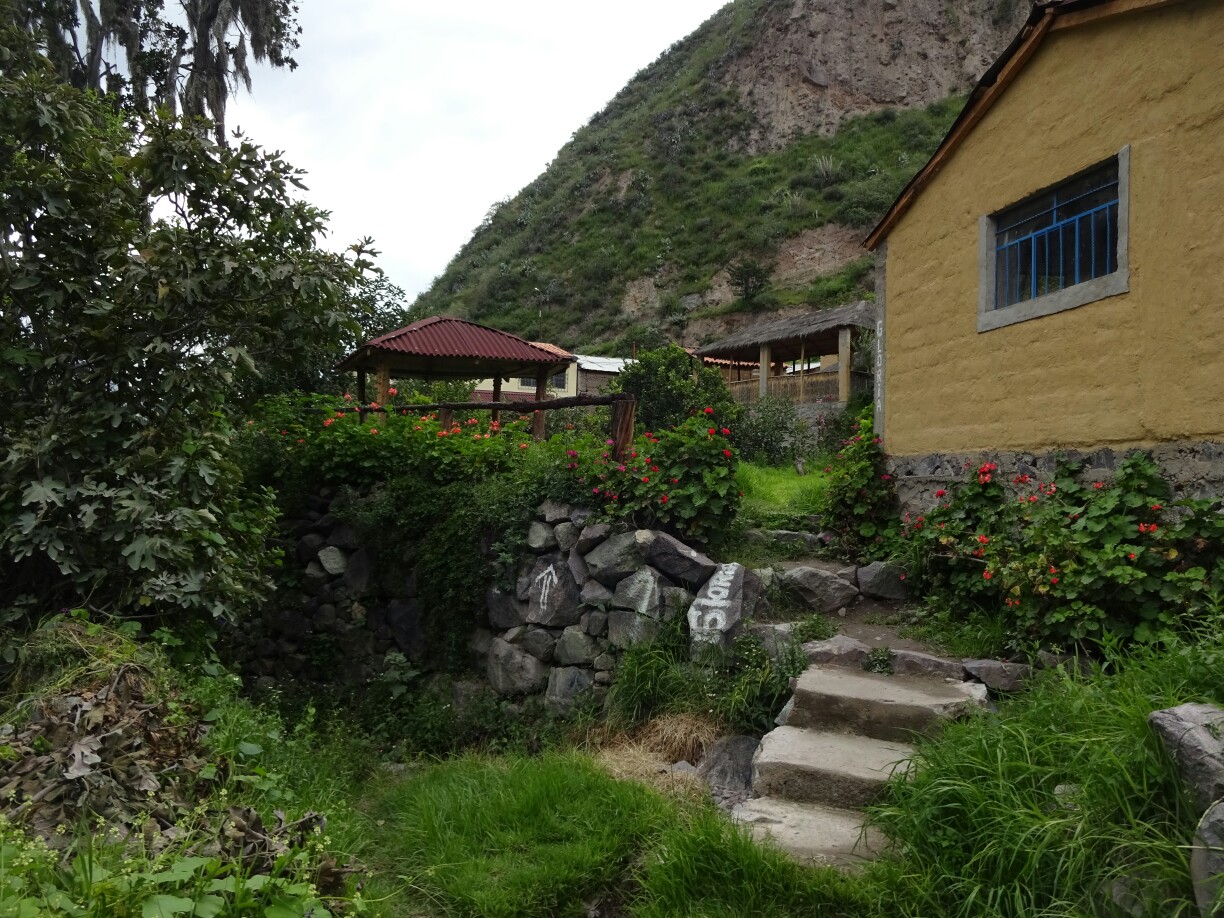
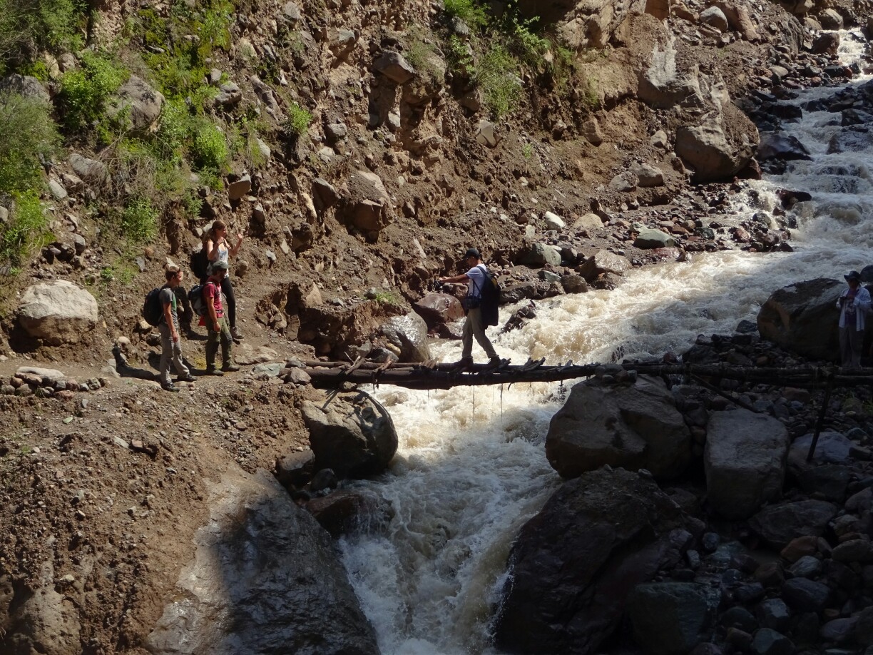
We continued our descend and were happy to reach the bridge across the river after losing 1100m of elevation while constantly hiking downhill. The suspension bridge across the fierce brown waters was in much better condition than on the “Inca Jungle Trek” and we reached the other side without a problem. A few minutes later we had reached our accommodation for that night.
Crossing the wild river by suspension bridgeWe reached our accommodation just before the rain started
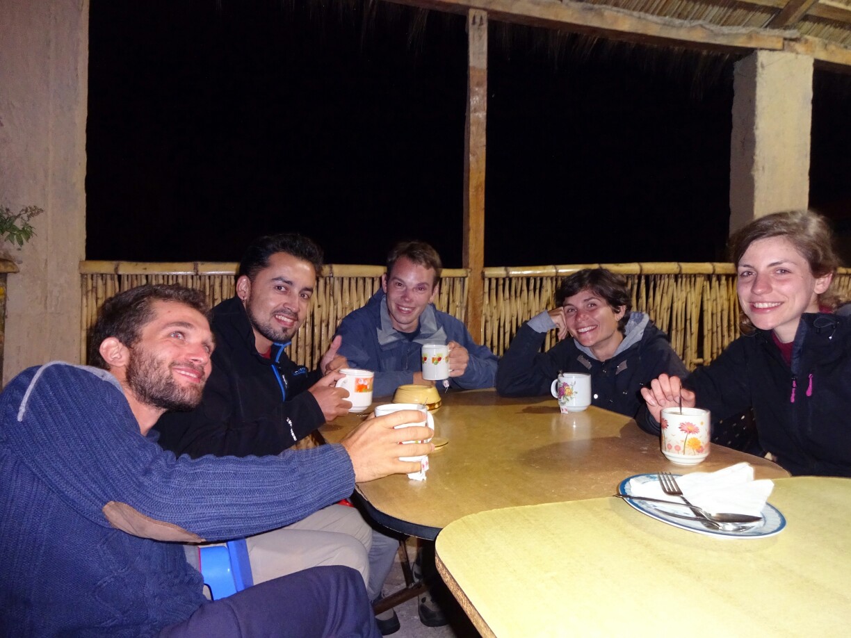
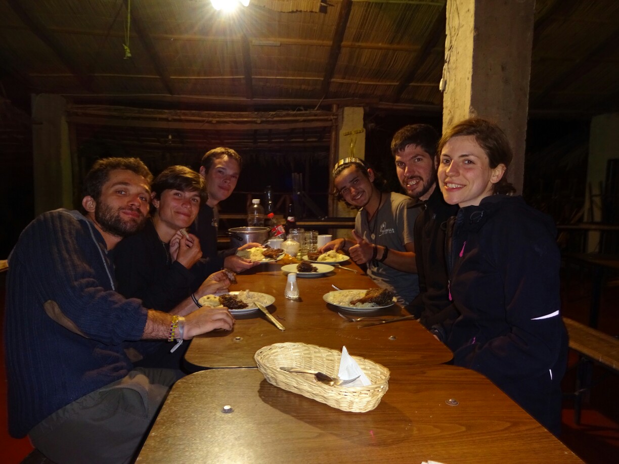
However, all further hiking plans were abandoned as it started raining during our lunch break. Instead Alice and Alessandro (Italy), Remy and Manon (France), Madalina (Romania), and Bastian and I (Germany) discussed European politics until nightfall, when dinner was served and the rain finally stopped. Unfortunately, Nelson (Chile) and Jean-Carlos (Peru) were too tired to join the conversation for some non-European views on the issues.
Interesting discussions with Alessandro, Nelson, Bastian, Alice and MadalinaRemy, Manon and I were at the other end of the table
After a good night of sleep, we woke up to beautiful sunshine and a bright blue sky. With a delicious pancake breakfast, everyone was ready to tackle the day’s hike. As we walked through the canyon, following the river downstream, we learned about the different fruits and plants that are grown here. We also learned about the little man-made caves, where the native people would store their seeds for the next seeding period or just to hide them from the Spaniards. These caves are called “colca” and gave the canyon its name – “Colca Canyon”.
A wonderful morning below the steep basalt cliffsThe little caves gave the “Colca Canyon” its name
Around noon we started to pick up cactus fruits as dessert after lunch. By the time we had filled our bag, we had crossed the river once again. On the other side of the river, elevated and in a riverbend lay a small oasis, which must be even more impressive during the dry season, when the rest of the canyon is brown and dry. To us it was still a little paradise with sunshine, swimming pool and free delicious mangos right from the tree.
We also came across a more basic bridgeWe were happy to spend half a day in paradise
In the afternoon we met Alex, a 19 year old guy traveling through Peru all on his own. A few days before he had bought a live guinea pig, as he wanted to try this Peruvian specialty. He had been looking for people to share it with and we were willing to pitch in. The former owner had told him exactly how to kill, skin, gut and prepare the animal, but we were still happy for the two Gauchos that Alex was staying with, who helped us with everything and knew exactly what they were doing.
Bastian holding on to Carnal
Luckily we were able to use the kitchen of our hostal after the regular dinner was served. We seasoned and fried the guinea pig and had it with rice and yucca as our second dinner. To me it wasn’t tasting like much and it had way to many bones for the little amount of meat that was on it. It was definitely a very interesting experience, but I wouldn’t order another guinea pig in a restaurant. Nevertheless, it added another nickname to the canyon – “Cuy Canyon”, which is Spanish for guinea pig.
Bastian and Alex preparing the guinea pigWe shared four servings of this Peruvian specialty
The next morning we had to get up before sunrise once again. For the next two and a half hours we climbed back up to Cabanaconde. Along the way we could have hopped on one of the “live taxis”, that take supplies down into the canyon and come back up with an empty saddle, but all of us made it without additional help. By the end we were still happy to get some breakfast, which we had been waiting for since 4:30 a.m.
No one of our group needed a ride with the horse taxisWe reached the rim as the sun emerged from behind the canyon walls
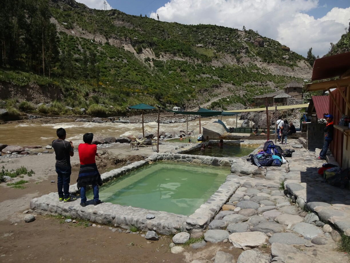
On our way back to Arequipa we stopped for a view of the “Colca Valley”, which is upstream from the canyon and much wider. Afterwards we visited the hot springs right by the riverside to relax our muscles for a bit. Together with another stop at 4900m, the highest point along our route, and one more for some llama-selfies, this day was also pretty action-filled and all in all we were quite happy with the value of this trip.
The “Colca Valley” is much wider than the “Colca Canyon”The hot springs are located right next to the river
From San Pedro de Atacama I took a night bus to the Chilean costal town of Arica. I arrived there while it was still dark outside, so I waited for the sun to come out. The hostal was not far from the terminal and I arrived there just in time for breakfast. Here I also ran into Fabio from Brazil, who also had been on the tour through the Salar de Uyuni. We wanted to explore the city and two Belgian guys joined us.
In Arica I’m back at sea level after weeks of being high up in the AndesOne day was enough to see the main attractions of Arica
Even though Arica is right at the coast, it does get pretty hot during the day, as it is surrounded by desert. During the “War of the Pacific” it was the scene of an important battle between the Peruvian and the Chilean troops in 1880. Back then the “Cerro Morro”, a hill overlooking the city, was occupied and the former Peruvian city now belonged to Chile. Nowadays, there is a small military museum on top telling the story of the battle.
Arica used to be Peruvian territory until the “War of the Pacific”The town with its strategic harbor is located in the middle of the desert
Back in town we visited the “Catedral San Marcos”, a little Gothic-style church made from cast iron. It was designed in 1870 by Gustave Eiffel, the French engineer, who would later provide the design for the Eiffel tower. After prefabrication in France it was shipped all around the globe to be assembled here on site. It’s now one of the nicest buildings in town and blends in perfectly with the colonial style architecture.
The “Catedral San Marcos” was designed by Gustave EiffelThe church is mostly made of cast iron
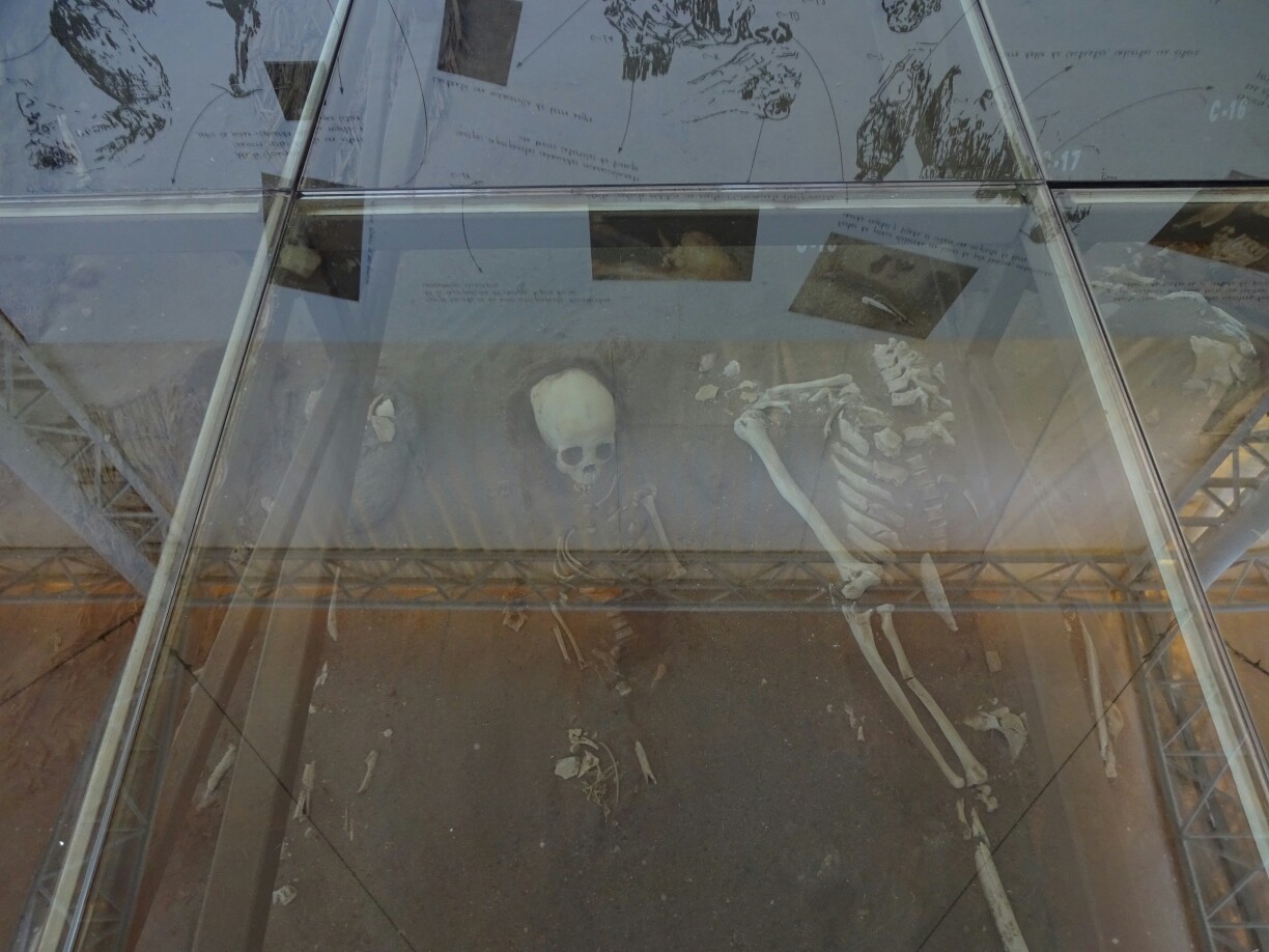
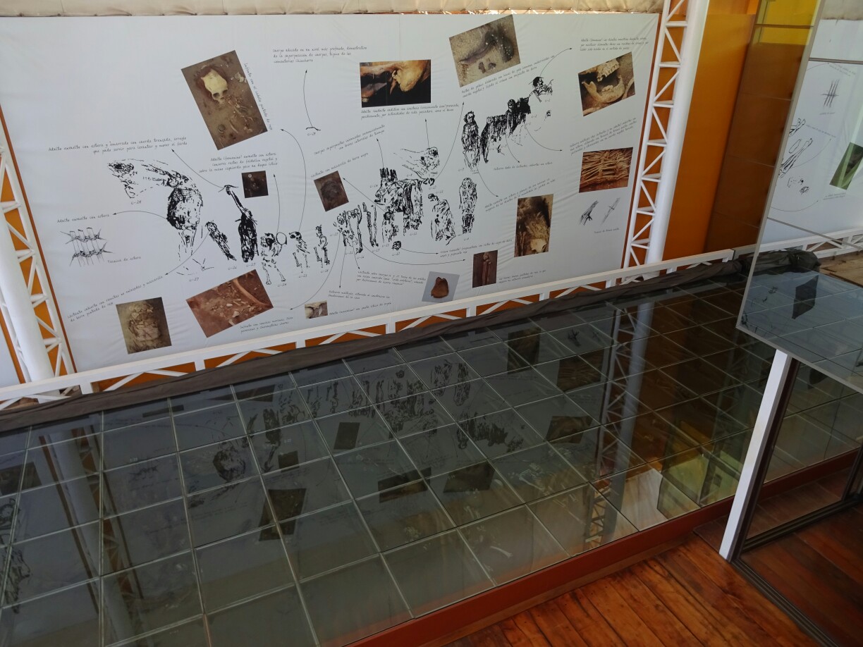
After a quick stop at the indoor market for lunch, we visited a small pre-colombian museum, the “Sitio Colon 10”. The name of the museum is the address of this former town house. A few years ago the owner wanted to remodel the house and found several dozens of mummies from the Chinchorro culture (5000-3000 BC) buried underneath. The demolition was stopped and the house was turned into a museum.
The mummies at “Sitio Colon 10” still have thick hair covering their skullDozens of Chinchorro mummies were found underneath this town house
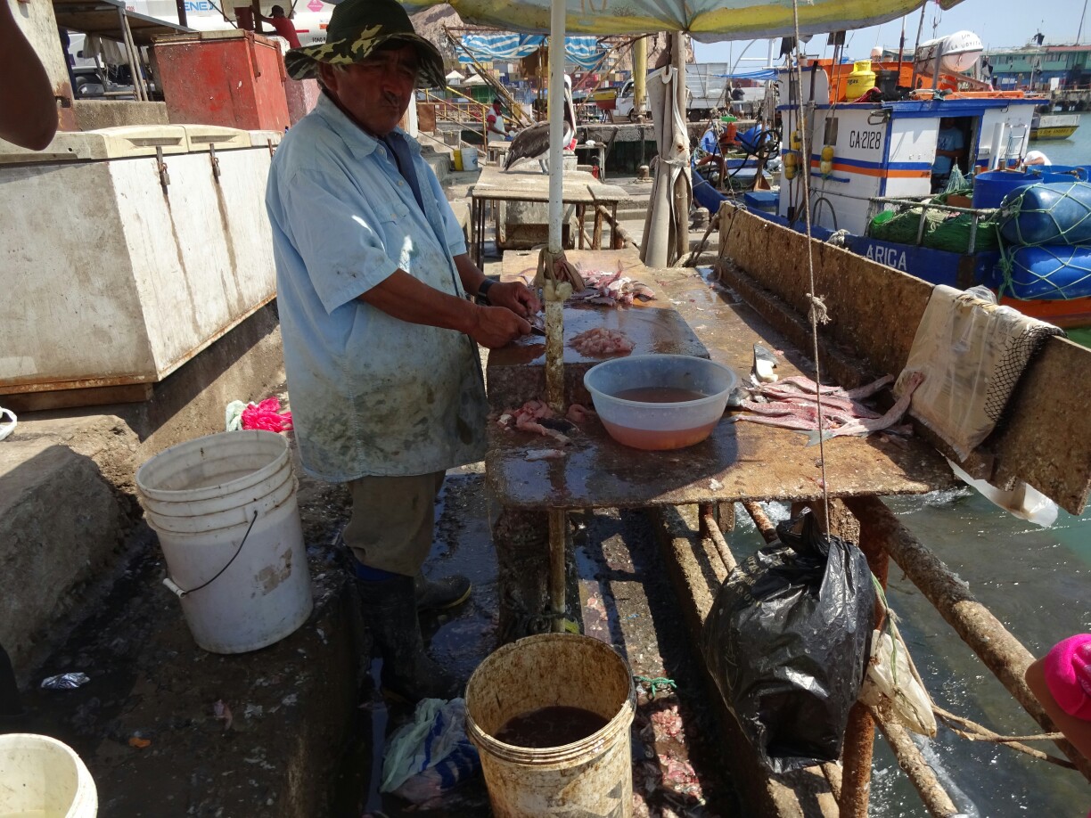
In the afternoon we also had a look at the harbor. During the morning hours, a large fish market is held here, but now there were only few fishermen left cleaning up the place. This attracts not only pelicans and other birds, but also several large sea lions, whose strategy is simply waiting. They know that sooner or later they’ll get their share.
Only a few fishermen were still in the harbor, cleaning up their catch of the dayThe sea lions were happy to finish any leftovers
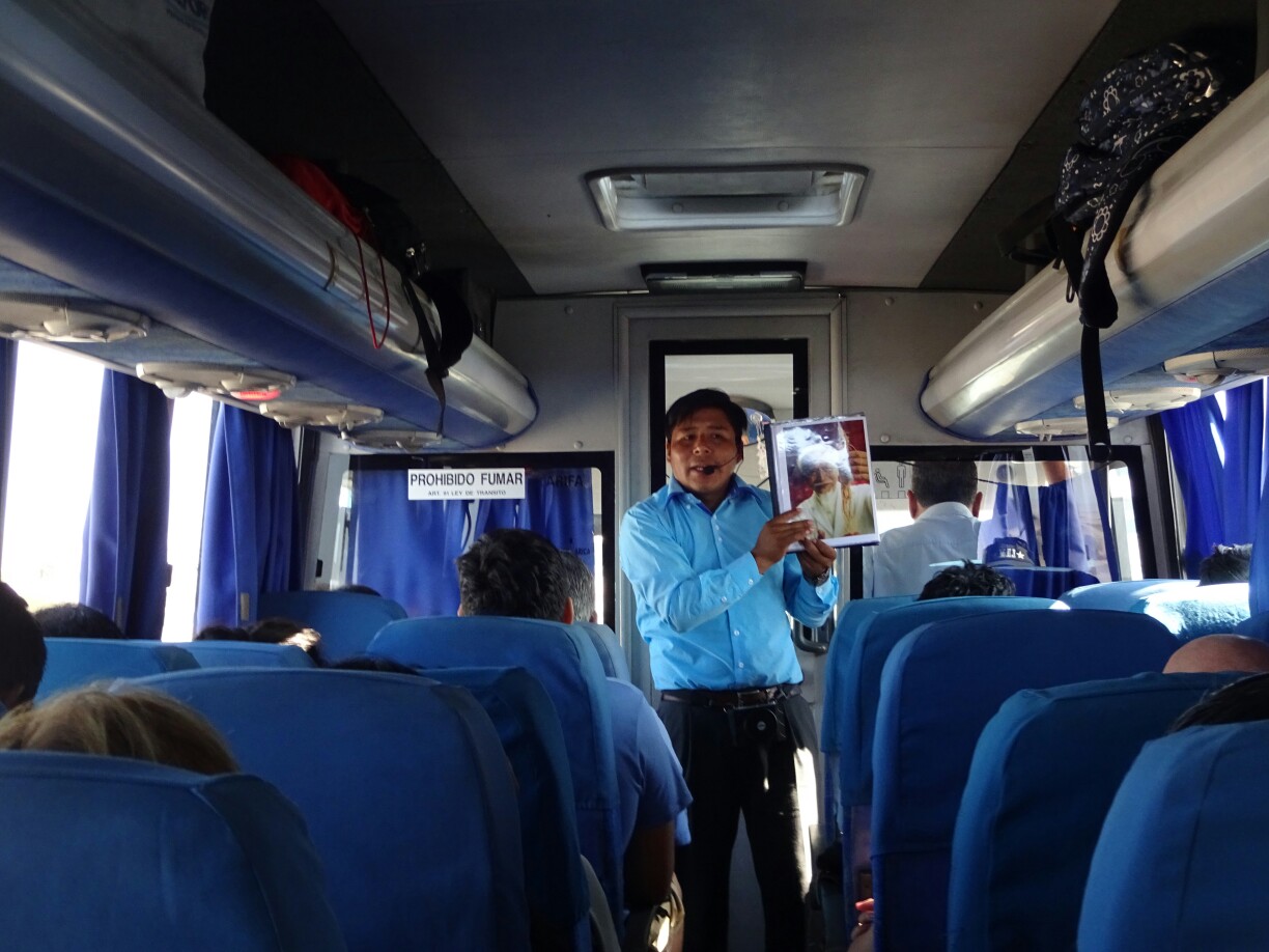
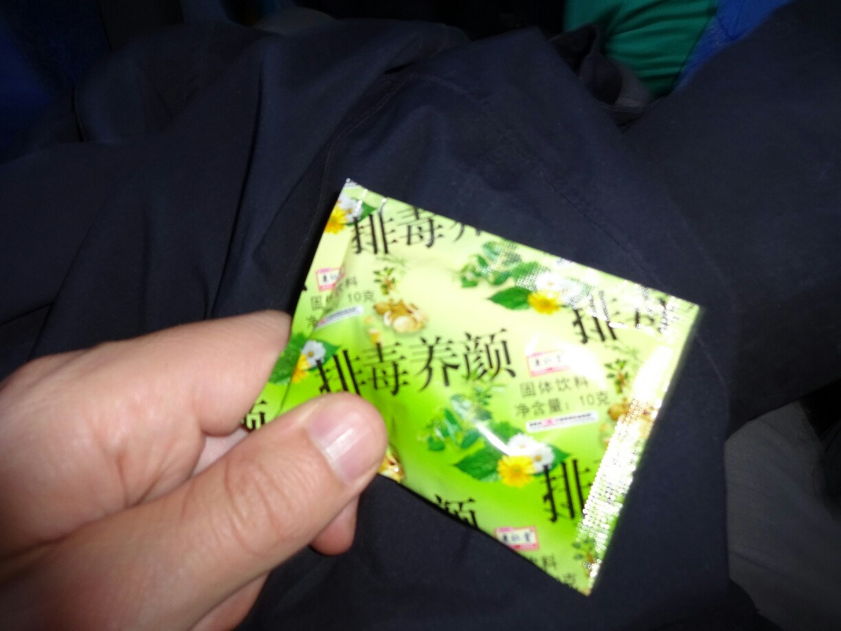
Back at the hostal I met Bastian from Germany, who also wanted to cross over to Peru the following day. That morning we caught a local bus heading for Tacna, the closest Peruvian town behind the border. Crossing the border was fast and easy, much to our delight. Just after, a young man entered our bus and started talking about bad eating habits and the diseases that come from them. We were fascinated about this free health education, but were a bit disappointed that it turned out to be part of the sales strategy to sell his magic products.
What seemed to be a free health education was in fact only a selling techniqueThe packages on sale were not legible, but supposedly contained stevia, a natural sweetener
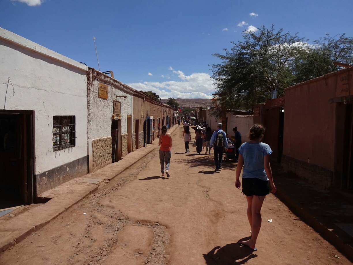
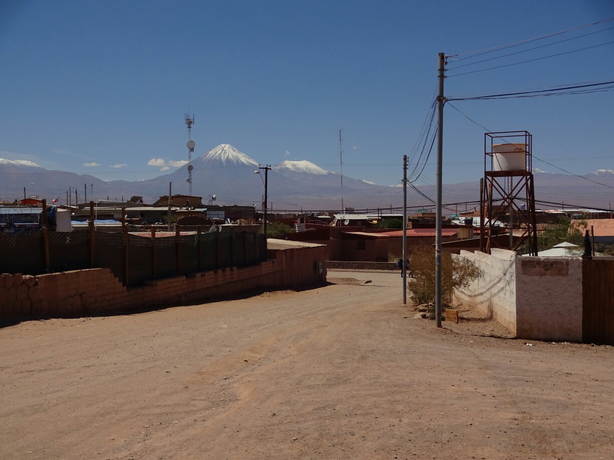
We had decided to take the one-way tour from Uyuni, which brought us to San Pedro de Atacama in the very north of Chile. We reached the town in the early afternoon and were quite happy that it greeted us with the warmth and sunshine that we had been missing for the last weeks. At about 2400m, San Pedro is much lower than all the places we had been to since Cusco, so it was naturally warmer.
Strolling through the dirt roads of San Pedro de AtacamaThe prominent Licancabur volcano reaches almost 6000m
In the evening we were still sitting outside in the courtyard of our hostel, when we heard some live music playing somewhere. As we went over to have a look, it turned out to be a “St. Patrick’s Day” celebration in the bar next door. And although we were a bit tired, we decided to join, which turned out to be a lot of fun. Unfortunately though we didn’t find the four-leaf clovers, which would have gotten us some free drinks.
The bar around the corner was celebrating “St. Patrick’s Day”
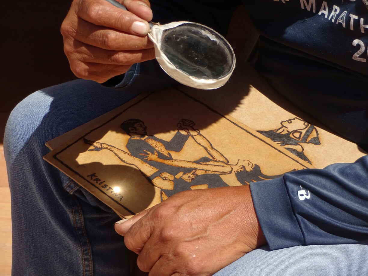
The next day we booked a tour to the “Valle de la Luna”, the moon valley. As the tour wouldn’t start before late in the afternoon, we walked around town for a bit and found a really cool shop just outside our hostel. And while Dani got a handmade top, Krissi went for a black and white picture on plywood. What made it so special was the fact, that the shop owner was burning the picture into the wood by using a simple magnifying glass.
Using the sunlight for drawing picturesKrissi got one of the plywood pictures with her name engraved
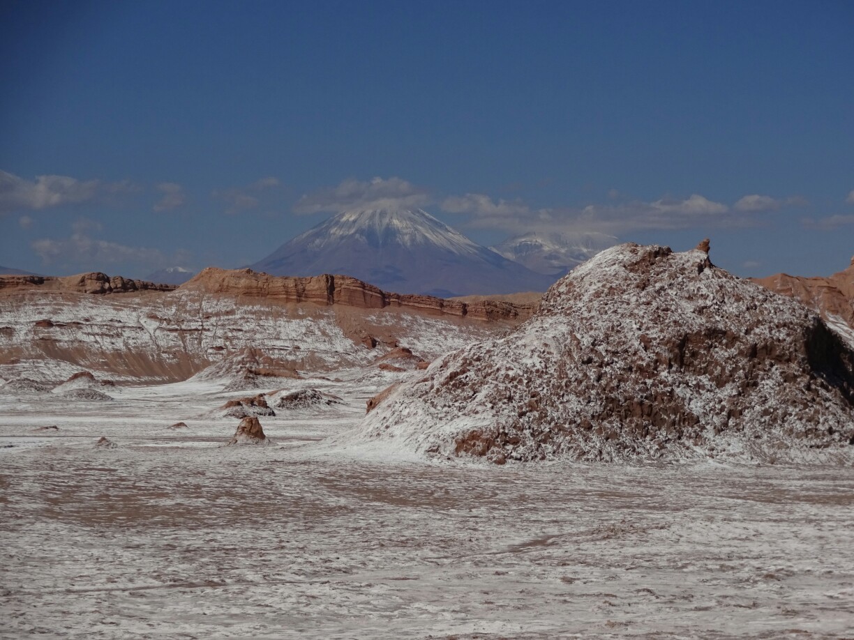
The tour of the moon valley was very interesting as well, as it rained just before we had arrived in San Pedro. The rain had washed out the salt from the rocks and as the water evaporated, the salt remained on the surface of the rocks, creating a white cover that almost looked like snow in the desert. And although this is one of the driest deserts of the world, rain is not uncommon in San Pedro between December and March, however only in small quantities.
What looks like snow is actually deposited salt crystalsThe bare landscape of the moon valley
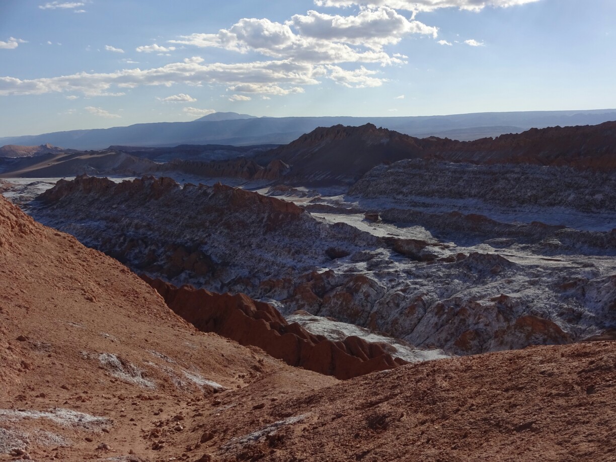
During the tour we had a look at the different rock formations – steep crater walls, eroded rocks supposedly looking like three virgins, and high sand dunes. Somehow our tour guide always managed to avoid most of the crowds that were with us in the park, which we were quite happy with. Only the last stop seemed to be identical for all tours, as everyone turned up at a cliff overlooking the moon valley to watch the beautiful sunset over the desert landscape.
The craters and sand dunes were quite impressiveSunset over the desert
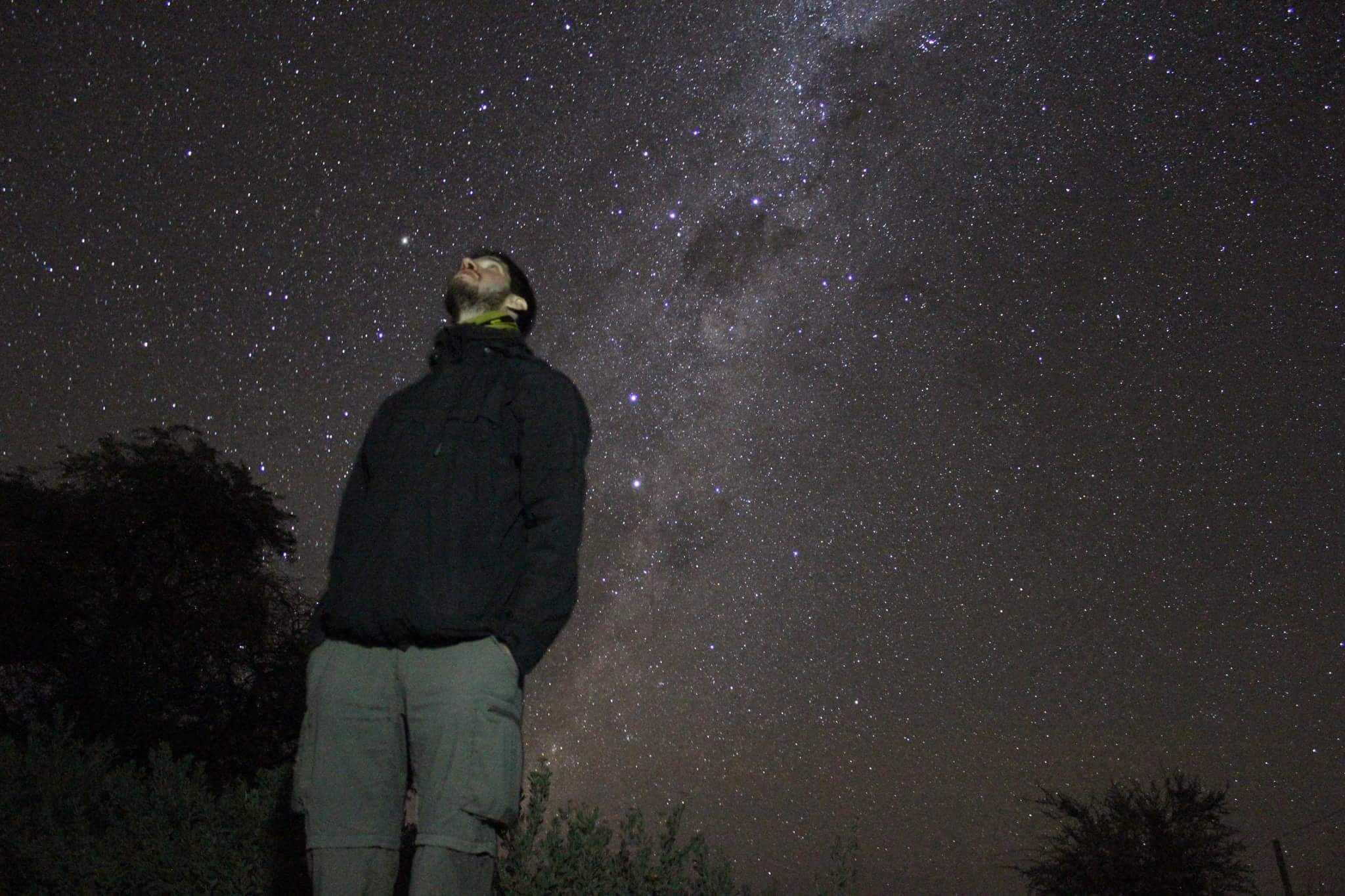
The next morning, after two exciting weeks of traveling together, it was time to say goodbye – Dani and Krissi were heading over to Argentina, while I was about to go the other way, back to the coast and up to Peru. But before I continued, I went on an astrological tour to watch the night sky with large telescopes. Here we got to read stellar maps and got explanations for different objects, the most impressive being Jupiter with its four largest moons.
The last adventure with Krissi and Dani on this tripWatching stars, planets and the milky way without urban light pollution (photo by Tour Astronomico Astrocoya)
Since we entered Bolivia it had felt like the days were getting better and better, with one highlight chasing the next, most of them leaving an unexpected impression of people, landscapes or local customs. With Uyuni we were headed for one of my “must-see” attractions on this trip: The “Salar de Uyuni”. But very little did I know about this salt flat, other than it can be visited on a three day tour, with one stop in the middle of the desert for some cool pictures with a dazzling perspective.
The only thing I knew about southern Bolivia was the “Salar de Uyuni”
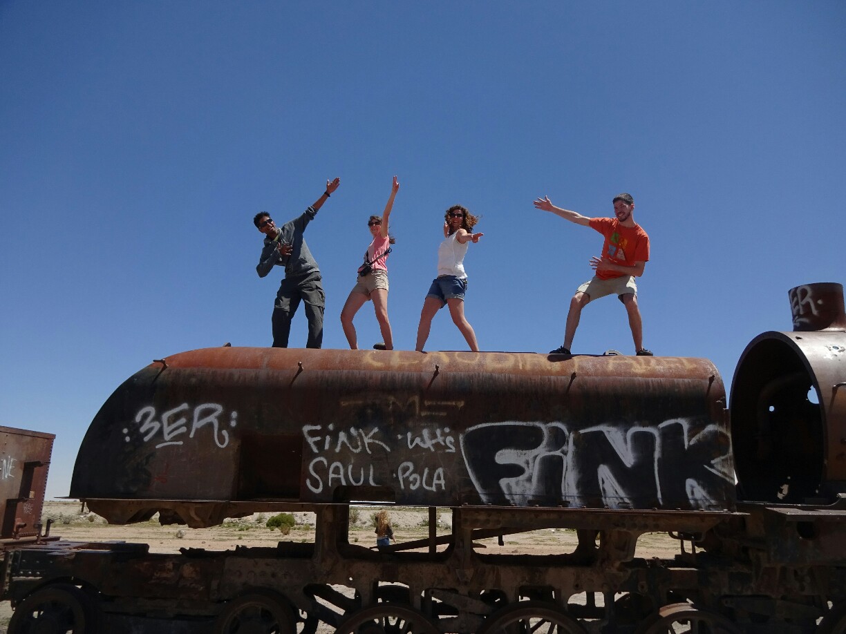
But the first stop on the tour was the train cemetery outside the town of Uyuni. Here, Markus, our guide for the tour, told us about the sulphur mining that used to be the main business for the train companies. After the Pacific war and the discovery of artificially produced sulphur the trains became obsolete and were disposed here. Like everyone else, we found ourselves an unoccupied locomotive for some nice pictures. The first stop was the old train cemetery outside of Uyuni
Old trains make for good pictures
From there we continued in the other direction. Santiago, our driver, took David and Lina from New Zealand, Nik, who had joined us after staying a bit longer in Peru, and Dani, Krissi and me to a little village outside the salt flats. Here we learned about the salt mining and the purification of the salt and had lunch in a house built from large salt blocks, where the layers of deposition were clearly visible.
Lunchtime in a house entirely built of salt blocks
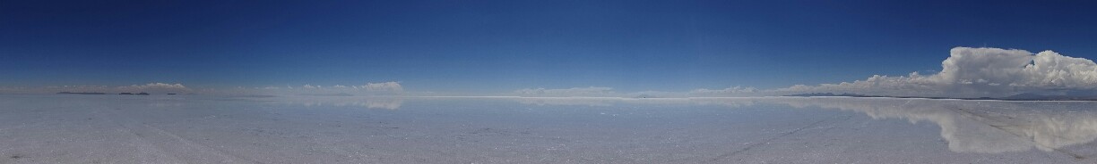
With more than enough food in our stomachs we entered the “Salar de Uyuni”, the largest salt flat in the world at about the same size as the Libanon. Again, it used to be connected to the Pacific Ocean until the continental uplift isolated the body of water and it eventually evaporated, leaving behind all the salt. Nowadays, in the dry season it’s a bright white desert covered in salt, while during rainy season it gets flooded, producing a giant mirror.
Hundreds of tourists visit the salt flats each dayThe price of this picture were some bloody hands, as the salt crystals are quite sharp (picture by GetReadyTours)
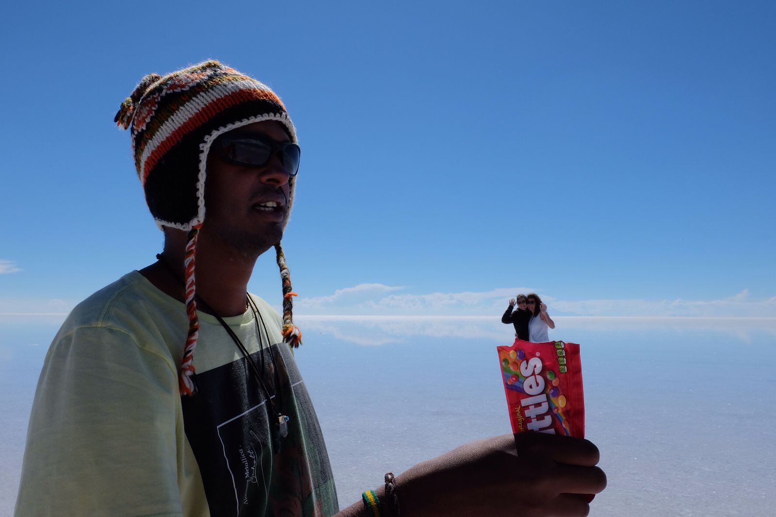
As we were in between the seasons, we got a little bit of both, but we could only imagine how it looks completely inundated or completely dry. We still got a lot of nice pictures. Some of our group were perfectly prepared with all sorts of little items for hilarious pictures. The perspective is everything, as the surrounding landscape is identical for miles and miles, playing tricks on the eye of the observer.
Someone must be very hungryBalancing on the camera lens is easier than it looks
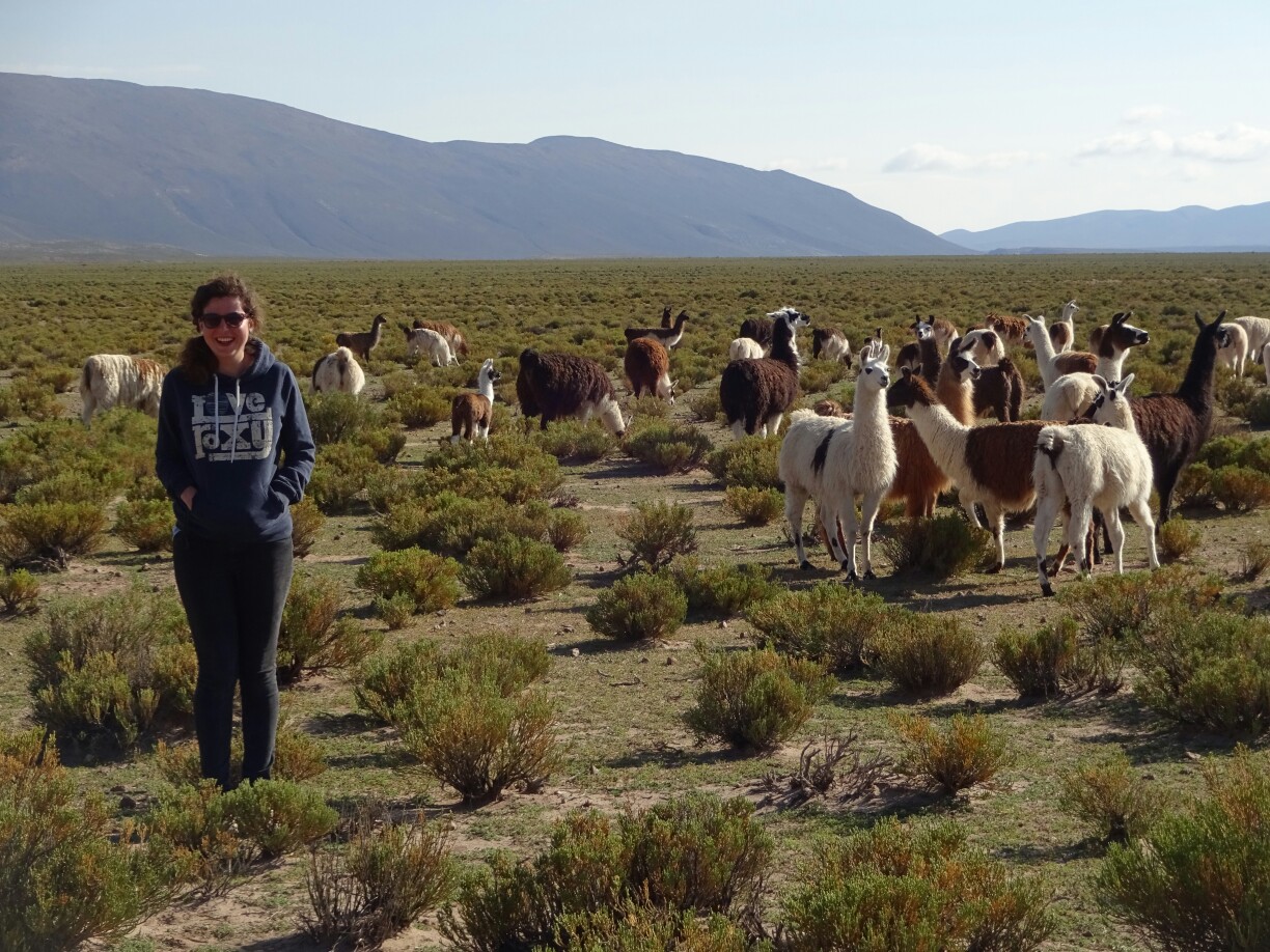
Because of the salty water, the cars can’t go very fast, as the more sensitive parts of the engine would come into contact with the water, damaging them through corrosion. Therefore, we had to get back out of the salt flats and drive all around to a little accommodation, where we spent the night. Early the next morning we hit the road again and find some llamas along the way. We tried our best not to scare them, but getting a proper “llama-selfie” was still nearly impossible unless you waited for them to take a pee. Sunset over the Bolivian desert
The “Llama selfies” did not really work, so we switched to regular pictures
Further down the road we stopped at a small canyon in search for puma and an ancient plant that is related to corals, but has adopted to a life without water. It only grows about 1mm per year and has various healing powers known to locals. Needless to say that we did find the plant, but not the puma, who was probably watching us. Therefore, we returned to the car and continued our way across the “Altiplano”, the high plains of Bolivia, with a base elevation of more than 4000m and higher.
The puma was nowhere to be seenThe green “rocks” are actually ancient plants growing only about 1mm per year
As the day continued, the landscape around us became even more breathtaking than the salt flats had been the day before. Every time we thought it couldn’t get any better, nature proved us wrong. The sight of the vast desert with the snow-capped volcanos emerging from the plains was truly amazing. And the desert around us was changing as well – from sandy to rocky or from beige to light red. Everything was possible.
The desert landscape around us was ever-changingBolivia’s vast and deserted “Altiplano”
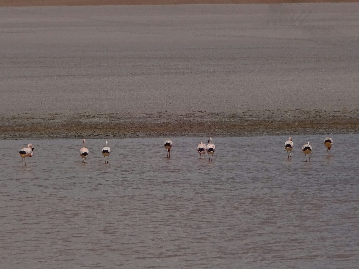
As the day progressed we encountered more and more lagoons. They had different sizes and colors, depending on the presence of certain minerals in their vicinity. When the air was calm and quiet they were like giant mirrors, perfectly reflecting the surrounding mountains. Dozens and sometimes even hundreds of flamingos call these lakes their home and can be watched how they search the water for food. Picture-perfect lagoons acted as giant mirrors
The lagoons are home to dozens of flamingos
Probably the most impressive lagoon is the “Laguna Colorada” with its distinctive red and white coloring, which is complemented by an intense green of plants in the lake. It’s also home to several different species of flamingo and is under special protection as part of the Eduardo Avaroa Andean Fauna National Reserve. It was definitely a worthy finale of our time in Bolivia.
“Laguna Colorada” was nothing short of breathtaking
But it was not the only finale of that day, as I had been troubled with diarrhea for the past two days. Maybe the altitude was also playing a role, as we were reaching 5000m, but by the late afternoon I was feeling really bad and didn’t care much for our last stop at the geysers. Once we reached our accommodation, I dropped everything and just went to bed, unfortunately missing out on some wonderful hot springs under a perfectly clear and starry night sky.
By the end of the day I wasn’t in the best condition to fully appreciate the geysersBy sunrise I was feeling much better
After taking two penicillin and sleeping for twelve hours, I felt much better. That way we could continue to “Dali’s desert”, where the landscape resembles the surrealistic paintings of Salvador Dali. From there it wasn’t far to the “Laguna Verde”, not green at that time due to the lack of wind, where we had to say goodbye to David, Lina and Nik, who would go back to Uyuni, while Dani, Krissi and I continued across the border and into Chile (once again).
Driving through “Dali’s desert”A great end to our time in Bolivia