Tag Archives: World trip

Oh solo Rio

When I arrived in Brazil I was quite fascinated – everything was different compared to the airports of Windhoek and Cape Town: The staff was friendly, helpful, English speaking and quite well organized and the suitcases arrived very quickly. I was off for a good start. However, my luck did not last very long, as there is only one ATM per terminal, which charges a lot of money for withdrawals. Nevertheless I had to take it in order to pay for the bus. Another issue is the language, since very few Brazilians (except for the staff at the airport) actually speak English. Spanish helps in several cases, so I was happy to see how much I already learned using Duolingo frequently.

Lush vegetation on the way to Rio

The airport of Sao Paolo is close to a city called Guarulhos, which also has a bus terminal. I was told to go there, because they also have busses leaving to Rio de Janeiro, saving me the trouble of going 25 km to Sao Paolo and back. What the people didn’t know was the fact that this terminal is way less frequented than the one in Sao Paolo. In the end I spent four hours at the bus terminal, including one hours delay of the bus. Luckily they had free WiFi and I had a few things to do, like downloading the offline dictionary from Google translate, so it didn’t get boring.

The landscape has many hills and valleys

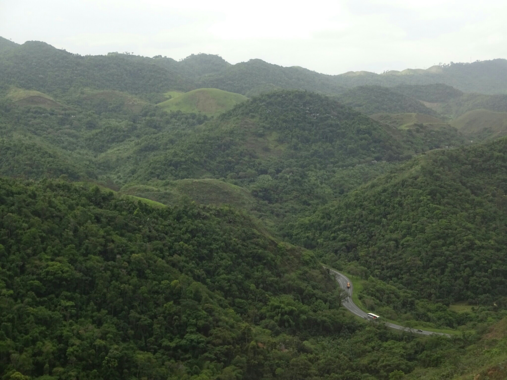
Since I hadn’t gotten any recommendation on a hostel in Rio, I looked at some online reviews and booked my hostel based on that. However, once I got there I had to find out that the location was safe and quiet, but a bit too much as it is located in a residential neighborhood. Additionally there were no other solo travelers my age, so it was difficult to meet new travel mates. Therefore, and because I only wanted to spent two days in Rio, I booked a tour that would take me to all major sights in one day.

My hostel was located in a very residential area

We started off with visiting “J. C.”, as our tour guide named him, being quite familiar with the statue. With its height of 30 m, the Redentor is very impressive, located on the Concorvado hill top overlooking the city. It was built in the 1920s with donations from mostly catholics all over Brazil. The open arms are forming a cross with the rest of the body, but also represent a welcoming gesture to the ships entering the port of Rio, as well as being a sign of peace.

The mighty statue of Cristo Redentor is towering above Rio

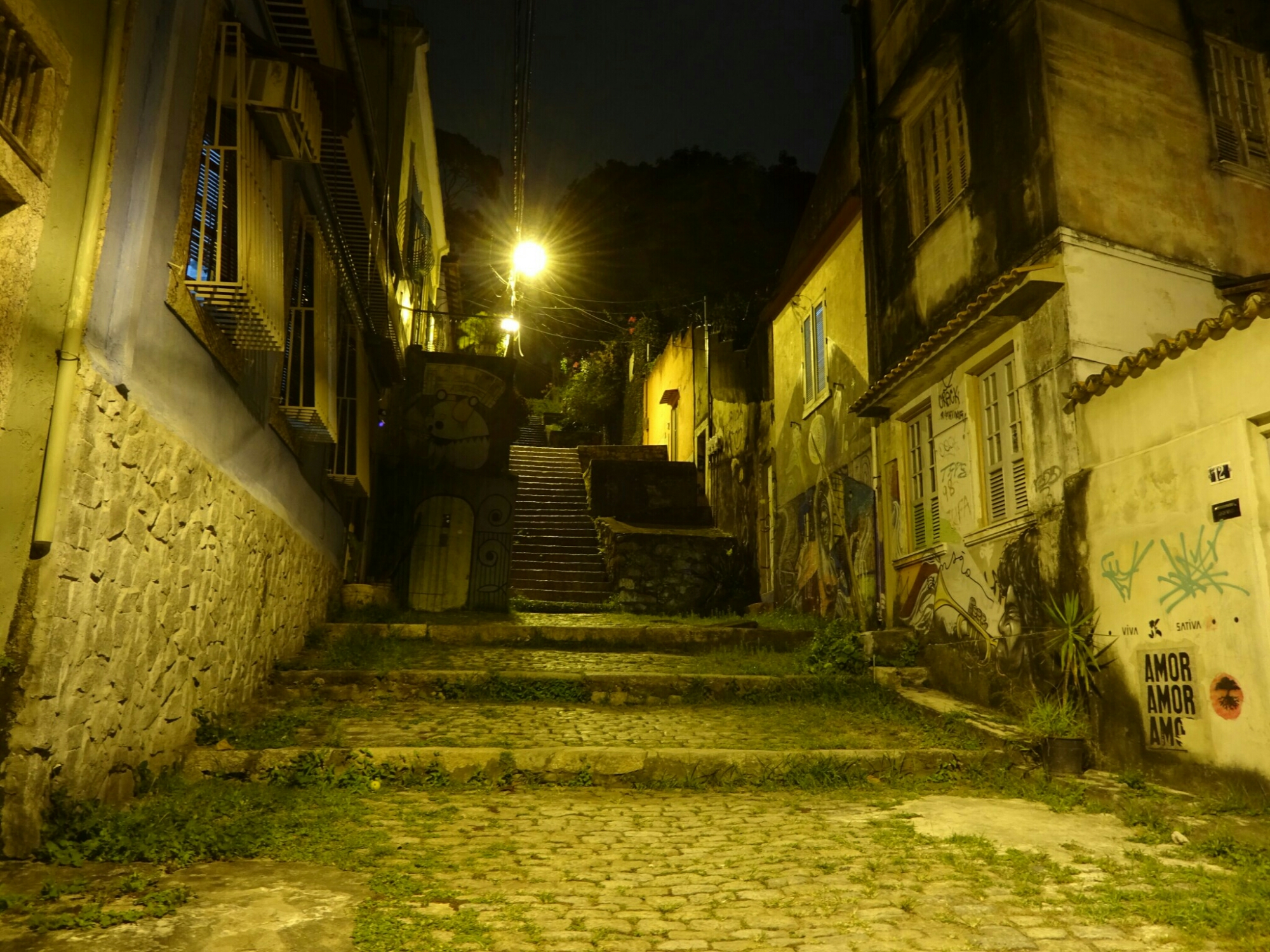
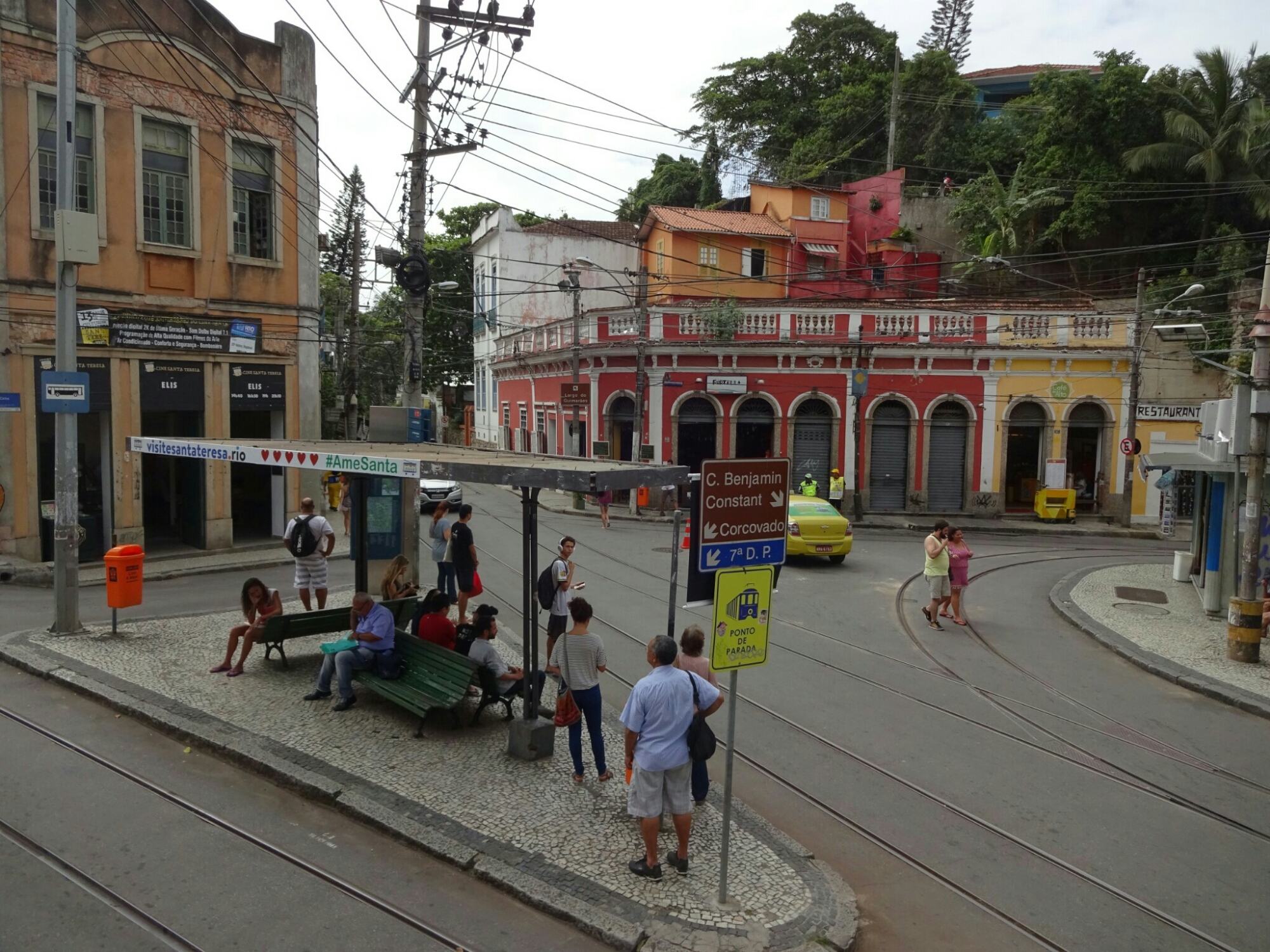
Up next was the neighborhood of Santa Teresa, which is an area where only rich people used to live. Now it has been overtaken by alternative people and artists, giving it a nice vibe. Very artistic are also the Seleron steps, a set of steps that were turned into artwork by a guy named Seleron. He decorated them with lots of tile fragments in the colors of the Brazilian flag. After getting internationally famous through music videos and social media, people started to send him tiles from all over the world. Now it includes tiles from over 60 countries, making it one of the most international pieces of artwork in the world.

The streets of Lapa
At the Seleron steps

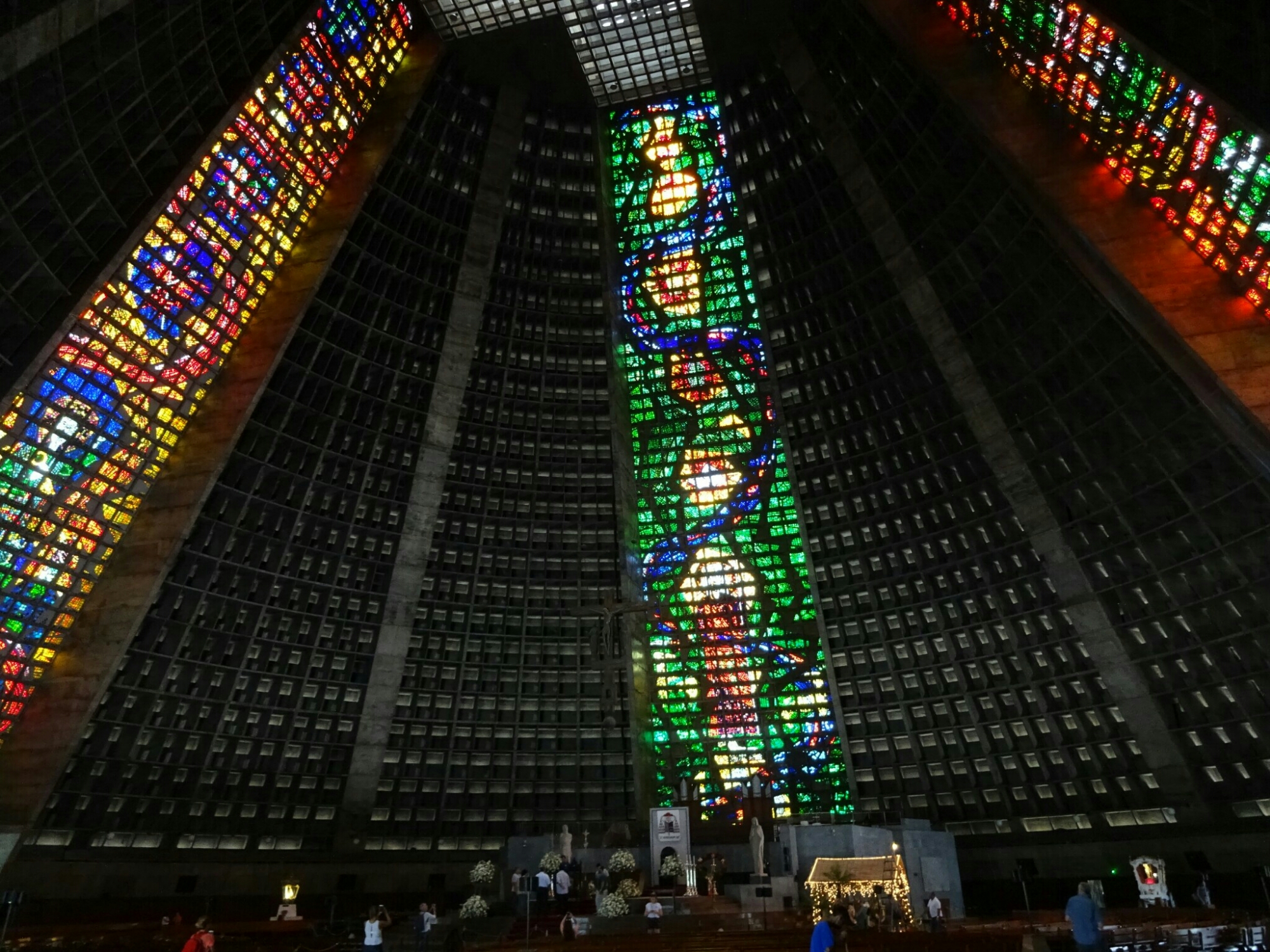
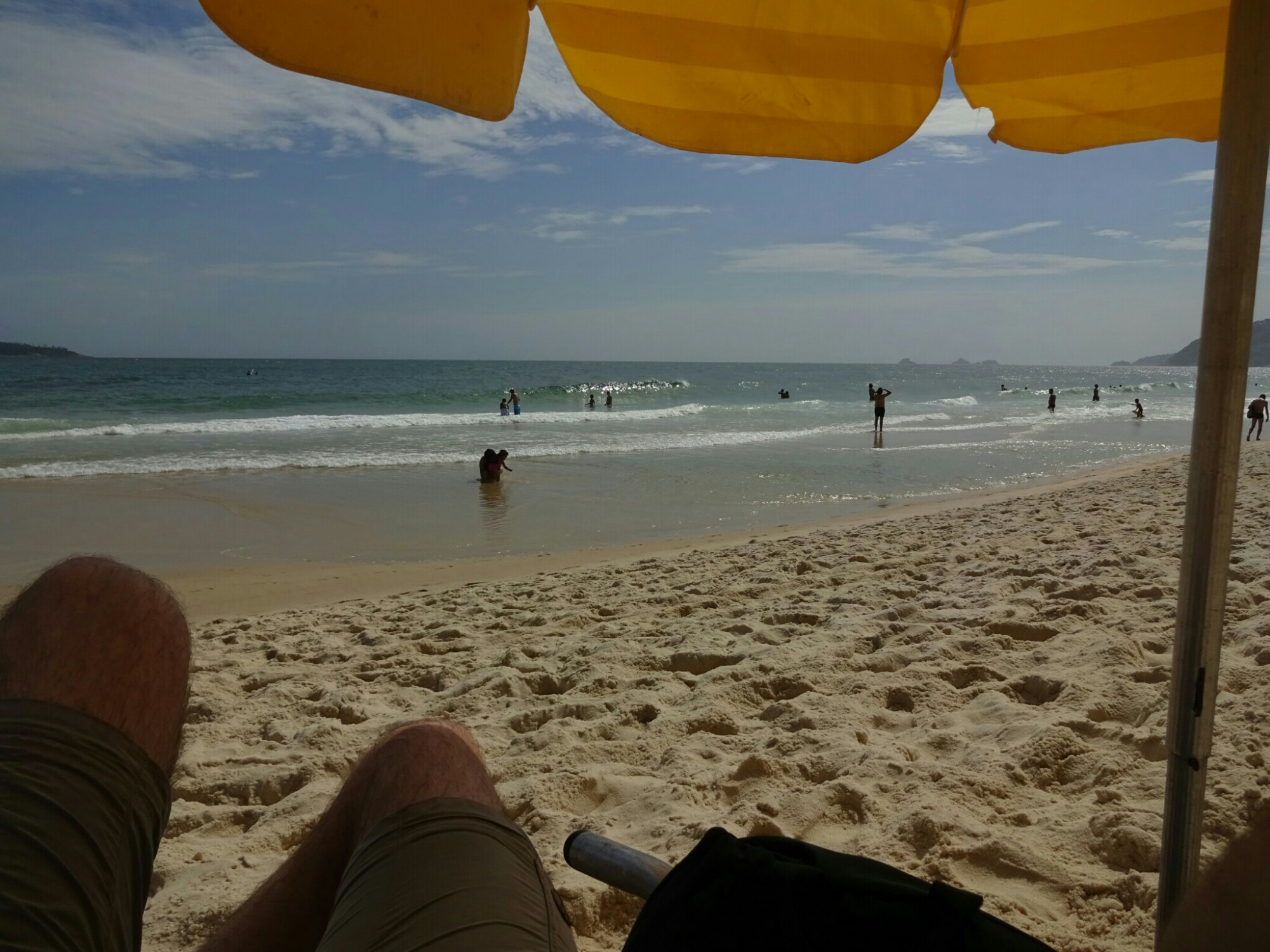
The huge cathedral, a modern structure which is made of concrete and glass, is big enough to seat 5000 people or 20000 people standing. However, it’s capacity is hardly ever needed, as our tour guide explained: Brazilians like to pray on the beach on Sundays. I guess that’s why some towns do have their churches right at the beach. Rio’s most famous beaches, Ipanema and Copacabana, are bordered by high-rise hotels, leaving no space for other buildings. Nevertheless you can still get a prime spot on sunny weekends.

Difficult decision for Brazilians on Sundays: Church…
… or beach, like here in Ipanema

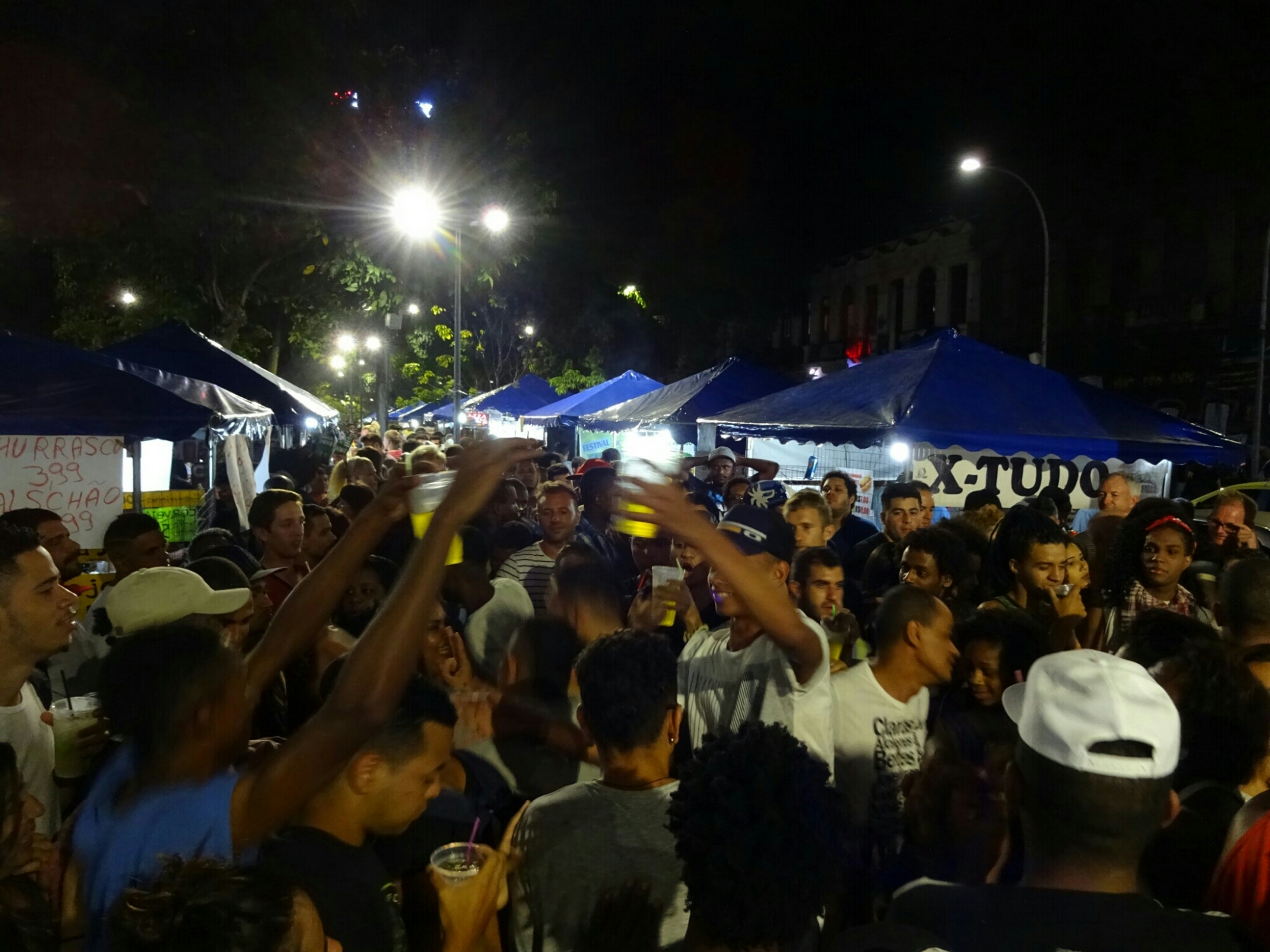
In the evening I tried to meet up with Nik, a guy from England that I had briefly met on the sightseeing tour. We were staying in different hostels and agreed to go to Lapa for some drinks. When we decided for a meeting point we had no idea of how crowded the streets would be. In the end we couldn’t find each other (no WiFi/phone), so I just walked through the streets enjoying the atmosphere.

The streets in Lapa are busy on a Friday night

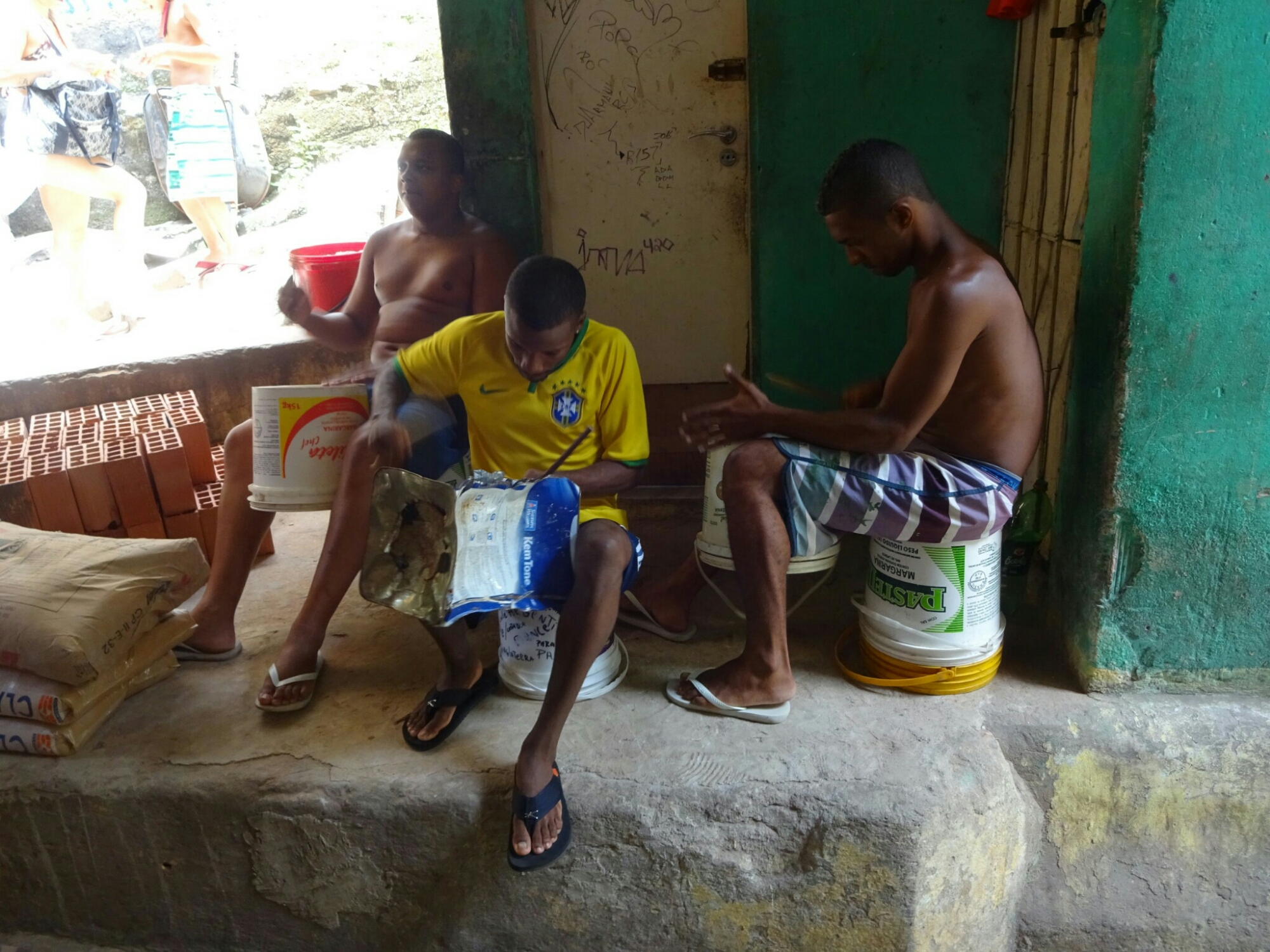
Another great experience was the guided walking tour through the favela Rocinha. Nowadays, favela is the word used for slums/townships in South America, or for a really messy and dirty place. Originally it is the name of a plant that was growing on the steep hills, where the townships were built. As it was hard work to remove the plants with their thick network of roots, the people identified themselves with the hard work and called the area favela.

Inside of the favela
One of the wider and livelier streets of Rocinha

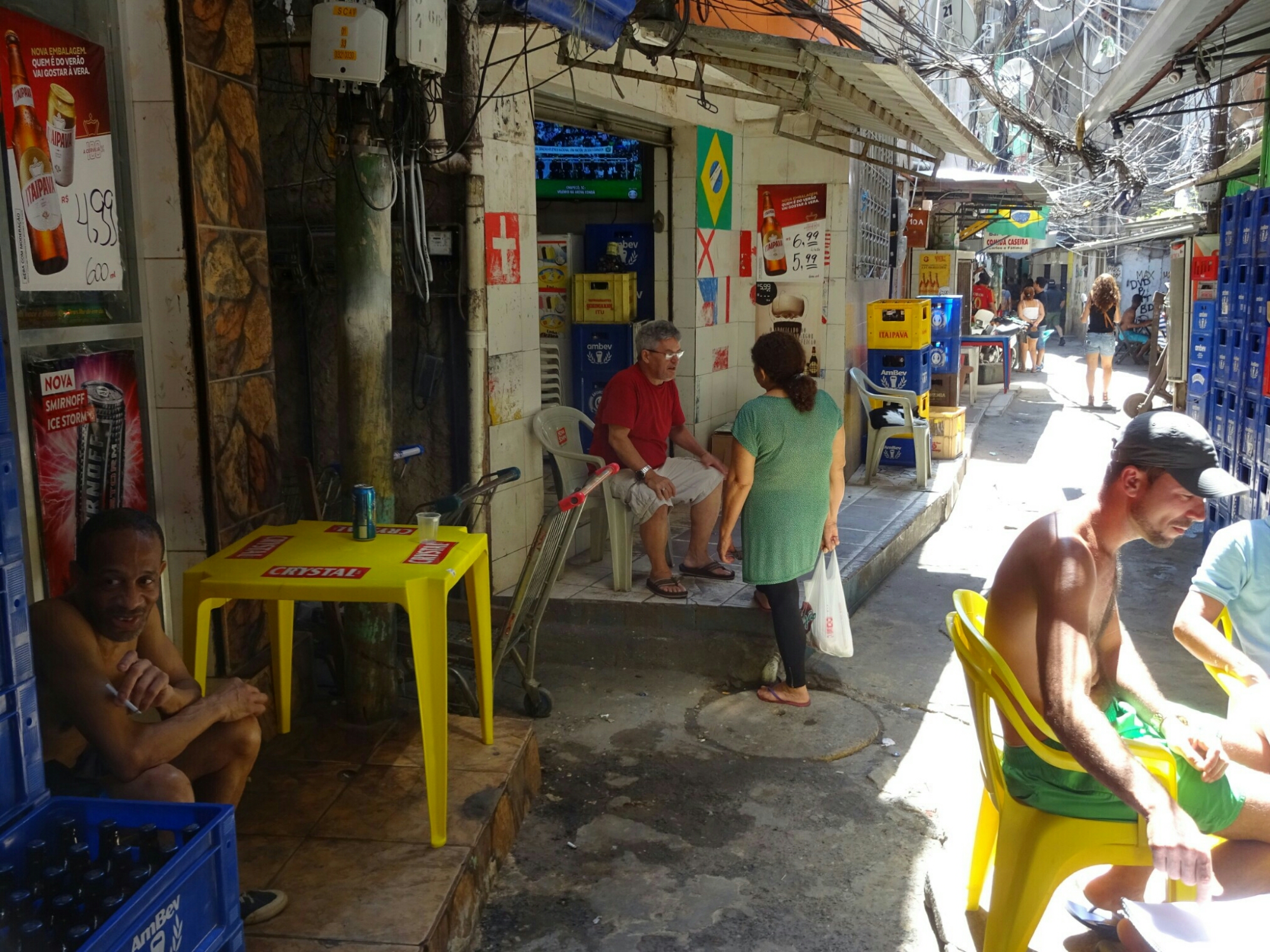
Rocinha is Brazil’s largest favela, with about 120,000 people living in a very small area without high-rise buildings, so everything is build very compact, with tiny alleys that are not big enough for cars to pass through. Some favelas are more dangerous than others, and here they seemed to have made some sort of agreement with the tour company to ensure their safety: Every stop on the tour is used to get more money from the tourists – the gallery with art from local artists, the drumming session of some locals, the bakery, women selling their handmade craft and the daycare center for children, which is funded by a part of the tour fee. Overall it’s still a very interesting tour!

Locals using improvised drums for some Samba beats
The local bakery has homemade delicacies

Penguins and table cloth

Cape Town is surrounded by mountains on one side and by sea on the other side. Less known but well worth a visit is the hike up on Lion’s Head, a steep hill (669 m) west of the city. Some say that it got its name from a sphinx-like lion shape, which can be seen from Camp’s Bay, others say it used to be a place where some lions were living and hunting. Roland and I climbed it, starting at the hostel, almost at sea level. The climb was strenuous, but the view from the top was phantastic with paragliders soaring around our heads.

Making our way up on Lion’s Head
The last section has a few ladders and chains, but nothing too difficult

And of course we visited the most prominent landmark of Cape Town – Table Mountain. That morning Roland wasn’t fit for hiking, so I took an Uber to Kirstenbosch by myself. Kirstenbosch lies on the other side of the mountain and is home to the botanical garden. The reason for this location is the amount of rainfall that they get there compared to the city of Cape Town –  a result of the combination of the dominant wind direction (towards the south-east) and its location in the lee of Table Mountains highest point.

At Kirstenbosch Botanical Garden

In the botanical garden I took a big loop that passed by the Arboretum, which included a treetop walk with a maximum height of more than ten meters above ground at its highest point. From there I followed a steep trail through the skeleton gorge and across a swampy plain all the way up to the top of Maclears Beacon (1085 m), the highest point of Table Mountain. By that time the table was still covered with a thick white table cloth and there wasn’t much of a view.

Sure enough it did rain while I was visiting the treetop walk at the botanical garden
The clouds are covering Maclears Beacon like a white table cloth

However, it was only midday and I was determined to stay on top until Cape Town would come into view. About half way to the upper gondola station (on the other side of the plateau) the clouds lifted, giving way to a gorgeous panorama of the city and the Hout Bay area on the other side of the  mountain.

Once the clouds had moved we had a clear view of Cape Town

With the sunshine came hundreds of tourists, who boarded the gondola immediately after the clouds had cleared. One of them was Roland as we had agreed on a time to meet at the top. Together we hiked down through the Platteklip Gorge jumping from rock to rock like the mountain goat that we had seen on top.

Descending through the Platteklip Gorge

Another day we took an organized day trip to the Cape peninsula. After a quick look at Boo-Kap, the colorful neighborhood of Cape Town, we went all the way down to the Cape of Good Hope, which is still part of the Table Mountain National Park. We avoided long waiting times and hundreds of tourists by going there early in the day. We had a look at the lighthouse and took a short walk to the cape itself, which is the most south-westerly point of Africa, before having a delicious South African lunch, consisting of buns filled with grilled veggies, chicken and chakalaka sauce.

The lighthouse next to the Cape of Good Hope
The most South-western tip of Africa

As the day continued we drove over to Boulders Beach, which is home to a large population of African penguins. Back in 1982 two breeding couples were taken from another colony across the Hout Bay and introduced in this very spot. They liked it so much that nowadays there are about 3000 penguins living here. You can get really close to them on a series of boardwalks that were built here.

The penguins are breeding in the bushes close to the beach
Boulders Beach is home to a few thousand African penguins

On our way back to Cape Town we stopped for some wine tasting at a local vineyard. Due to the proximity to the ocean, this vineyard produces mostly white wines, whereas red wines require more heat and less moisture, a climate which can be found more inland.

Wine tasting at a local vineyard

Meat and greet at Wild

Instead of visiting Etosha, I came up with a different plan. After seeing really cool pictures from a friend, I decided to visit R. at Wild* (*name changed). The only problem was getting to the farm, which is located about three hours east of Windhoek. This was quickly resolved, because I was able to get a ride on the shuttle that picks up new volunteers once a week. Lucky me, since there was only one seat left

Setting up camp

Wild* is a non-governmental organization, which takes in injured or abandoned African wild cats (lions, leopards, cheetahs, caracals) and other animals (African wild dog, baboons, ostriches, meercats and others). They are self-funded and make their money from donations, tourists and volunteers, who have to pay around 900 € for two weeks plus their working hours. Currently they have about 40 volunteers working on the farm. It’s not really a farm though, because they’re not breeding the animals and they don’t grow their own food.

The lawn at the farm was usually filled with dozens of animals

At the farm I was allowed to follow R. on the different activities. In the morning she was assigned to do the feeding tour, which took us all over the place to feed the different animals. Since most of their animals are carnivores, Wild* needs about two horses or donkeys per day (about 500 USD each). They are chopped up and distributed accordingly. For feeding of the lions and the leopards we stayed at a safe distance behind the fence and they would throw the meat in the enclosure.

Feeding the lions

Feeding the caracals was different, because we could enter the enclosure while they were eating. During that time they are too busy eating, so that we could have a close look at them. The same was true for the cheetahs – we entered their area on our trucks and R. and A. (another volunteer) climbed a wooden tower with meat pieces for all 21 cheetahs, who had only eyes for their food, totally ignoring us in the open vehicles.

The caracal being busy with eating
Inside the cheetah enclosure

. The baboons were given some sticky oatmeal, that was thrown over the fence while driving alongside. This method was adopted so that all monkeys get their share and not only the strongest ones. Last but not least I helped with feeding the ostriches, who will pick the mixture of corn and bird food out of your hands, which gives you a funny feeling.

I still have all my fingers
Ostriches are quite curious

In the afternoon everyone – volunteers and bushmen, who work for the farm – went to church to pray for some much needed rain, which did come in the evening. There was a big thunderstorm, common during this time of year, with enough heavy rain to prevent us from having an outdoor braai (barbecue).

The rain clouds are gathering while we’re inside the church

But before we got caught in the rain, we went for a walk with two baby cheetahs. They were found abandoned about four months ago and were hand-raised afterwards, making them being used to humans for the moment. At the farm they have a small enclosure, so that they’re able to keep a close eye on them. However, they need to exercise running, so they are taken to an open space, where they can chase after a rattling bottle that one of the volunteers is pulling behind on a string. But beware – you have to be really fast to outrun the cheetahs. And that only works on the baby cheetahs, because they get distracted quite easily.

R. and the cheetah
Walking the cheetahs

The next day I joined R. at the food preparation, where we had to cut up the donkey chunks into even smaller pieces. It took all morning to prepare all the food for the afternoon (more feeding happens in the afternoon), and we were about seven or eight people. Afterwards, I was able to catch a ride to Gobabis with a Belgian couple and from there a shared taxi back to Windhoek.

Food preparation means cutting up donkeys

Swakopmund over and over

After getting back to Windhoek from our trip to Sossusvlei, our paths separated again – Brendans trying to find a way to get to Maun and/or Livingstone, while Teemu and Carlos had to go back home again. Arttu and I decided to take the night train to Swakopmund. The train took almost 12 hours to cover the distance of about 350 kilometers. Once again it was due to the fact that it picked up different cargo wagons during the night, but also because we were delayed by two hours due to a broken TV, which was still not working after some maintenance.

Our train had one passenger car, the rest is freight cars
Watching the super moon from the night train

In Swakopmund we wanted to go for some sandboarding in the dunes surrounding the city and I wanted to meet up with Cameron and Natasha (the couple that I had met in Lüderitz) again to join them on their trip up the skeleton coast and into Etosha National Park. However, they were planning to arrive after us, leaving us two days to explore the city on our own.

At the waterfront

The town itself is supposed to be the most German town in Namibia. And it’s true, you can see it everywhere: The buildings, the bakery and the food offered in pubs and restaurants is all German. The streets are full of German speaking tourists (more than in other towns), emigrants and locals and even the weather makes me feel like I’m back home in Hamburg – it’s cold (23° C, compared to the rest of the country where it’s around 35° C) and grey; at this time of the year the clouds often don’t clear at all during the day.

German style houses in Swakopmund

For sandboarding we managed to find a good deal, which included transportation, stand-up and lay-down sandboarding plus lunch and a movie of this half-day  activity. After everyone was equipped with helmet, boots and board, we made our way up to the top of the dune. The first few runs we were going sideways down on the board, because the dune was too high and too steep to go down straight.

Making our way to the top of the dune

Going sideways requires the same practice that you need for snowboarding, so the people who had experience here had a clear advantage. This is one thing that should have been highlighted in the beginning. Luckily there was also the lay-down sandboarding, where you get down on a thin wooden board, get a big push by one of the assistants and race down at a top speed of up to 64 km/h. Even if you’re so close to the ground, you don’t get covered in sand – unless you fall off the board or make a wrong move; the latter one happening quite often…

Sandboarding is pretty similar to snowboarding

By the end of day two we still hadn’t met up with Cameron and Natasha, who were delayed at Sossusvlei. So we spend the next day biking and jogging from one end of town to the other to do some exercise, which I haven’t been doing for quite a while. We also walked some more around downtown with Margje (Holland), who happens to be the volunteering doctor that Renske (I met her on the first day in Windhoek) is replacing.

Biking up and down the coast in Swakopmund

By now Cameron and Natasha had reached Walvis Bay, a little south of Swakopmund, but got stuck there with some problems with the car. Here is where Arttu and I decided to go back to Windhoek with Margje, because the car would not be ready for another two days. We were counting on better and warmer weather, as well as more activities and a better hostel. And we did get all of the above, including a nice dinner with game meat at Joe’s Beer House, free food, drinks and movies at the Brazil-Namibia Film Festival and of course more time at Chameleon Backpackers!

Trying different kinds of game meat at Joe’s Beer House
At Joe’s Beer House with Margje (and Arttu)

When C&N’s car was supposed to be ready I said goodbye to Arttu and boarded the train to Swakopmund once again. However, I was not lucky and the car was still in the repair shop for another day when I arrived in Swakopmund. This, along with misunderstandings, a lack of communication and a bad feeling in my stomach made me change my plans. I canceled my ride with C&N (along with the prospect of going to the Skeleton Coast, Twyfelfontein and Etosha) and took a shared taxi back to Windhoek.

I decided to change my plans over some delicious fish and chips

Life and death in Sossusvlei

Back in Windhoek, Teemu had already found Arttu (Finland) and Carlos (Bolivia), who also wanted to go to Sossusvlei to see the red dunes for which Namibia is famous for. We managed to book the car two days in advance, but it seems like we were quite lucky, because a day later there were no more cars available in all of Windhoek. Getting to Sossusvlei involves mostly gravel roads, which is why we decided to take an SUV instead of a normal car.

On the road to Sossusvlei

At the pick up of the car we were lucky again and got upgraded to a Toyota HiLux with four wheel drive (4WD). This solved any problem we would have had with our luggage, but also enabled us to take Brendan (Canada) along, who had almost given up on getting to Sossusvlei due to the lack of rental cars. The only downside to the upgrade is the fact, that the back of the car was not air tight, leaving little holes where the dust could enter, covering everything with little layers of dust.

Traveling lots of gravel roads

However, the better car did not prevent us from getting a flat tire about 100 km from the park entrance. So we got out the necessary tools and the spare tire to get us moving again. We managed quite well, but from now on we were driving even more carefully. It felt a little bit like losing the last life on Mario Bros., because one more flat tire would have screwed us up completely. But everything worked out and we managed to reach the park just before the gates closed for the day.

Keeping the spirits high even with a flat tire

When visiting Sossusvlei it is important to stay on the campground within the park limits, because the gates are closed during the night, making it impossible to get deeper into the dunes on time for sunrise, when the light on the dunes is best. Equally impressive is the sunset, which is also impossible to watch if you have to leave before the gates close.

Sunrise in the dunes

For sunrise many people are going to “Dune 45”, which is located 45 km from the park entrance (where the campground is located). To be on time we had to get up at 4:45 am, leaving us enough time to get there. Fortunately the main road through the park is paved, allowing us to go at higher speeds than on the gravel roads. Nicer and more quiet is “Dune 40”, where I went the next morning.

Chasing the sun at “Dune 45”
At “Dune 45”
Arttu, Carlos, Brendan, Teemu and I

After a magic sunrise we drove deeper into the park. Here is where our 4WD came in handy, because the last few kilometers are sandy road, where normal cars are not allowed. Driving slow and steady, we managed to get to the end, saving us another 10 Euros per person. From here we climbed the highest dune of Namibia – “Big Daddy” – for an amazing 360° panorama of the red desert.

Climbing “Big Daddy”
Getting down is much easier…

As hard as it was to get on top of the dune, getting down was so easy and quick, because you can run/slide straight down to “Deadvlei” (=dead valley), which was cut off from the (infrequent) water supply of the neighboring Sossusvlei. As a result most of the trees in the valley died. Due to the dry climate, the wood is not decaying, leaving only the trunks standing.

Deadvlei
The heat enables Arttu and Teemu to perform some difficult acrobatics

During midday we went back to the campground, because it’s too hot to do anything. As it cooled off in the afternoon, we got a new tire at the gas station, giving us more safety for the drive back to Windhoek (or a “1-up” to stick with Mario’s terms). But before going back there were still a few things worth seeing – Sessriem Canyon, sunset at “Elim Dune” and the best apple pie in Namibia, which can be found at “Moose’s Bakery” in Solitaire.

Exploring Sessriem Canyon with Indiana Jones
Watching the sunset at “Elim Dune”
Newsfeed in the middle of the desert