Category Archives: South America 2016

The miner’s devil

In Sucre we had been at the first real tourist information that we had come across in South America. Many offices have written “tourist information” in their window, but most of them are only trying to sell their tours and don’t have much information about anything else. This one was different. He was a nice guy from Switzerland, who took his time for us and gave us lots of tips and useful information. One of the things he had recommended was a tour of the mines in Potosi.

The “Cerro Rico” dominates the city in many ways

Potosi was originally not on our agenda, but it sounded pretty interesting, so we looked at our calendar and counted backwards the days we still needed for the rest of our trip here in South America. By the end we figured, that we would have enough time to visit Potosi. So we wrote to Jhonny, whose contact details we had gotten at the tourist information, and asked him, if he could give us a tour of the mines.

In Potosi it’s all about mining
The old town is much nicer than what we had expected

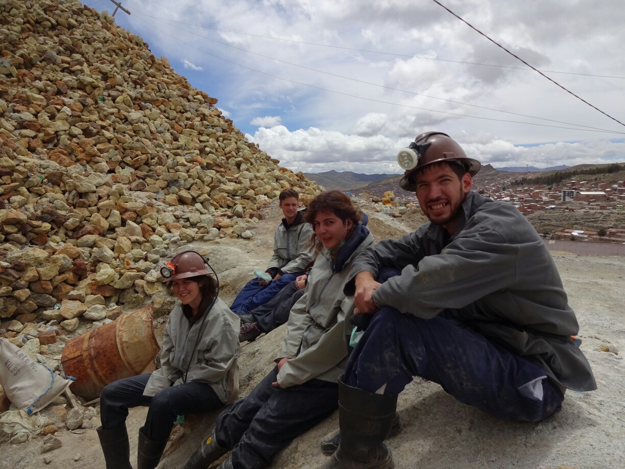
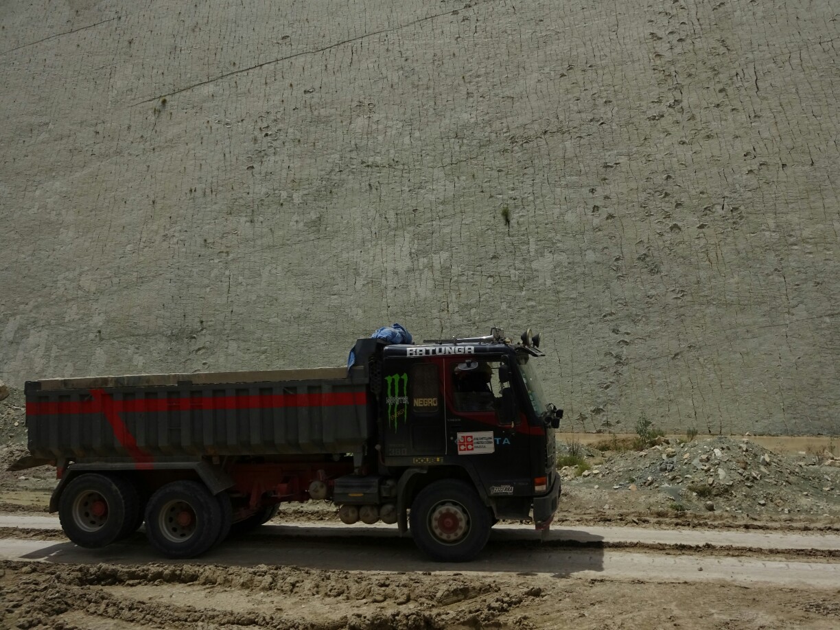
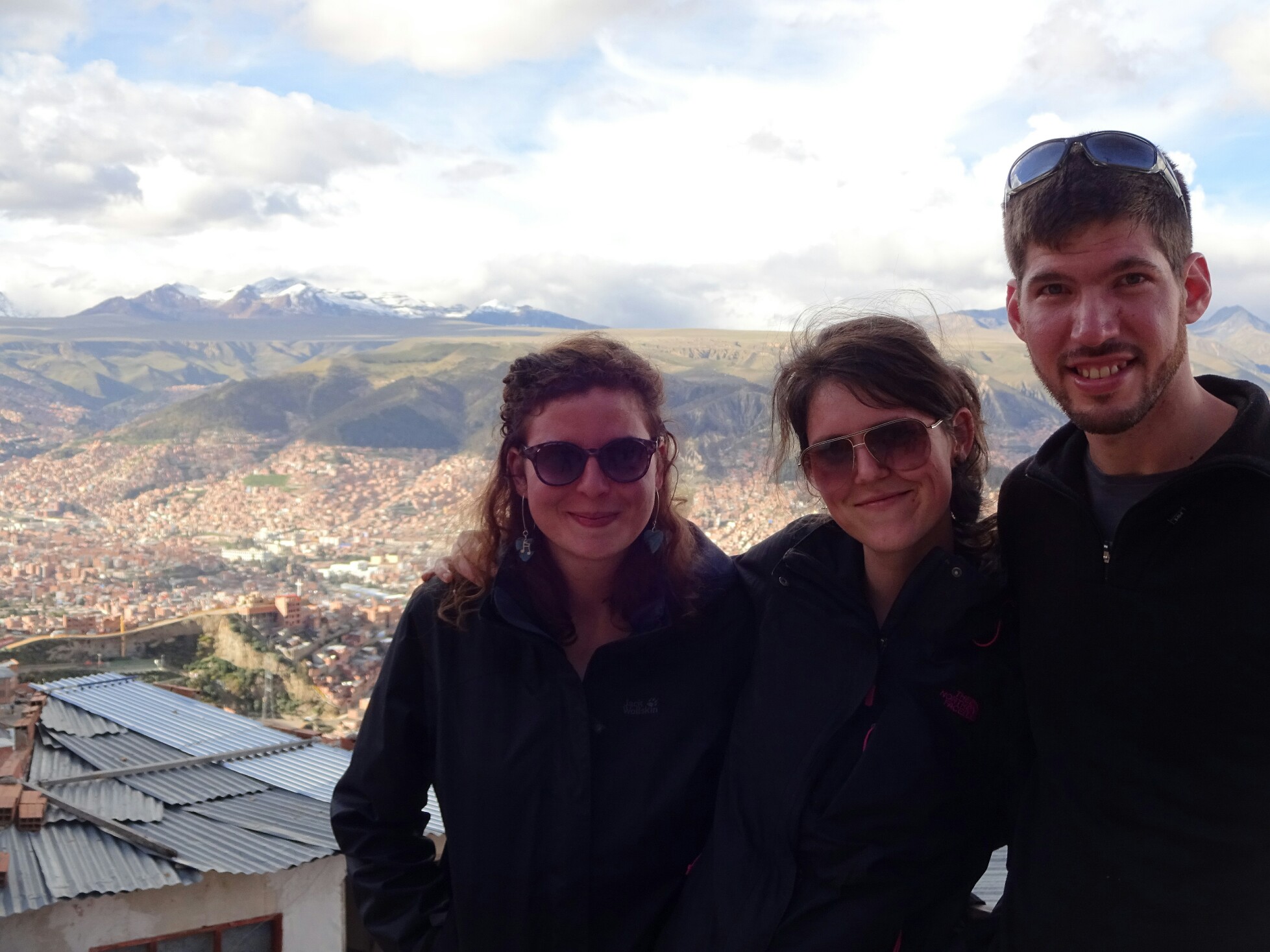
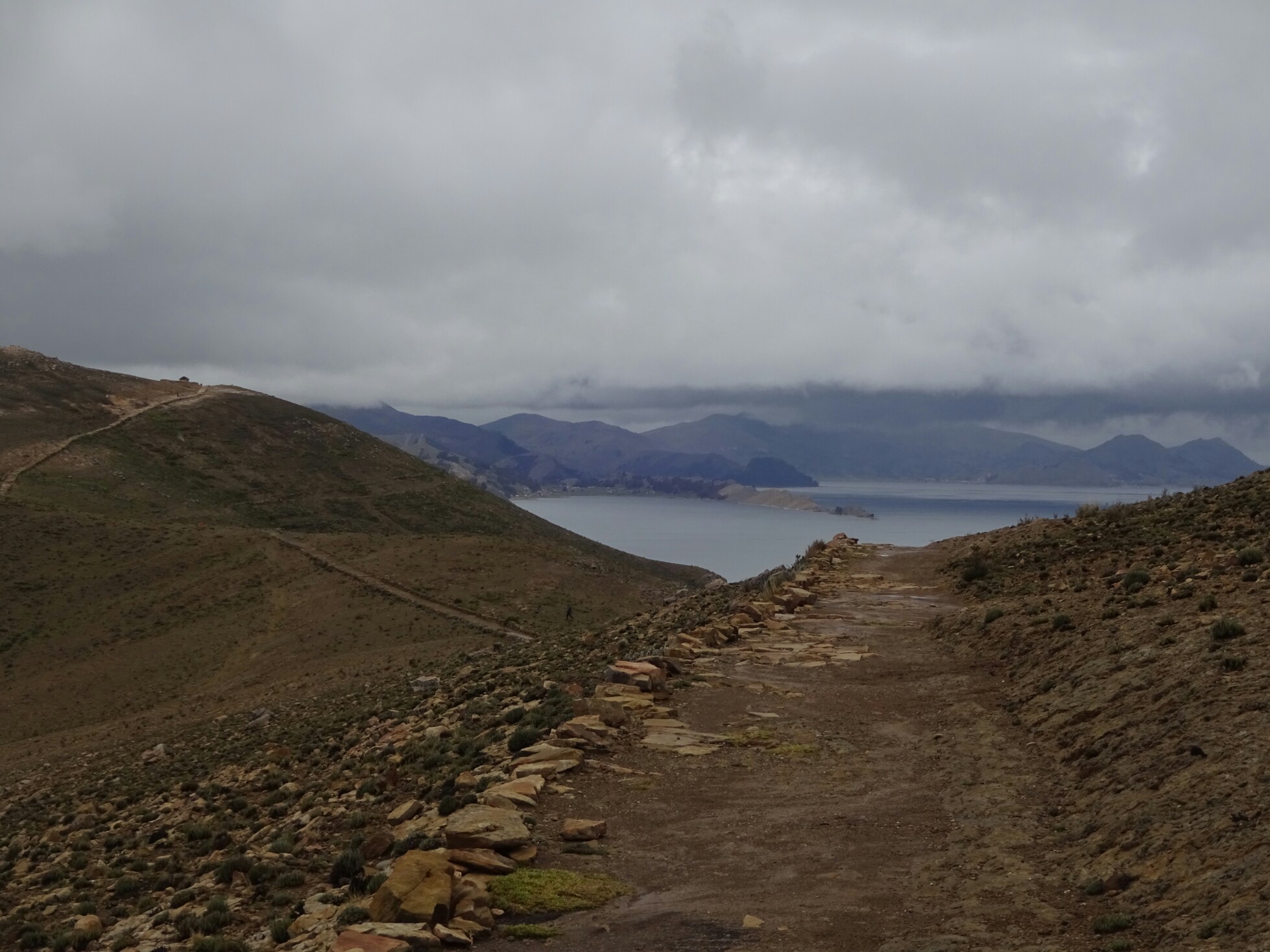
Jhonny, a former mine worker, now tour guide, confirmed our tour and set the pick-up time for Monday morning. In order to make this time, we boarded another rundown bus and were happy that the ride took only four hours. With the night spent in Potosi we were all ready and rested for this new adventure. Fredrik and Fredrikke from Denmark, who we had met on the market tour in Tarabuco, and Ilja and Tryxt from the Netherlands, who we had met back on the “Isla del Sol” joined our tour.

Ilja, Tryxt, Frederik and Frederikke joined us for a tour of the mines

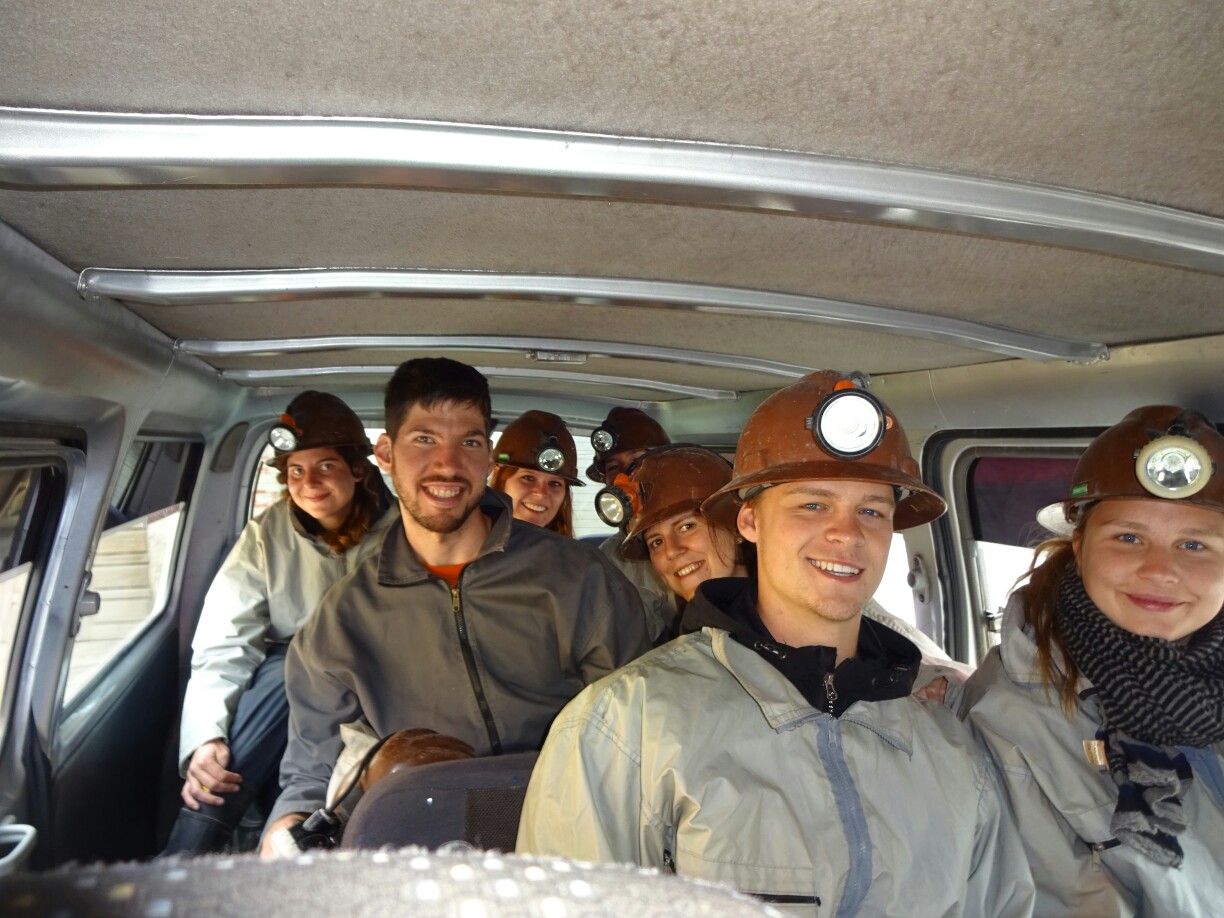
After everyone was equipped with working clothes, rubber boots, helmet and a head lamp, we were ready to go. The first stop was still in town. We got off at one of the little corner stores to buy presents for the miners. We bought juice, crackers, coca leafs, cigarettes, little bottles with 99% alcohol and some dynamite. Yep, that’s right, dynamite, a stick costing about 3 Euros. We didn’t even need a special permit or present our ID or anything, we just asked for it.

Buying coca leafs and dynamite at a regular corner store

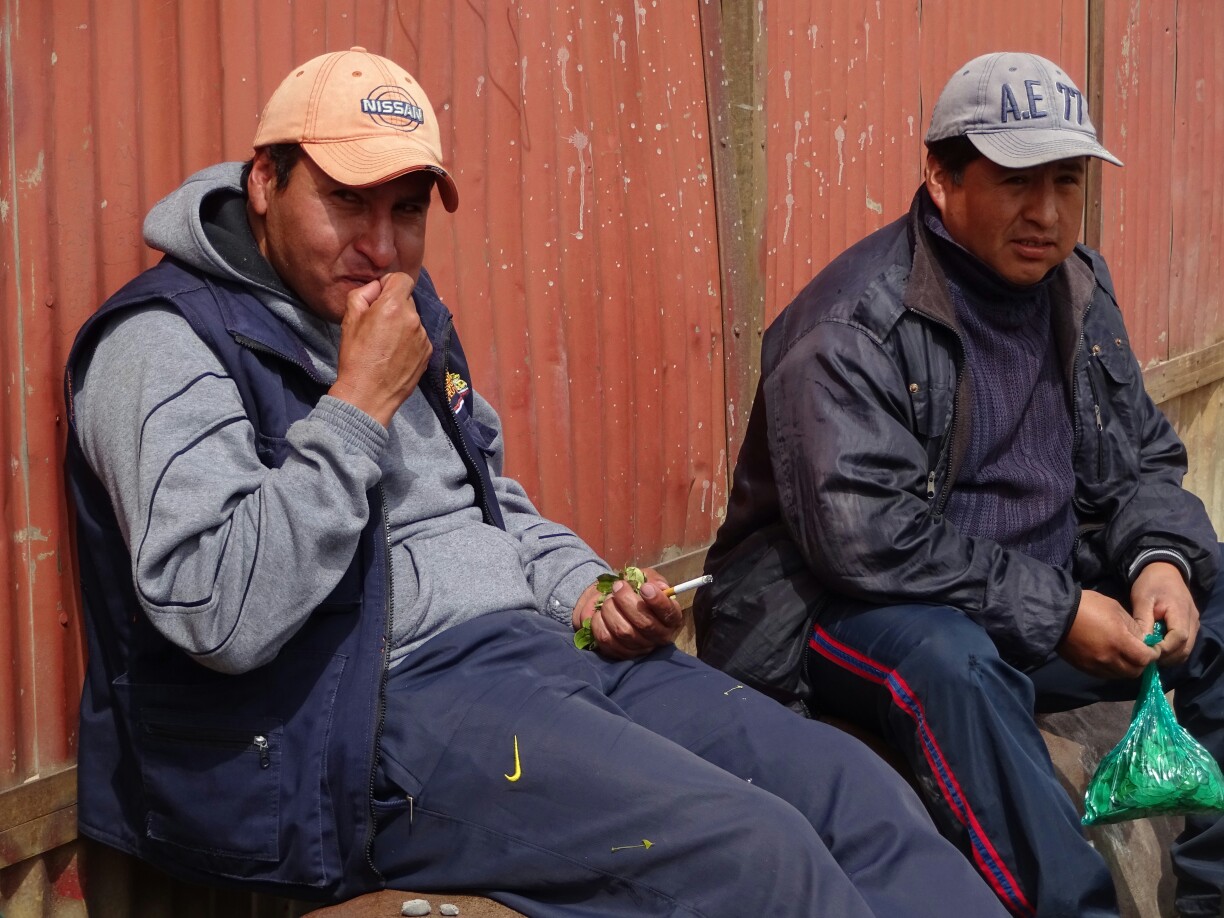
At the mines we left our car behind and entered the compound on foot. There were miners sitting around everywhere. Most of them had a stuffed cheek, which was filled with a bunch of coca leaves. This is not only good against altitude sickness, but also stimulates the body in order to be able for the long and hard work shift underground. We greeted all of them with “Imaynalla”, which is Quechua and means “How are you?”, and gave them some of our presents.

Some of the miners with their cheeks full of coca leafs
Women are not allowed to go into the mines. Instead they pick up the minerals that fall off the trucks

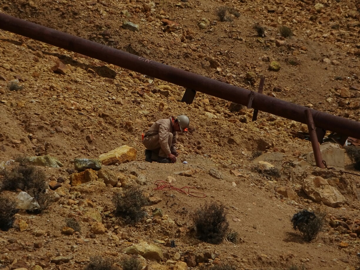
Then it was time for a quick demonstration of the explosive force of our dynamite. We opened the packaging and revealed some white matter with the consistency of modeling clay. We turned it into a small ball and added about one minute worth of fuse cord. Afterwards, Jhonny took it up the hill, lit the fuse and came back to us and watched the big cloud of smoke disappear after a deafening bang had startled most of us. We were quite happy that we were out in the open for this demonstration, as the narrow tunnels of the mine would have concentrated the noise even more.

Dynamite with a fuse cord for about one minute
Jhonny started the fuse cord at a safe distance

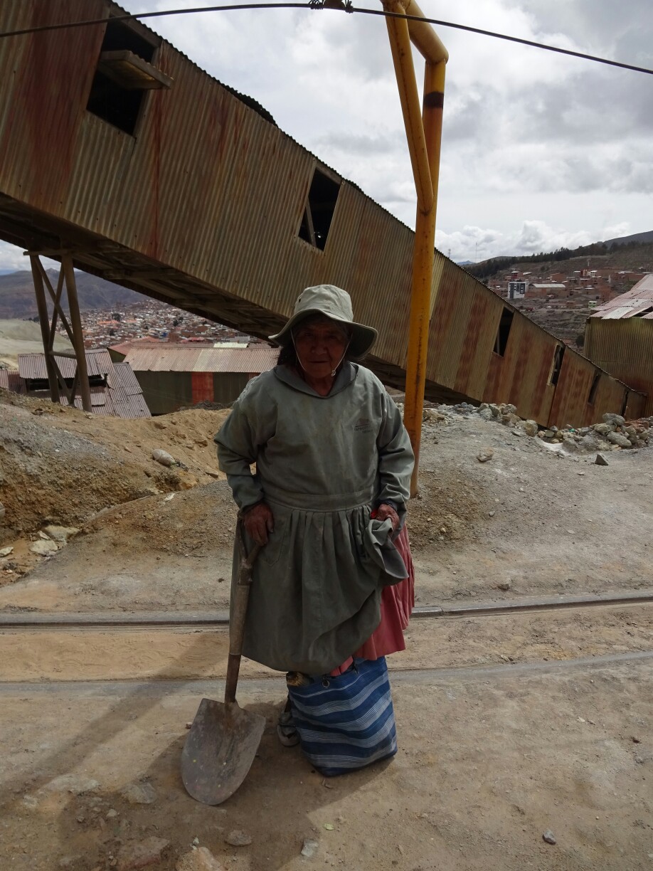
With this in mind, we took a deep breath, put on our respiratory protection and entered the underworld. Jhonny lead us through a maze of small tunnels and passages deeper into the mountain, which has been mined for silver ever since the colonial times. It’s crazy to think that people work down here every day for many hours, most of them with basic tools and without big machinery, often carrying the minerals back out on their back.

Entering the darkness of the mines
In the faint light of our head lamps we explore the narrow tunnels

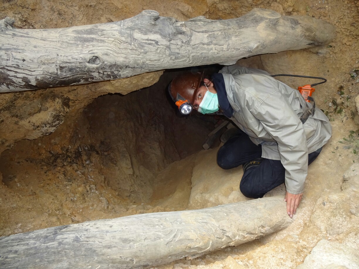
We met a few people along the way, but most of them work even deeper down. After turning left and right, climbing up and down through the tunnels, everyone but Jhonny had lost their orientation. At that point a devil had appeared out of nowhere, probably telling us that we had lost our mind. But it turned out to be a statue of “El tio” (“The uncle”), the god of the miners. We offered him some of the alcohol and some cigarettes and asked him for a safe passage back out.

Helping a mine worker with one of the heavy rocks
Face to face with the devil

It seems like the offerings were accepted, because all of us made it safely back into the daylight. By the end we were exhausted of crawling through the tunnels, and the altitude and the bad ventilation left us craving for fresh air. Back out in the open we enjoyed the warm sunshine on our faces, but we were happy for this outer-worldly experience.

By the end of the tour we were quite exhausted and craving for fresh air
We successfully escaped the underworld

Steps back in time

After La Paz we were heading for Bolivia’s capital, Sucre. It was here that Bolivia declared its independence from Spain and the other Spanish colonies in 1825. The very place where it proclaimed used to be a church, was later turned into a university and is now a museum known as “Casa de la libertad” – house of liberty. Although it was very interesting and considered to be one of the top sights, the “English tour” consisted of a tablet with a badly implemented app, leaving more questions than it provided answers.

Sucre is full of white buildings from the colonial times
The “Casa de la Libertad” used to be a church and is now home to the Bolivian declaration of independence

In the evening we tried out one of the free Salsa classes, which I had been wanting to visit for a long time. I have danced Salsa before, but that was a long time ago, so it was good to review the basic steps. However, we didn’t stay very long, as the location was a little bit odd, being in a courtyard full of junk, with Salsa music coming from one speaker and different music coming from another one in the bar next door. Additionally, I was the only guy, which meant that half the girls had to dance as the guy.

Free Salsa lessons in the courtyard of a hostel

The next day we decided to visit the “Parque Cretacico”, a dinosaur park on the outskirts of Sucre. It is located on the grounds of a cement factory and was opened about 20 years ago, when they accidentally found a large area with fossilized dinosaur footprints. The factory had been extracting limestone from the ground and had stopped the extraction one layer before the footprints were visible. Wind and rain eroded that last layer and revealed the world’s largest area of dinosaur footprints.

Life size models of South American dinosaurs at the “Parque Cretacico”

This part of South America used to be covered by a big salt lake, after the continental uplift had cut off the connection to the Pacific Ocean. Over time the lake slowly dried out. Just before the ground was dry, dozens of dinosaurs had walked across the area, leaving their footprints in the mud. They were quickly covered with sediments and thus fossilized and were preserved.

A drawing of the tracks and the dinosaurs that made them
A replica of one of the dinosaur footprints

We took one of the free guided tours down into the quarry to get a closer view of the footprints. It was really amazing and felt a little bit like they had been here just yesterday. However, the noise of bulldozers and large trucks quickly brought us back to reality, as they are still working in the quarry. This is also the reason why the park hasn’t been declared a UNESCO world heritage site yet and probably won’t be in the near future even though the application is ongoing.

It was almost like standing right next to the dinosaurs

The trucks are still working in the quarry

On our last day in Sucre we decided to go to Tarabuco, a small town which is known for its traditional markets. It has a market for livestock, which was very quiet and looked more like a few people meeting up on a fenceless pasture than the loud and bustling market that we had imagined. The textile market was full of the typical tourist souvenir booths and didn’t look like locals were buying anything here.

The market for livestock in Tarabuco was very quiet
The textile market seemed to be more for tourists than for locals

Only the vegetable market was busy with people selling their produce and buying their weekly supplies of fresh fruits and vegetables. However, we didn’t see anyone trading goods for goods like we were told before. Everybody seemed to be using money to pay for the purchases. And after two hours on the markets we were quite happy to sit back and enjoy a presentation of traditional dances in a nice but overpriced restaurant.

Money is used by most people to pay for the produce at the vegetable market
A presentation of traditional dances at a touristy restaurant

Back in Sucre we had a few more hours before our bus to Potosi was leaving. While Krissi decided to update her diary, Dani and I decided to visit the main cemetery. This proved to be way more interesting and authentic than the markets, as it was a Sunday and the cemetery was full of locals. They seemed to be on family excursions to replace the flowers and the small bottles of soda or alcohol, which are left at the graves for a refreshment of the deceased.

The cemetery is a common place for locals on Sundays
Reflections of the multi-storey graves on the cemetery

Between two worlds

From Copacabana we took a bus to La Paz. The bus was rather old and we were quite happy that it didn’t fall apart before we reached our destination. But the ride had several hurdles that we needed to overcome: Shortly behind Copacabana we had to leave the bus for a short passage on Lake Titikaka. While we took a small passenger boat, the bus was transferred on a small pontoon, moved by manpower through poling and a tiny motor.

The bus was crossing Lake Titikaka in a tiny pontoon
We had to leave the bus and take a boat to the other side

Some hours later, as we thought we made it to La Paz, the bus started to take tiny roads in really bad condition, either to avoid some tall fees or to stop at the abandoned terminal of El Alto, which is part of the metropolitan area of La Paz. In any case, the last 15 km took us about an hours time, reaching the final terminal in the middle of the night. Luckily the hostel we had chosen was right around the corner and had space for us.

La Paz has different levels all over town

We used the next day to discover more of this vibrant city. We strolled along the busy streets until we reached the yellow “teleferico”, part of a gondola system that connects the city high above the roofs. It’s not only much easier and cheaper to build than a metro system, but it’s also quite easy to cover the large differences in height between the different parts of the city. As a bonus there is a wonderful view of the city with majestic snow-capped mountains in the back.

The snow-capped mountains can be seen from the “teleferico”
Discovering La Paz with Daniela and Kristina

These mountains were our destination for the following day. We got picked up early in the morning, along with two slightly hungover Israelis and Rick from the Philippines. The minibus took us up to about 4700m, where we got our safety equipment and the bikes. In the distance we could still see some traces of snow from two days ago, when the tour had to start at a lower altitude for safety reasons.

We started the “Death Road” at about 4700m (photo by Altitude Adventure)

The first part of this 50 km downhill ride was on smooth asphalt. We had the chance to get used to the bikes and take in some of the amazing landscape around us. We were surrounded by a bare alpine flora with waterfalls dropping off the cliffs everywhere. And just when we had gotten used to the easy biking we turned off the road for a short section to avoid a tunnel. Afterwards we boarded the bus again and were taken to the beginning of the actual “Death Road”.

The first part of the road was paved and led through an alpine terrain (photo by Altitude Adventure)
One of many stops along the way (photo by Altitude Adventure)

The “Death Road” was built in the 1930s by Paraguayan prisoners to connect the Yungas region, part of Bolivia’s rainforest, with La Paz. Many prisoners died during the construction period, but it didn’t get any safer once was finished. About 200-300 people per year died in accidents on this narrow and winding road up to 2006, when a new road replaced the most dangerous section. Nowadays it is only used by very few locals who live along the way and by adventure tourists like us.

The beginning of the old road to the Yungas region
The second part of the journey leads us through a thick rainforest

The further we descended on the road, the hotter it got. By then we were surrounded by a dense rainforest with occasional waterfalls across the road. Of course we got wet, but it dried pretty quickly and was all part of the adventure. At the end of the road (1200m) our hands and arms were hurting from the constant vibration on the gravel road and we were happy to relax a bit in paradise – a hostel with pool in the middle of the jungle – before the minibus took us back to La Paz.

Getting wet while crossing some waterfalls along the way
wp-1490741183079.jpeg
The “Death Road” ends in paradise

In La Paz we still had the evening to explore the city by night. While walking around we found an area with several esoteric shops, which were selling different herbs, alternative medicine and dead llama babies, probably for sacrifices or other superstitious rituals. It’s interesting to see that even this modern city has its more traditional side, hidden among hundreds of high-rise buildings.

One of the many esoteric shops in La Paz, which are selling dead llama babies
La Paz by night

Costumes, customs and carnival

After two weeks in Cusco and its surroundings it was time to move on in the direction of Bolivia. I boarded a bus to Puno, the first major city at Lake Titikaka when coming from the west. The bus arrived early in the morning, but I was able to leave my backpack at a hostel and go on a tour to see the “floating islands” – home to hundreds of small communities on Lake Titikaka – after having some breakfast.

Puno is known for its “floating islands”

The “floating islands” are made of large blocks of reed roots, which float on the water, and several layers of reed. All is tied together and anchored in the lake to ensure that they don’t float elsewhere. The very basic reed houses are supposedly still inhabited by the native people, who we visited on this tour. However, to me it looked more like a movie set with actors dressed in colorful traditional clothing.

The chief of one of the islands explained to us the design principles
Trying out the different traditional clothes

The tour guide tried to convince us that they only host tourists two days per week, while they do fishing and sewing the rest of the time. They might have lived like this at some point, but I’m sure they have tourists every day and go home every afternoon. It was also really commercial, as they tried their best to sell typical souvenirs or additional boat rides and wanted to get tips for their international song repertoire.

The whole island seemed to be a set up stage for tourists
At least the kids seemed to be happy

On the tour I met Natalia and Carlos from Mexico and Maca and Gracie from Chile. They also stopped in Puno just to visit the islands and continued with me to Copacabana, a small town on the east end of Lake Titikaka. It was our first stop in Bolivia and we were quite surprised to find more carnival celebrations going on, which we thought had ended about a week ago. Supposedly today was the last day. Jeremiah from the US joined us – he had missed his bus with his luggage as we had crossed to a different time zone at the border without knowing.

A carnival party in Copacabana
Joining the party with Jeremiah, Natalia and Carlos

The next day we climbed Cerro Calvario for a great view of the town and of Lake Titikaka. It was quite tough, as Copacabana is located at over 3800m. Afterwards the five of them continued to La Paz, while I stuck around. I wanted to visit the “Isla del Sol” after several recommendations from friends. I didn’t know when and how, but just when I took the others to the bus station, Dani and Krissi from Germany arrived. I knew them from Cusco, as we had stayed in the same dorm room.

Hiking up to Cerro Calvario with Maca, Carlos, Natalia and Gracie
View of Copacabana and Lake Titikaka

The three of us postponed the island for the day after and spent the afternoon downtown, watching even more carnival celebrations. It seemed like the whole city was dressed up in colorful clothes – the men in cowboy-like outfits, the women in long skirts. There were also a few couples, who seemed to be carnival kings and queens, as they were honored by others with tons of confetti and paper streamers.

The carnival celebrations continue
Crowning king and queen with confetti and paper streamers

The following day we took a boat to the “Isla del Sol”. Despite its name, the island welcomed us with rain. Maybe because it thought that it would be customary for us Germans at this time of the year, because most people we met here were Germans. Luckily it was only light rain, which stopped around noon. And after leaving the north part of the island, we had the trail almost to ourselves.

Tea time on “Isla del Sol” with Krissi and Dani
The north of the island was still rainy

Without taking too many breaks, we walked for about five hours and got back to the other harbor just before the departure of the boat. In the end the trail across the island had taken us much longer than what we had been told, but we had still enjoyed the bleak landscape and the views of Lake Titikaka. On the way back to Copacabana we even got a sunburn, as we had forgotten to put on sunscreen.

Hiking across the deserted island
The clouds are treacherous and didn’t prevent us from getting a sunburn

In the jungle with Darwin

After two days of resting I decided to go on my next adventure – a four day trip Manu National Park, located on the other side of the Andes mountains. Nik didn’t join the tour, because he had to sort out some issues with his company, as he was trying to quit his job. We had one more beer together and toasted to our last two weeks of exciting travels, before I had to go to sleep, as I got picked up early in the morning once again.

Manu National Park promises a rich flora and fauna

This time the group was very mixed: There were Denisa and Casuelo, two Dutch girls, who were only with us for the first day, as they had booked a tour that would take them even deeper into the jungle, Esteve from Australia, Charlie and Luise from France and Gary and Sharon from Canada. After a quick stop to pick up some rubber boots and during a late breakfast stop we had some time to get to know each other more.

A Peru-style cappuccino for Casuelo, Esteve and Denisa

In Paucartambo we picked up some head lamps, because our lodge would be without electricity after the generator is turned off. Additionally we would need to pay attention for snakes and other wild animals while walking outside after dark. During a quick visit to the local museum we learned a bit about the National Park and about the local festival of the “Virgen del Carmen”, a colorful celebration in mid July that draws thousands of people each year to the village.

The festival for the “Virgen del Carmen” in Paucartambo draws thousands of people to the little town
Men and women dress up in colorful clothing during the festivities

A little further down the road we entered Manu National Park at over 3500 m, one of the highest points of the park. The vegetation changed quickly from deserted rocky slopes to a lush green rainforest as we descended through the “cloud forest”.  Here, we in constant search for the “Cock of the rock”, in bright red and black, which is Peru’s national bird. In the end found it somewhere along the road along with several other bird species.

The road leads through the dense cloud forest
Peru’s national bird can be found here – the “Cock of the rock”

We spent the night in Pillcopata and continued the next morning. This time we exchanged the van for our hiking boots and discovered more birds, monkeys and different tropical plants. Our guide Lucho pointed them out to us and explained their different medical properties that are known to the indigenous population. Afterwards we visited an animal rescue center, where different wild animals are taken care of until they decide to move on.

The baby sloth at the animal rescue center was much faster than expected
Feeding time for the macaws

After a short boat passage on the massive “Rio alto de Madre Dios” we reached our eco-lodge, which would be our home for the next two days. It lies a bit elevated to protect it from flooding, giving it a magnificent view of the river valley. Here, we said goodbye to the Dutch girls and Lucho, who would be the guide for the rest of their tour. And while Barbie, our excellent cook, prepared a full lunch buffet for us, we had some time to gather energy for our afternoon expedition.

Our group for this adventure in Manu National Park, plus Gary, who was taking the picture
The view from the dining room of our eco-lodge

In the afternoon we crossed the river and found ourselves in the middle of a papaya plantation. The riverbed is considered no man’s land, so anyone can come and built a plantation here, because the course of the river may change next year, destroying the whole plantation. And this is how the trails looked like – flooded and overgrown, so that Darwin, our new guide for the rest of the trip, had to make good use of his machete. It was definitely an adventure in itself.

This papaya plantation is about one year old

Rubber boots and machete were of good use on this jungle expedition

After dark we set off again, this time to discover the creatures of the night. In the light of our torches, we explored the vicinity of a more beaten path and found owls, night monkeys, crabs, spiders and other insects. The most interesting animals were a tiny, blue and red poisonous frog and a cricket, which was being eaten from the inside out by some sort of fungus that takes control of the body.

This giant cricket was very much alive
A poisonous red and blue frog

Early the next morning we left to watch “blue headed parrots” and “blue and yellow macaws”, who come to a clay-lick by the river to obtain different minerals important for their diet. After breakfast we went for another walk in the woods, this time the path was not as overgrown, allowing Darwin to explain us more about different plants and animals. We had the chance to try termites or swing across the forest floor like Tarzan.

Parrots and macaws at the clay-lick
Our guide Darwin is swinging above the forest floor like Tarzan

Another time we went to a little lagoon, which was a disconnected part of the river. It was almost fully overgrown, but a perfect place to watch some more birds. We took a little raft to the other side, where a little observation tower allowed for an even better view. It was really nice, by the end of the day we were so tired and exhausted that nobody felt like going on another night walk.

A boat ride on an old and disconnected part of the river
The most prominent bird was the hoatzin

The last day was needed for the long journey back to Cusco. Along the way we stopped once in Pillcopata for the market, where Darwin bought his weekly supply of pineapple, oranges and yucca. Another stop was made for the funeral towers of Ninamarca, which were by a pre-Inca culture: Either by indigenous people close to Puno, as they had similar towers. Or they were constructed by an unknown and forgotten culture, as the walk from Puno took about three weeks.

A quick stop at the market of Pillcopata for fresh fruits and vegetables
It’s not completely solved, who built the funeral towers of Ninamarca