Tag Archives: Nova Scotia

Land in sight!

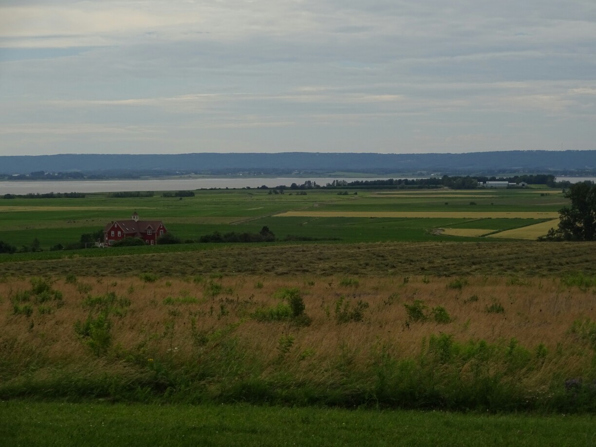
I left Fredericton and followed the highway back into Nova Scotia. I still had a day to spare before my friend Eiko was coming, so I decided to make a stop over at the “Five Islands Provincial Park”. By the time I had reached the park, the drizzle had stopped and I could set up my tent with a perfect view of the bay. Since it was still high tide, there was no point in going to the beach, as it was non-existent.

Looking out into the bay of the “Five Islands Provincial Park”
The “Five Islands Lighthouse”

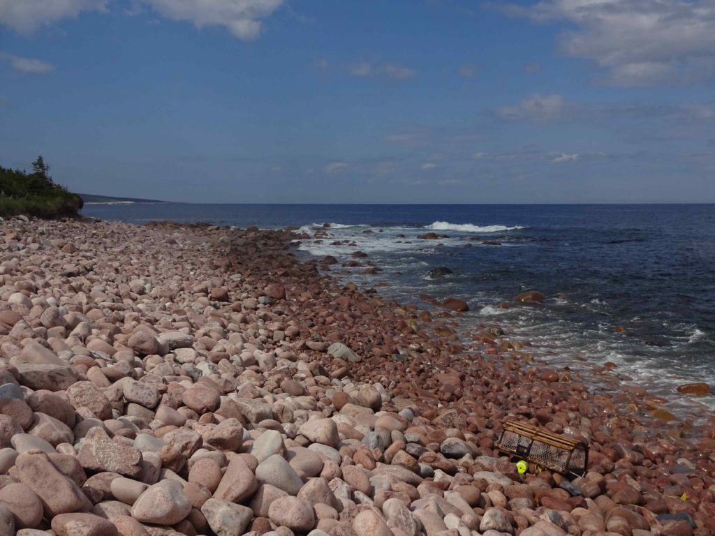
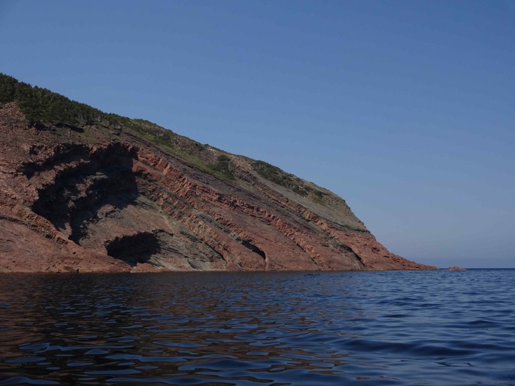
The next morning I packed up everything and headed to the beach. This area of the “Bay of Fundy” is famous for the numerous semi-precious stones that can be found between the high tides. They are deposited by the strong currents or fall down from the mineral-rich cliffs, which are slowly eroded by wind and waves. I did find a cool rock, but I didn’t know if it was just quartz or something more, so I left it there, hidden under a big rock, waiting for the ocean to reclaim it.

The colorful rock formations are only visible from the beach
I decided to take a picture instead of the rock since I had enough luggage

My next stop was also very specific to this area – tidal rafting! And it turned out to be one of my favorite things to do on the east coast. I had booked it with one of the biggest companies on the Shubenacadie River, which had everything perfectly organized. And timing is the key factor here! After everyone had put on their yellow rain gear (for wind protection) we headed to the water, where we could see the tidal bore, a small wave, coming up on the river.

Preparing to go tidal rafting in bright yellow rain gear

We saw giant sandbanks disappearing within five minutes – a 12m difference between high and low tide means that the water level rises 1m per 30 mins on average, often even faster. For the next hour we were riding the up to 2m tall waves created by the tidal currents that pushed the water up and inland. It was a lot of fun and everyone got soaked!  I couldn’t imagine how it would be with 5m waves, the highest ones that our guide had had in her four years of working here.

Back in Halifax it was already nighttime

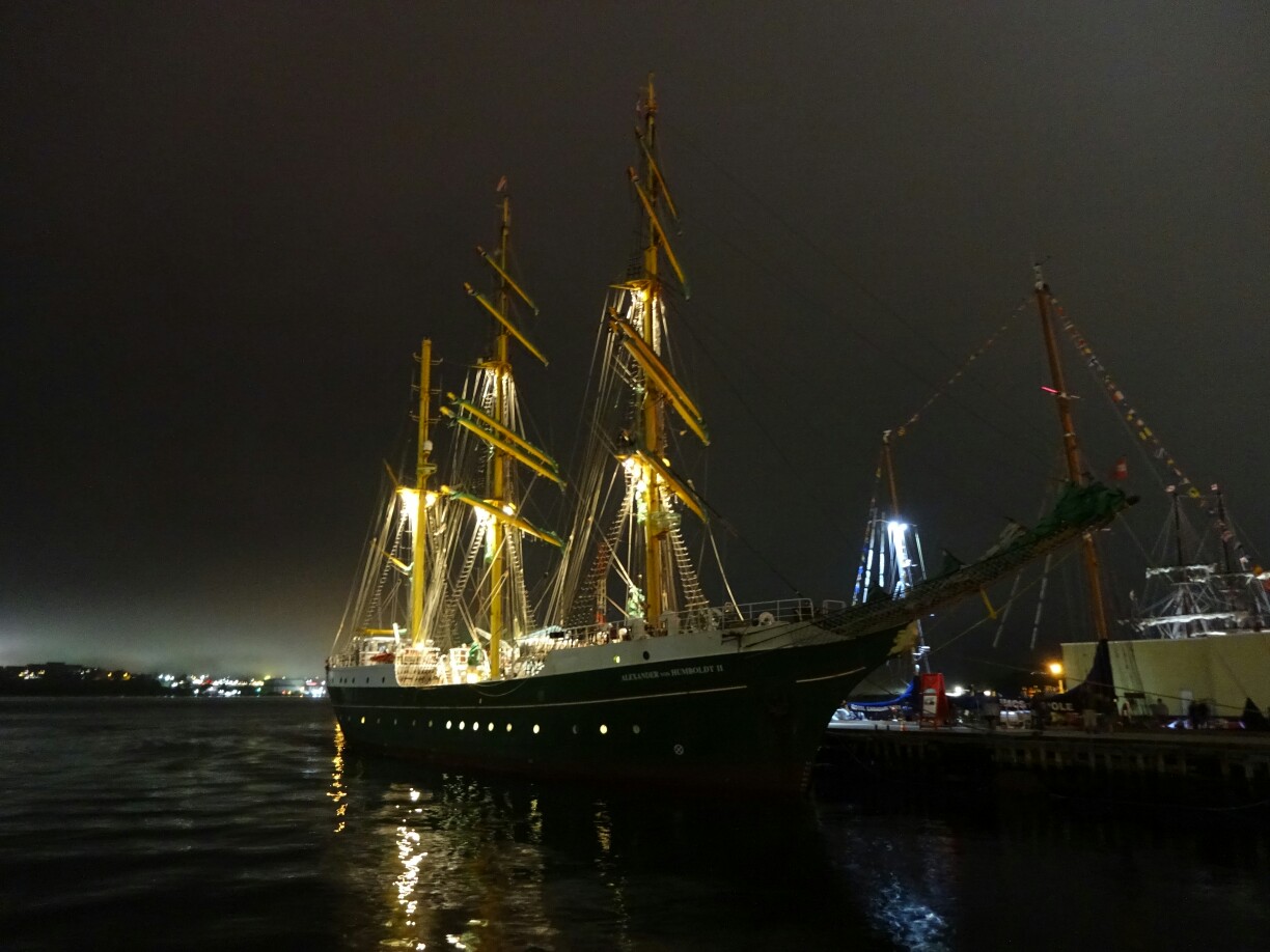
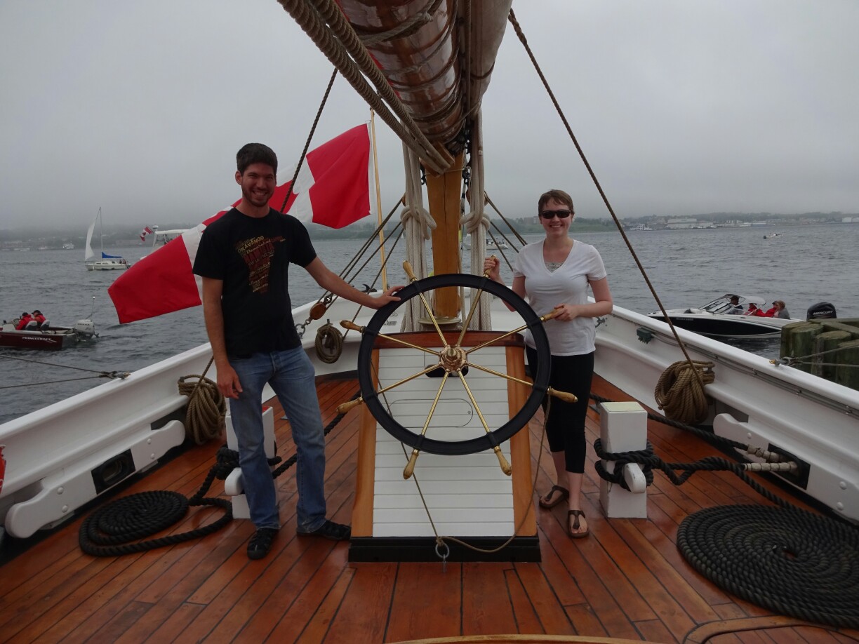
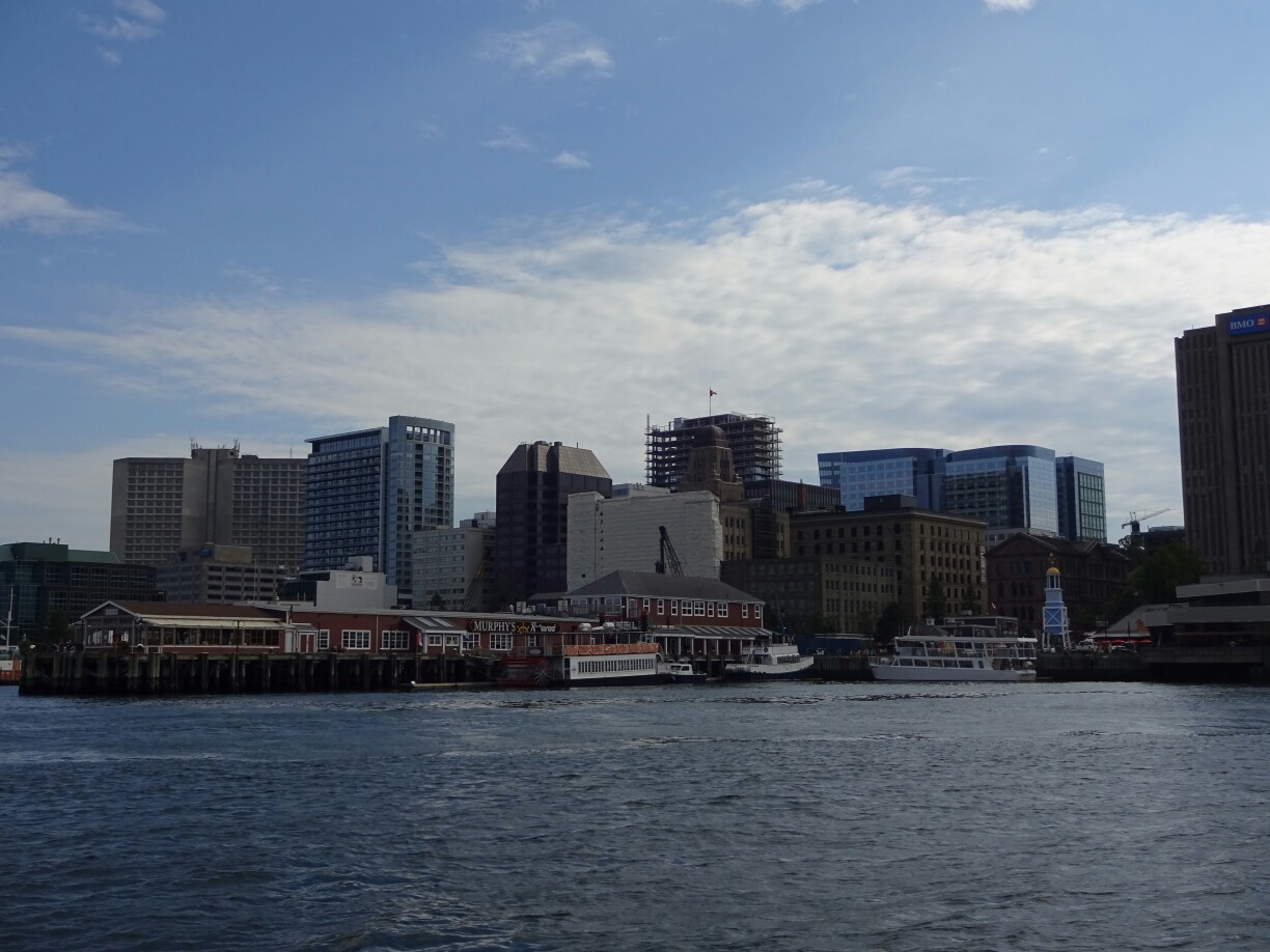
After a hot shower I drove back to Halifax, where Sarah had successfully defended her Master’s thesis. Together we had a look at the activities offered in the downtown area for the “Tall Ship Days”. The waterfront was full of famous ships, including the “Blue Nose II”, but all of them were already closed for the day. Instead we had a look at one of the busker shows, where a group of international street artists were playing with light and fire.

The street artists were playing with light and fire

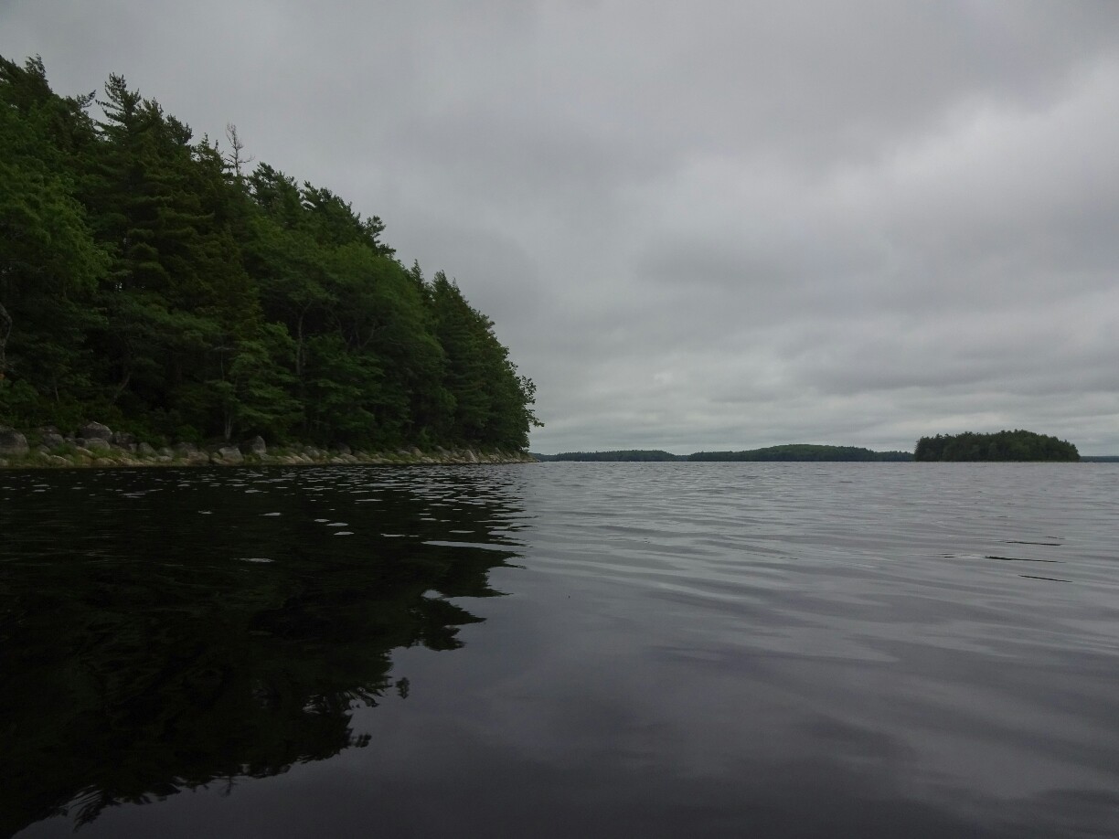
As Sarah had more time now, she also showed me the “Crystal Crescent Beach Provincial Park” the next day. It’s not too far from the city and offers hikes along the beautiful coastline. The big rocks reminded me a bit of “Peggy’s Cove”, just without the tourists. That might also have been due to the weather, which was quite foggy, compared to Halifax where we had left while it was still sunny. And as we returned to the city we left the fog behind.

The weather was pretty foggy when we visited “Crystal Crescent Beach Provincial Park”
Fortunately the rocks were not slippery, so we could explore the rocky coastline

All afternoon we walked around the waterfront and tried to get a closer look at the different ships. Most of them were open for a visit, but we didn’t feel like lining up for too long, so we only went onboard the “Blue Nose II”, where everyone was shuffled over the upper deck for a quick look. And after a huge serving of delicious fish and chips in Dartmouth, located on the opposite side of the bay, I drove out to the airport once again. This time it was for Eiko.

On board the “Blue Nose II”
This Spanish ship looked like it was from a pirate movie

Close-up on the Cabot Trail

From Baddeck it was easy to access the “Cabot Trail”, a scenic highway that hugs the shoreline of the Cape Breton peninsula. We left in the morning and drove all the way to the Eastern entrance of the national park, only stopping a few times to take in the spectacular scenery. The road leads almost 300km through the “Cape Breton Highlands” and some people do it in one day. We decided to take two full days to be able to do some hiking as well.

The entrance to the “Cape Breton Highlands National Park”
The road has many fantastic viewpoints

After a picnic outside the lighthouse at Neil’s Harbour we parked the car and followed the signs for the “Coastal Trail”. We had specifically asked for a trail that would allow us to take in the beautiful coastline from up close. But after the first 2km we felt that the name was a bit misleading, as we had only been walking through a thick forest filled with agressive mosquitoes and horse flies.

After the first 2km our trail deserved the name “Coastal Trail”

Luckily it didn’t last much longer after that and soon enough we reached the shore, where a slight breeze was strong enough to keep the bugs away. We followed the shore and watched the blue waves crashing into the steep cliffs or running up boulder beaches. We were only missing the whales, but we were planning on going whale watching tour at the northern end of the peninsula.

Watching the waves coming in

After a successful hitchhike back to our car we followed the road up north to Meat Cove, where we had managed to get one of the last cabins at this remote campground. The brochure promises a 95% chance for whale sightings, which is probably the reason why most regular campsites (non-reserveable) are already occupied around midday. We enjoyed our dinner with a spectacular view of the ocean and watched the sunset from a hilltop nearby.

Preparing dinner outside of our little cabin with ocean view
After dinner it was time to watch the sunset from the neighboring hills

The next morning we finally went for a whale watching tour. But despite the almost perfect conditions with calm and clear water, we didn’t manage to spot a single one during the three hours on the water. Instead we got a nice view of the rugged coastline and saw several seals, which were clearly not as impressive as the kings of the ocean that we had hoped to see. A little bit disappointed we left the bay and headed back to the “Cabot Trail”.

Watching the coastline from the water was spectacular
Despite of being on a whale watching tour we only saw some seals

At “Cabot’s Landing Provincial Park” we found a great lunch spot, which almost made up for the lack of whales: It was a picnic table overlooking a fine sandy beach with large waves rolling in. It was so warm and sunny that Maren and I decided to take a dip in the cool water. For Raghu it was a bit too cold, so he just watched us going up and down with the waves. Completely sun-dried we continue inland across the highlands to the east side of the Cape Breton peninsula.

Our picnic spot was picture-perfect!

Here, one of the highlights was waiting for us: The”Skyline Trail”. It leads through an open forest, where the abundance of moose have prevented the forest to regrow. Despite the numbers we hadn’t seen a single one of these majestic animals, but we were hopeful, as a moose had been spotted just before. And when we got there, it was still standing a mere ten meters off the trail! It didn’t move as it seemed to protect its baby, so we moved on after taking our pictures.

Everyone was getting excited…
… as there was a full-sized moose at the side of the trail!

The trail led to the edge of the highlands plateau from where we had a fantastic view of the ocean. Off in the distance we could make out the “Cabot Trail” as it was winding its way down on the mountain slopes. A little bit later we were following that same road again and encountered another moose at a lake next to the road. We even watched it swimming across! After the disappointing start to the day it had still turned out to be a memorable one!

Raghu, Maren and I made it to the end of the “Skyline Trail”
Another moose was waiting for us at the side of the road

Two hundred years of history

Our next stop was “Fort Louisbourg”: I had no expectations whatsoever, I only knew from my travel guide that it is the largest replica of a fort in North America, built in the 1960s as an employment program. The sky was bright blue and the temperature was perfect to spend the day outside. A short bus ride took us from the visitor center to the main gate of the fort. It was guarded by a man in a soldier’s outfit and a musket in his hand. Before we could enter the premises we were told how to behave so that we wouldn’t end up in prison.

The gate to “Fort Louisbourg” was guarded by armed soldiers
The port at Louisbourg was the only ice-free French harbor in the new world

The whole day at the fort is filled with activities that were typical during the 1750s, when it was used by the French to protect their only ice-free harbor in the new world. The activities included the demonstration of how a cannon or a musket were loaded and fired, along with the matching marching music and drums. However, we were too late to witness the public punishment, where soldiers were punished, if they had been caught asleep during their regular 24h shift.

The “King’s Bastion” was home to the soldiers of Louisbourg
During the “Tales of a Soldier” the actors demonstrated the loading and firing of a musket

We strolled through the little village inside the fort, where we encountered other historical inhabitants, like a woman who was working on fancy dress decoration. In another room there was a demonstration of several upper-class dance styles, where mostly the kids enjoyed joining in. And with that two hours had already gone by and the fort was closing its gates for the day. There was still so much to see and to explore!

It was really interesting to meet historical figures and to learn about their daily lives

The kids enjoyed watching the dancing for the upper class

But it wasn’t the end of our day in the 18th century: Maren and I had booked a dinner show, where all guests would join the actors and also dress up like back in the day. The location, a windowless hangar, looked rather boring, but the inside was nicely decorated and we enjoyed lobster and halibut with fresh bread and common vegetables from that time while listening to some traditional music. Meanwhile, the widowed owner of the inn was looking for a new husband. It was a great finish to this memorable day!

The “Beggar’s Banquet” was a historical feast with traditional food

Maren needed a little help with the lobster

The next day Maren and I wanted to go back to the fort for a bit more, since we felt like we hadn’t spent enough time there. Raghu had seen enough and decided to explore the shoreline around the lighthouse a bit more, which he had been doing already while we were at the dinner show. The weather was still perfect to spend the day outside and in no time we were back on the usually clean streets of “Fort Louisbourg”.

The fort now has clean streets and a proper sewage system

The kids can go on a separate tour to discover the fort

Back in the day, all dirty water and human waste had been thrown onto the street due to the lack of a proper sewage system. Similar systems had been in place in Europe for centuries. Talking to the inhabitants about problems like this led to interesting discussions, where sometimes it was not clear, if we were talking about past or present as in some European countries some of these problems are still relevant today.

There are daily demonstrations of canon firing

In the early afternoon we left this wonderful place and drove across the island to Baddeck. Alexander Graham Bell had discovered this peaceful place for himself, where he spent most of his summers always working on his latest inventions, while being financially independent after the patenting the telephone. We spent the last hour before closing time in the museum, which was built in the 1950s and displays his award-winning flying machines and record-breaking speed boats.

Alexander Graham Bell’s flying machines and speed boats can be visited in Baddeck

And after setting up our tents, Maren and I decided to make use of the remaining daylight to visit the picturesque “Uisge Ban Falls”, which had been recommended to us by a local bus driver. The valley was quite far off the main road, so that we weren’t surprised to find this little trail almost deserted. Only in the beginning we had to share the river walk with countless mosquitoes, forcing us to cover up and quicken our pace.

At the “Uisge Ban Falls” we had left most of the mosquitos behind

Recharging the batteries

From “Blomidon Provincial Park” Maren and I drove back to Halifax to pick up my friend Raghu, who had arrived from Calgary. Now was the perfect time to have a closer look at this bustling city. While walking along the waterfront, we found out about a jazz festival that would start the next day. Even better was the fact that it was free and open to the public for the afternoon shows.

Maren and I picked up Raghu back in Halifax
Ships and artwork at the waterfront

But for that day Maren and I decided to go on a city tour with the “Harbour Hopper” first. Those giant amphibious busses were originally used by the army and were bought and refitted for tourism after their time in service. From the elevated back of the bus we had a great view and a bit of a breeze cooling us down during the tour, where the first part took us through the narrow streets of downtown.

The tour with the “Harbour Hopper” took us through the urban canyons of Halifax

Out in the harbor we were side to side with the big container ships

Our transition from land to water happened with a big splash and suddenly the bus was swimming. We had a closer look at the large container ships that were going in and out of the port and had a better overview of the downtown area. Most of this is less than hundred years old, as the largest man-made explosion before the development of nuclear weapons had flattened most of the buildings in an 800m radius. Two ships, one carrying high explosives, collided in the harbor in 1917 and caused this what is now known as the “Halifax Explosion”.

Most of the present buildings in downtown Halifax were built after the “Halifax Explosion”

The best way to experience Halifax is by sitting in one of the hammocks at the waterfront

The next day we listened to the music of “Quinn Bachand’s Brishen” and the “Riot Squad” at the jazz festival and then continued to explore the waterfront. It was good to relax a bit before we got back on the road for some more adventures up north on the Cape Breton Island. Meanwhile Raghu was getting eager to leave the city and to get out onto the rugged coast of Nova Scotia, as this the reason why he had come so far.

The concerts at the “Halifax Jazz Festival” were free during the day

Tugboat “Theodore” is at home in Halifax

Soon enough we were working on it and had reached the “Battery Provincial Park” on the southern end of Cape Breton Island after a long day of driving. By then the clouds had cleared and we enjoyed an unobstructed view over the “St. Peter’s Bay” from our campsite. To make it even better we decided to have a small campfire, for which we got firewood at the park entrance just in time for an amazing sunset.

Our next adventures were waiting for us on Cape Breton Island

Perfect timing for the sunset at “Battery Provincial Park”

The sound of silence

From the Atlantic coast we turned inland to visit the “Kejimkujik National Park”, which had been established before the land at the sea had been acquired. It consists of several larger lakes, which are connected by rivers. At the shore of the largest lake are also some indigenous petroglyphs, making it a site of national importance that led to the declaration as a “National Historic Site” at the same time.

Dark clouds were hanging above “Kejimkujik Lake”
Maren and I still decided to go for a kayak tour on the lake

Unfortunately all the tours to the petroglyphs were booked out, so instead we decided to rent a kayak to explore the lake on our own. I was surprised well it worked, considering that I had cracked my clavicle just about a month ago. When we entered the lake we could hear nothing but the sound of the waves and the birds. We paddled around some little islands until we landed at a tiny beach and claimed “The Sisters”, a small and long stretched island, before heading back out.

We claimed our own island at “The Sisters”
When we headed back out the weather was improving

In the afternoon we continued our journey north until we got to the shores of the Bay of Fundy, where the world’s highest tides can be experienced. The difference between high tide and low tide is more than 10m for most places around the bay, twice per day, everyday! But when we arrived at our campground in Whale Cove we couldn’t see anything through the thick fog. We had no choice but to hope for better weather for the next day.

Once we arrived at Whale Cove we were surrounded by thick fog

The weather was still foggy when we got up the next morning. We decided to take the ferry to Long Island anyway, since the forecast promised the clearing of the clouds for midday. So when we got to the Tiverton lighthouse it was no surprise to hear the deafening sound of the fog horn about three times per minute, warning the incoming ships of the rocky coastline. We took our pictures as fast as we could and tried to get away again as soon as possible.

The next day the houses and boats on Long Island were still hidden in the fog
Due to poor visibility the lighthouse sent out deafening sound signals

The main reason why we had come to this island was waiting for us at the next stop – the “Balancing Rock”. We had seen pictures of it and wanted to see it for ourselves. After a short hike we had reached the side of the island facing St. Marys Bay. A set of stairs took us down the cliffs, where a large basalt pillar was sitting on a protruding edge. It looked pretty neat with the blue sky, which had come out in the meantime, and the mist that was still hanging over the water.

The stairs down the cliffs marked the border between fog and blue sky
The “Balancing Rock” was impressive, but not as big as we had imagined

After a quick lunch break back the car, we decided to hike out to the other side of the island facing the Bay of Fundy. Once again we were almost the only ones on this trail, which was covered with branches and a bit muddy. This time the silence was filled with the sound of dozens of mosquitos and horse flies that were buzzing around our heads. Luckily the breeze at the water was strong enough to keep the away while we were enjoying the view.

The other side of the island looked a bit different and involved fighting many mosquitos

Back on the mainland we headed for Annapolis Royal. It’s one of the oldest towns in Canada and was founded by the French in the early 17th century as Port Royal. During its relatively long history it changed hands many times between French and British forces and used to be the capital of Acadia, mostly French settlements in what is now Nova Scotia and New Brunswick. Today the large fortified walls and the former barracks are a silent remainder of these troubled times.

Nowadays the fortified walls are covered in lush green grass and make it look quite peaceful
Annapolis Royal is one of the oldest towns in Canada

The next day we continued through the Annapolis Valley, where most of Nova Scotia’s fruit and vegetable farming takes place, which is why we stopped for strawberry picking and wine tasting along the way. Despite having a harsh winter, there are many vineyards in the area, most of them producing white wines. In 2012 a special appellation blend was created known as “Tidal Bay” using only grapes grown in Nova Scotia.

The appellation blend “Tidal Bay” can only use grapes from Nova Scotia

At the end of the valley we visited the “Grand Pré National Historic Site” commemorating the deportation of Acadians during the French and Indian wars in the late 18th century. The Acadians were neutral, but they were seen as a potential threat to the British, who had taken over Nova Scotia by that time. Anyone who didn’t swear allegiance to the British crown was forced to leave. An interesting display, a historically reenacted movie or self guided tour through the area provides more detailed information.

The “Grand Pré National Historic Site” commemorates the deportation of Acadians

The land around Grand Pré has been reclaimed from the Bay of Fundy by the Acadians

That night we found ourselves a campground high up on the cliffs of the “Blomidon Provincial Park”. We set up the tents and found a nice spot for dinner from where we could watch the beach and the red rocks, which seemed to be aglow during sunset. Afterwards we tried to chase the water of the Bay of Fundy, where we had to walk out quite far, as the water had receded at low tide to reveal a large sandy beach.

The view from the campground at “Blomidon Provincial Park”

We visited the steep red cliffs and the exposed beach after dinner