Tag Archives: Carnival

Costumes, customs and carnival

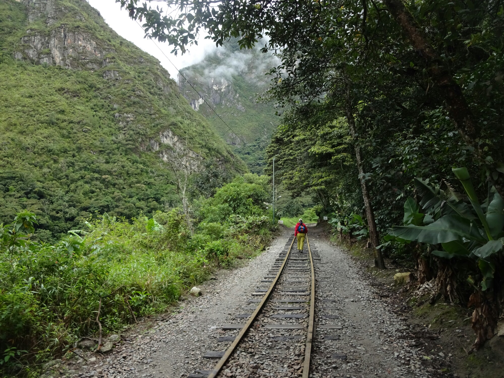
After two weeks in Cusco and its surroundings it was time to move on in the direction of Bolivia. I boarded a bus to Puno, the first major city at Lake Titikaka when coming from the west. The bus arrived early in the morning, but I was able to leave my backpack at a hostel and go on a tour to see the “floating islands” – home to hundreds of small communities on Lake Titikaka – after having some breakfast.

Puno is known for its “floating islands”

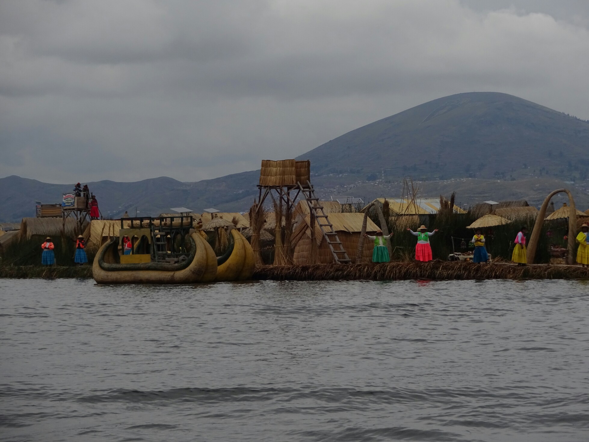
The “floating islands” are made of large blocks of reed roots, which float on the water, and several layers of reed. All is tied together and anchored in the lake to ensure that they don’t float elsewhere. The very basic reed houses are supposedly still inhabited by the native people, who we visited on this tour. However, to me it looked more like a movie set with actors dressed in colorful traditional clothing.

The chief of one of the islands explained to us the design principles
Trying out the different traditional clothes

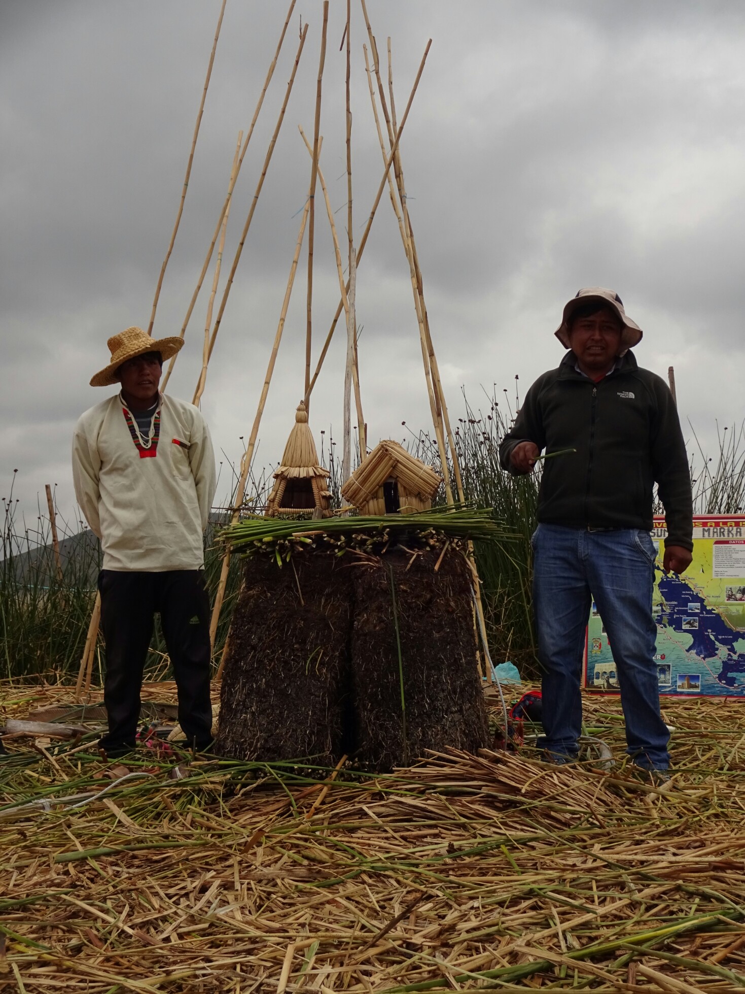
The tour guide tried to convince us that they only host tourists two days per week, while they do fishing and sewing the rest of the time. They might have lived like this at some point, but I’m sure they have tourists every day and go home every afternoon. It was also really commercial, as they tried their best to sell typical souvenirs or additional boat rides and wanted to get tips for their international song repertoire.

The whole island seemed to be a set up stage for tourists
At least the kids seemed to be happy

On the tour I met Natalia and Carlos from Mexico and Maca and Gracie from Chile. They also stopped in Puno just to visit the islands and continued with me to Copacabana, a small town on the east end of Lake Titikaka. It was our first stop in Bolivia and we were quite surprised to find more carnival celebrations going on, which we thought had ended about a week ago. Supposedly today was the last day. Jeremiah from the US joined us – he had missed his bus with his luggage as we had crossed to a different time zone at the border without knowing.

A carnival party in Copacabana
Joining the party with Jeremiah, Natalia and Carlos

The next day we climbed Cerro Calvario for a great view of the town and of Lake Titikaka. It was quite tough, as Copacabana is located at over 3800m. Afterwards the five of them continued to La Paz, while I stuck around. I wanted to visit the “Isla del Sol” after several recommendations from friends. I didn’t know when and how, but just when I took the others to the bus station, Dani and Krissi from Germany arrived. I knew them from Cusco, as we had stayed in the same dorm room.

Hiking up to Cerro Calvario with Maca, Carlos, Natalia and Gracie
View of Copacabana and Lake Titikaka

The three of us postponed the island for the day after and spent the afternoon downtown, watching even more carnival celebrations. It seemed like the whole city was dressed up in colorful clothes – the men in cowboy-like outfits, the women in long skirts. There were also a few couples, who seemed to be carnival kings and queens, as they were honored by others with tons of confetti and paper streamers.

The carnival celebrations continue
Crowning king and queen with confetti and paper streamers

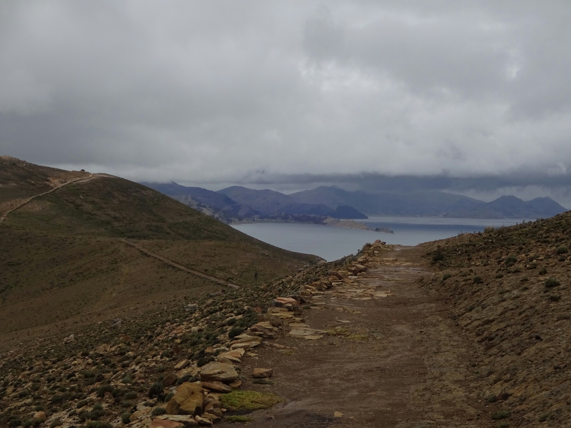
The following day we took a boat to the “Isla del Sol”. Despite its name, the island welcomed us with rain. Maybe because it thought that it would be customary for us Germans at this time of the year, because most people we met here were Germans. Luckily it was only light rain, which stopped around noon. And after leaving the north part of the island, we had the trail almost to ourselves.

Tea time on “Isla del Sol” with Krissi and Dani
The north of the island was still rainy

Without taking too many breaks, we walked for about five hours and got back to the other harbor just before the departure of the boat. In the end the trail across the island had taken us much longer than what we had been told, but we had still enjoyed the bleak landscape and the views of Lake Titikaka. On the way back to Copacabana we even got a sunburn, as we had forgotten to put on sunscreen.

Hiking across the deserted island
The clouds are treacherous and didn’t prevent us from getting a sunburn

The Inca experience

After seeing the ruins of the “Sacred valley” and the Moray terraces it was time to visit the most famous of all Inca ruins – Machu Pichu. There are different ways to get to there: The Inca Trail (closed in February for maintenance), the Salcantay Trek and the Inca Jungle Trail among others. We chose the latter one, which includes biking, rafting, hiking and zip lining and allowed us to be back in Cusco for carnival without skipping part of the tour.

The Inca Jungle Trail promised different activities and great views

We got on the bus early in the morning. With us on the tour were Alex and Lucie from France and three American machos, who were still drunk and hungover from last night’s party. With the bikes and protective equipment all tied up on the roof we left Cusco and drove up to a mountain pass at about 4400m. Since it was covered in clouds, we had to continue a bit further down for a better visibility.

The mountain roads are in bad condition during the rainy season
Alex, Lucie and three drunken American machos joined our tour

At about 3500m the conditions were better and we changed the bus for mountain bikes. From here it was about 50km only downhill biking. It was a lot of fun! The weather was perfect and we stayed dry except for the times when a stream was crossing the road. On our way down we encountered a bus that got stuck in a narrow curve and trucks who had to cool down their engine manually, because it kept overheating.

Downhill biking for 50 kilometers was a lot of fun
While the bus got stuck in the curve, the truck had to cool down its engine in the same spot

In the afternoon we had the chance to go rafting. While Nik, Alex and Lucie went for it, I decided to skip it, as the water levels of the river were pretty high and the tour agency in Cusco had advised us not to do it for safety reasons. The Americans wanted to go as well, but they passed out on the sofa, as they needed to catch up with some sleep. In the end everything went well with rafting and Nik, Alex and Lucie had a great time.

Santa Maria is a pretty quiet village

The next morning we left Santa Maria and walked along a bumpy road through the jungle. After about an hour we took a small path that left the road and led us up into the mountains, through small banana, coffee and coca plantations. During a short break at the “Casa del mono”, the monkey’s house, we learned about the different types of cocoa products, coffee beans and Inca tequila, an alcohol made from potatoes and several different herbs.

Hiking a lonely road through the jungle
Inca tequila with serpent flavor

The following section was part of the original Inca trail and led us along a narrow path high above the river valley. The views were truly amazing! After a steep descend we followed the course of the river, crossing it twice – by a suspension bridge in disrepair and on a little pulley platform. At the end of the day we were quite exhausted and happy about having some time to relax in the hot springs of Santa Teresa.

This section is part of the original Inca Trail
Part of the railing and some planks were missing on this suspension bridge

Day three started with some rain, delaying our next activity – ziplining. Fortunately we didn’t need to wait too long for the rain to die down. We put on a body harness, gloves and a helmet and were ready to fly across the deep valley. We conquered the different ziplines in different styles, first sitting down, but then also upside down, spinning and “Condor-style”, all of which were a lot of fun! The rest of the day involved some more hiking to Aguas Calientes, the closest village to Machu Pichu.

Upside down ziplining high above the valley
The last part of the trek followed the train line

By then we were ready for the most magnificent Inca ruins. At five in the morning we started our ascend of the several hundred steps that lead up to Machu Pichu. On a guided tour we learned that the city was built in the mid 15th century for the family and friends of the ruling Inca king at that time. With the arrival of the Spaniards it was abandoned and forgotten for about 400 years.

First sight Of Machu Pichu and Waynapichu through the clouds
The roofs of some of the houses were rebuilt

The rest of the day we explored the large area on our own, discovering little details that we hadn’t seen before on the tour. We also climbed the steep slopes to the top of Waynapichu, constantly wondering how and why the Incas had bothered to build more structures up there. Reaching the top, it became clear, that the 360° view is perfect for the defense of the city and a great spot for sending signals across large distances.

The narrow path to Waynapichu
The classic view of Machu Pichu

The way back to Cusco was long and included a train and a bus. It’s the fastest, but also more expensive route, but it allowed us to be back in time for a crazy carnival party the following day. The main scene was happening on the “Plaza de Armas”, where hundreds of locals and tourists engaged in a huge fight with foam spray and water bombs. But the fighting was not limited to the main square, so we had to be careful while walking through town.

Carnival in Cusco was a huge fight with water balloons and foam spray
Allied fighting with Catherine