Tag Archives: Alberta

Spring time

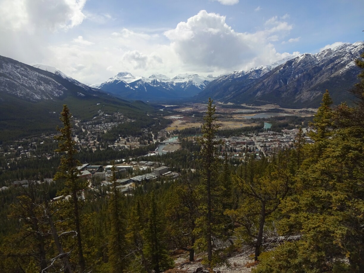
As soon as the weather forecast promised a few days of sunshine and warmth, I asked my friend Raghu, if he wanted to go on a little road trip to make use of the extra hours that I had accumulated. Raghu is living in Calgary and is still looking for a job, so he didn’t mind going in the middle of the week. He picked me up in Banff and together we continued towards Radium Hot Springs, a town west of “Kootenay National Park”, where the climate is warmer and drier than in Banff.

Raghu joined me for a two day road trip
“Kootenay National Park” was largely affected by bark beetles and forest fires

After a quick stop at the “Paint Pots”, where it was more exciting to navigate around the ocre mud holes than to watch the three slightly blueish colored spring pools, we continued our journey along the “Banff-Windermere Parkway”. The road leads right through the “Kootenay Valley”, which is mostly bare at the moment, despite being covered in evergreen trees. However, bark beetles and forest fires have diminished large areas of the pristine forest, which is only slowly recovering.

The ochre soil has been used by Indians for centuries for painting
The “Paint Pots” were not as spectacular as we had expected

We reached Radium Hot Springs by the late afternoon and set up our tent on one of the campsites overlooking the valley. As there was still some time left until sunset, we decided to go on another little hike to the “Sinclair Creek Waterfall”. A spontaneous extension of our hike led us to the actual hot springs, only accessible through a modern swimming pool. But instead of a concrete pool, we wanted to have a more natural experience, which was waiting for us the next day.

View of the gorge just outside of Radium Hot Springs
The “Sinclair Creek Waterfall”

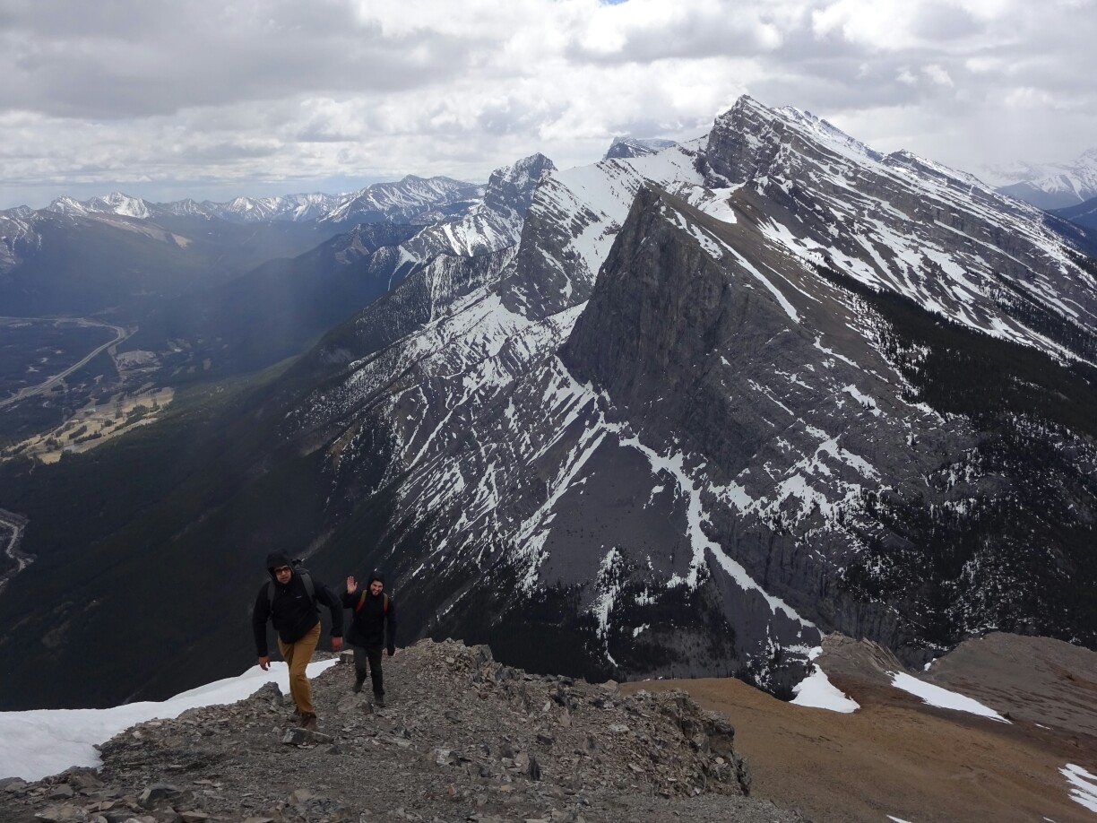
The next day kept its promise and we had perfect weather throughout the day. We started off with what we thought would be a short hike. At the tourist information, we had been recommended to visit “Mount Swansea” overlooking the “Columbia River Valley”. However, instead of driving almost all the way to the top, we decided to park the car at the bottom to hike up along the southern ridge.

Climbing the southern ridge of “Mount Swansea”
An interesting bird encounter on our way up

The climb was steep up through the forest, but it was nice and quiet. We didn’t encounter any bear, but a very interesting large bird that was suddenly sitting almost right on the trail. And if that wasn’t enough, we were constantly rewarded with amazing views of the valley and the surrounding snow-capped mountains. Only the way down was a bit too steep in our opinion. By the end we had accomplished a solid four hours hike and were quite hungry for some lunch.

It took longer than expected, but we made it to the top!
Amazing views of the “Columbia River Valley”

After an extensive lunch break and another short hike at the “Hodoos” next to Fairmont Hot Springs, we continued our road trip along the “Columbia River” and the “Columbia Lake” until we reached the turnoff for the “Whiteswan Lake Provincial Park”. As we were driving, the valley got narrower and the road led us higher and past the sign for the “Top of the World Provincial Park”. That sounded pretty good, but unfortunately we couldn’t go there, because there is still too much snow. However, we’ll definitely keep it in mind for some other time.

On top of the “Hodoos”, looking down
The “Hodoos” as seen from the bottom

At “Alces Lake”, which is already in the provincial park, we found a nice little campground with a superb view over the lake. We occupied a site, set up our tent and started making dinner. By the time we were finished it was getting dark – the perfect time for a bath in the “Lussier Hot Springs”, free and all natural hot springs, just a few kilometers from our campground. Afterwards we were all warmed up and it was time to go to bed, as it had been a long day.

Great campsite and great dinner!
The “Lussier Hot Springs” have become quite popular with the new access path

The next morning we had a look at “Whiteswan Lake”, before heading back to the “Columbia River Valley”. Here, we wanted to do some more hiking, but the weather had changed and it was all cloudy and rainy. Therefore, we changed our plans and drove back to the “Johnston Canyon”, which had better weather and is much closer to Banff than where we had been before. This was important, as I still had to work the evening shift that day.

The morning at “Whiteswan Lake” looked quite promising
The trail through “Johnston Canyon” leads through a narrow gorge

The canyon was very crowded up to the upper falls, even if it was not a weekend. However, was still worth going and seeing the narrow gorge with the suspended trail at the walls of the canyon. With a bit of time left, we decided to continue our hike to the “Ink Pots”, several spring ponds, which were much more interesting and colorful than the “Paint Pots” on our first day. Eventually we got back to the car and back to Banff with only half an hour behind schedule.

The spring weather had melted most of the ice at the upper falls
The “Ink Pots” were more impressive than the “Paint Pots”

Beautiful Banff

Most of the people who work here at the hostel have been here for a while or are planning to stay for the summer. Therefore, their motivation to get out and explore the area was not the same as mine. If I would stay longer, I probably would have waited for better weather as well. But I didn’t, so quite a few times I put on my coat and went out into the cold on my own.

Banff in spring is definitely not as busy as it was in July 2015
St. Paul’s Church with “Mount Rundle” in the back

However, I wasn’t alone on my very first hike. Katrina, whom I had met already during my first week in Calgary, was in Banff for the weekend and together we decided to climb the locals’ favorite mountain – “Tunnel Mountain”. The walk up is pretty easy and short, which is why most locals run all the way to the top to exercise. From there we had a great overview of Banff and all the places I planned to visit during the next few weeks.

Katrina joined me for my first hike in Banff
Banff from above – the view from “Tunnel Mountain”

A few days later we had a big dump of snow and my hopes for spring had been dampened once more. But instead of hiding inside, I went on a hike through the winter wonderland, which took me along the base of “Tunnel Mountain” to the “Surprise Corner”. The name can be taken quite literally, because the “Fairmont Banff Springs Hotel” can only be seen after turning the corner. The luxury hotel was opened in 1888, but has been remodeled in the early 20th century. At the base of the hotel are the “Bow Falls”, a series of cascades, after which the river lost about 9m in altitude.

The “Fairmont Banff Springs Hotel” on a winters day
The “Bow Falls” as seen from the base

The reason for building the luxury hotel was not only the beautiful mountain scenery, but also the discovery of the hot springs at the bottom of “Sulphur Mountain” during the construction of the Canadian railway. To prevent the exploitation of the hot springs, a protected area was set up around them and Canada’s first national park was born. The original cave with the hot springs can still be visited today and is now specially protected as the “Cave and Basin National Historic Site”.

The original cave is home to an endangered snail species
The “Bow River” carries turquoise glacier water

Another day I set out to climb up “Sanson Peak” on “Sulphur Mountain”. I had originally planned to go with Tristan, but he was sick that day. Instead I went with Endija and his three Spanish friends Tatiana, Marta and Diana, who happened to be going the same day just a bit later. The way up was pretty straight forward, as the path was zigzagging underneath the expensive gondola. Although it had been warm for a few days, there was still a lot of snow, making it quite slippery.

The way up on “Sanson Peak” is still snowy and quite slippery
The descent with the gondola is for free

We reached the top just on time. After taking in the great view of Banff and the surrounding mountains we had a quick look at the old meteorological observatory building from 1903. Then the rain showers really started and urged us to seek refuge in the summit station of the gondola, where we witnessed a perfect rainbow over the “Banff Springs Hotel”. Eventually it was time to go back and this time we used the gondola, as the descent is for free.

Inside the old meteorological observatory building
The weather changed quickly and suddenly we were above the rainbow

One more trail that I discovered on my own was the “Bow Valley Trail”, which I hiked on a nice spring day. First it leads through the forest and along the “Bow River”, but later on it climbs up to a little ridge overlooking the river valley and the majestic “Mount Rundle” in the back. It definitely looked like one of the mountains I would love to climb, but not alone. A little later I had reached the “Hodoos”, pillar-like rock formations, where I left the trail and headed back to the hostel.

Hiking the “Bow Valley Trail”
The “Hodoos” seem rather small and insignificant compared to massive “Mount Rundle”

With just a few days left in Banff I had almost given up on the idea of climbing “Mount Rundle”. But then I met three Canadians at the hostel bar – Adreon, Curtis and TJ – who wanted to climb it the next day. That fitted perfectly with my work schedule, as my shift was starting in the late afternoon. The plan was to go up from Canmore to the “East end of Rundle”. With its 2530m it is about 400m lower than the top of “Mount Rundle” and the chances of snow are therefore much lower.

The “Ha Ling Peak” is a masterpiece of the Canadian Rocky Mountains
The last part of the ascend leads along an exposed ridge

The total ascend is still about 900m from the “Whitemans Pond”, where our car was parked. It may not seem like a lot, but neither Curtis nor TJ had ever climbed a mountain before. The steep trail and the exposed scramble at the ridge close to the top added to the difficulty. However, with sufficient breaks, snacks and “special drinks” all of us made it to the summit in one piece. At that point the wind died down and the sun came out, allowing us to fully enjoy the rewarding view.

We made it to the summit – TJ, Curtis, Adreon and I (from right to left)
The magnificent view from the top of “East end of Rundle”