Tag Archives: Argentina

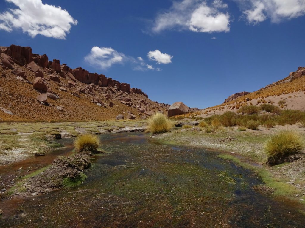
The colors of the earth

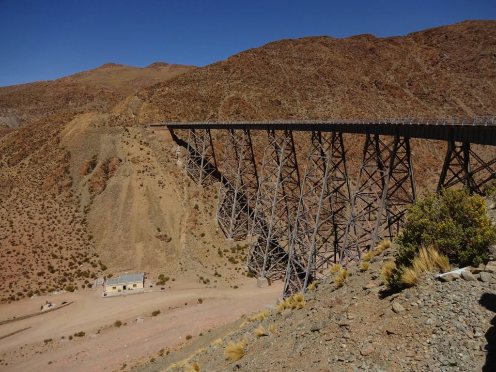
From San Antonio de los Cobres we continued northbound on the RN40 for some more gravel roads. Just behind the city is the Polvorilla viaduct, the last stop of the “Tren a las Nubes” (Train to the clouds), which offers a tourist train ride from Salta to here and back. Climbing the 63m from the bottom of the valley to the proved to be quite a challenge due to the general altitude, which is still at about 4200m above sea level.
The road trip continues
The P viaduct
The Polvorilla viaduct

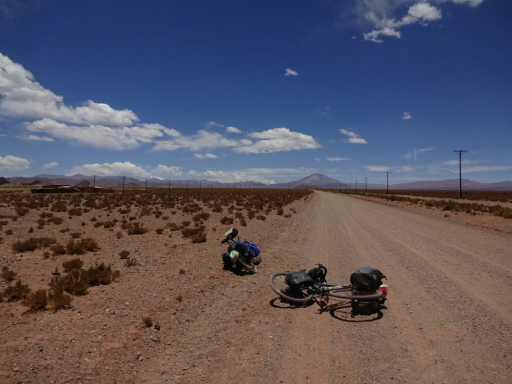
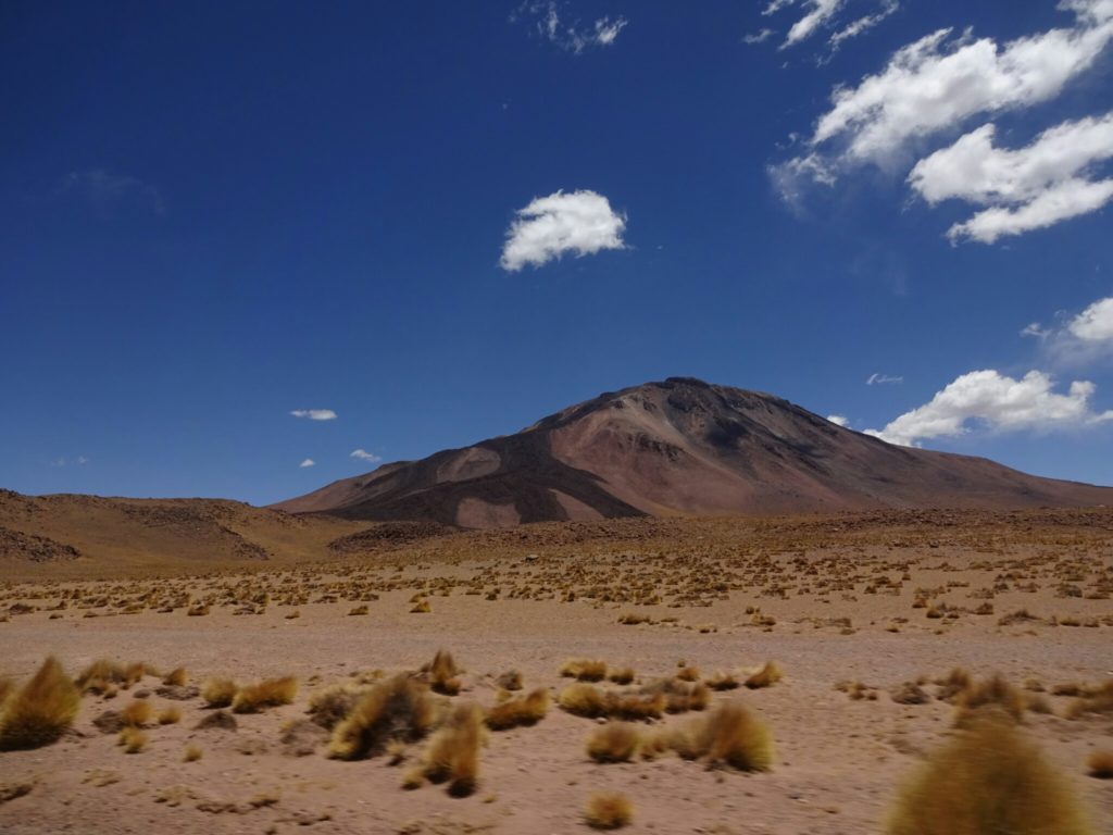
Through more canyons and wide open landscapes we drove to Susques. Along the way we passed alpacas, nandus, volcanoes and crazy bikers, who are cycling through this deserted area. It was not as hot as the days before, but there are almost no villages along the way, so you’re kind of screwed, if your tire has multiple punctures and no more glue to fix the holes. We tried to help them, but our glue didn’t work and we were going in the opposite direction.

A herd of alpacas was waiting for us today
Volcanic mountains
Volcanic mountains
When the glue is missing...
When the glue is missing…

After a quick lunch break in Susques, we passed the two great salt lakes of northern Argentina, which are more salt than lake – the lakes are pretty dry at the moment, leaving a thick layer of salt on the ground. However, this resource is being exploited, leaving the open areas rather gray than white, which is not as impressive. Since Brice had already seen the salt flats of Uyuni (Bolivia) and it being on my agenda as well, we decided to go straight to Purmamarca instead of getting off the main road to find an undisturbed area of the salt lakes.

{"total_draw_time":0,"uid":"1ed8038c-5aff-4d64-ba22-8e7609b39949","layers_used":0,"effects_tried":0,"photos_added":0,"origin":"unknown","effects_applied":0,"brushes_used":0,"total_effects_time":0,"total_draw_actions":0,"total_editor_actions":{},"longitude":-1,"total_effects_actions":0,"latitude":-1,"tools_used":{},"fte_image_ids":[],"total_editor_time":2}
Downtown Susques
Salty rivers...Salty rivers…

...deposit the salt in one of the big salt lakes where it is gathered mechanically
…deposit the salt in one of the big salt lakes where it is gathered mechanically

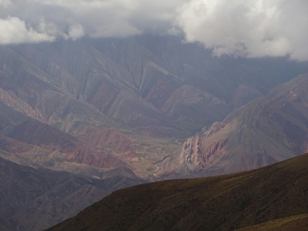
Purmamarca is well known for the “Cerro de los siete colores”, the seven-colored hill, which flanks the town on one side. And although the light was not perfect, it was still an impressive sight. The same is true for Mount Hornocal, a mountain just outside of the town of Humahuaca (3012m), which is even titled fourteen-colored mountain. Here, we had to drive back up to over 4000m in altitude to get a good view of it, because it is located in the next valley.
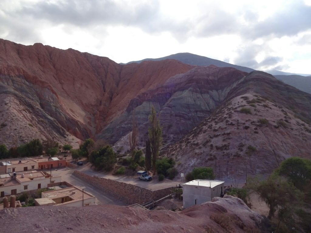
The seven-colored hill of Purmamarca
Mount Hornocal is covered in clouds

But the “Quebrada de Humahuaca”, a world heritage site, has more to offer: There are several hikes that take you to other colorful rock formations, such as the one to the “Quebrada de las Senoritas”, which leads to an area that looks like a natural cathedral with lots of colorful pillars, statue-like rocks and an open roof. Best of all was, that we had it all to ourselves, because nobody else wanted to hike the 2km through the heat of the desert. But it was totally worth it!
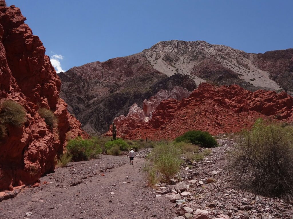
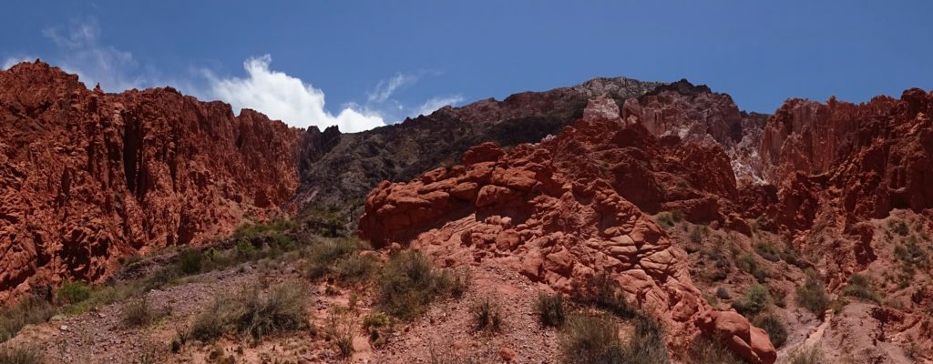
A hike to the "Quebrada de las Senoritas"
A hike to the “Quebrada de las Senoritas”
Alone in a natural cathedral

On our way back to Salta we stopped in Tilcara, where the oldest traces of human inhabitation in Argentina were found, dating back more than 10000 years. A pre-Inca town is located on an exposed hill in the center of the town, having an excellent view over the valley and any incoming enemies. It was partially rebuilt with information gained during archeological excavations and includes houses like the ruines at Quilmes, but some also have a roof made of wood or dead cactus in combination with clay.
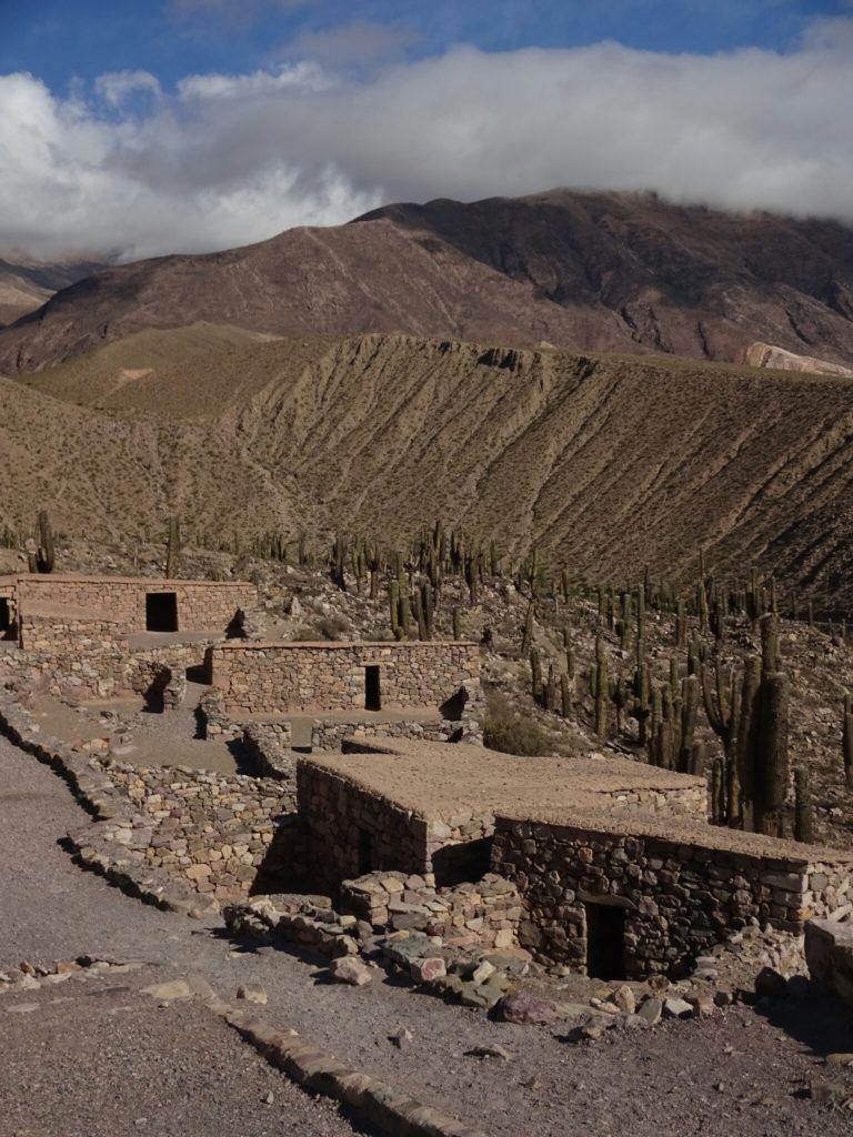
The Pucara de Tilcara
Houses of the Pucara (fortress) de Tilcara

They also had a temple with altars for sacrificing animals or humans, but it was probably built during the Inca occupation. Another impressive structure is the small pyramid that sits on top of the hill. However, I was a bit disappointed when I found out that it was only built in the 1950s as a commemoration of the pioneer archeologists that helped in the discovery of Tilcara.
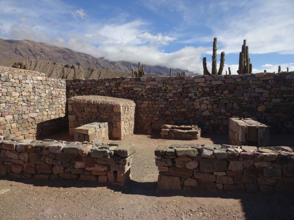
The temple with the altars for sacrifice
A disappointing pyramid

In Salta we decided to stay two nights to discover the city. However, we had some bad luck and someone broke into the back of our car during the first night and stole my tent. Therefore Brice spent a lot of time the next day with the rental car company and the police to get everything figured out. It would have taken Elise or me a lot longer with our basic Spanish skills, so thanks again!

The cable car was not running that day, so we had to walk back down
The cable car was not running that day, so we had to walk back down to Salta
The San Francisco church in Salta

Although the day had been troublesome, we managed to finish it well and had a nice end of our road trip, with a beer, the sunset and a rooftop pool! While Brice and Elise returned the car in Tucuman the next day, I stayed in Salta, because I had booked a flight from here to Buenos Aires. But we decided to meet up again after Christmas in Buenos Aires, before the two of them would return to France.
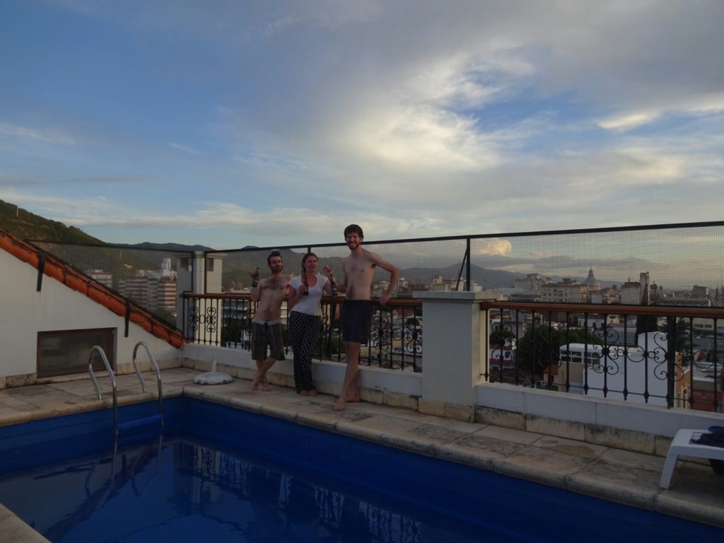
A beer at the rooftop pool finishes our great road trip

Highway to hell

Due to the recommendation of my Argentinean friends Michael and Sabri, I set off to explore the north of Argentina. From Puerto Iguazu I took another 22 hour bus ride to get me to San Miguel de Tucuman. Here I wanted to find some fellow travelers to rent a car together. While boarding the bus, I had already spotted two couples that were also heading to Tucuman. Randomly I asked one of them, what their plans were: Renting a car for one week and exploring the area. Bingo! Even if I didn’t win the free on-board Bingo game, I had just won the main prize, far better than a bottle of wine: Two new friends and a week full of adventures!

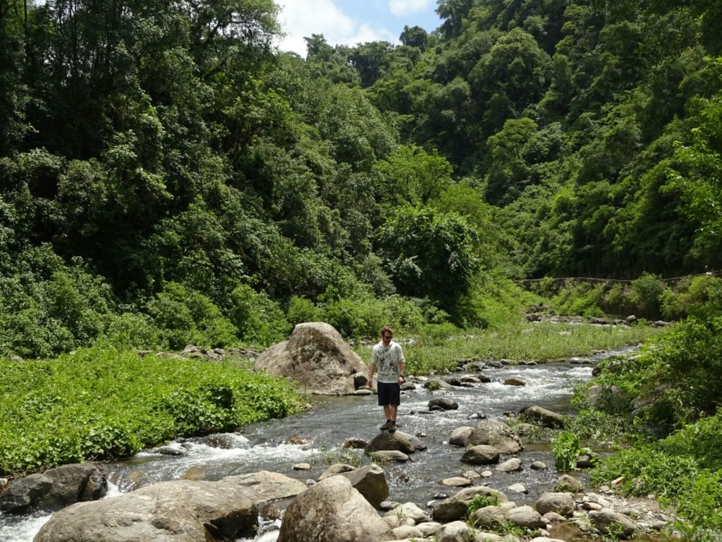
As we left Tucuman we were surrounded by thick forest

We set off the following morning with a Chrysler Corsa that Elise and Brice had booked the same day. On our way to Tafi del Valle we entered the mountains and the landscape around us changed from lush green forests to open grasslands. After a quick stop at the Menhir collection of El Mollar, we continued and took a mountain pass with a little shop, titled “Infiernillo” – little hell. And it was almost like passing a gate (to hell), because the climate changed once again and turned into a hot and dry mountain desert, favoring the growth of little shrubs and cacti in the area behind the pass.

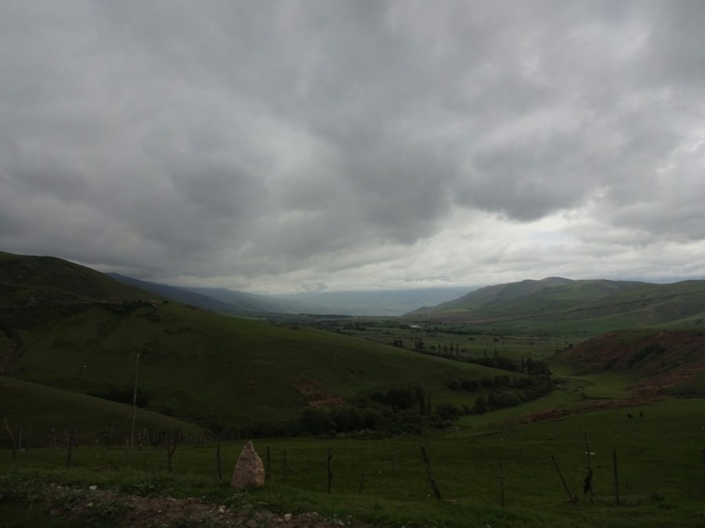
Higher up we found green hills
One of the monoliths at the Menhir collection
Some of the monoliths at the Menhir collection in El Mollar

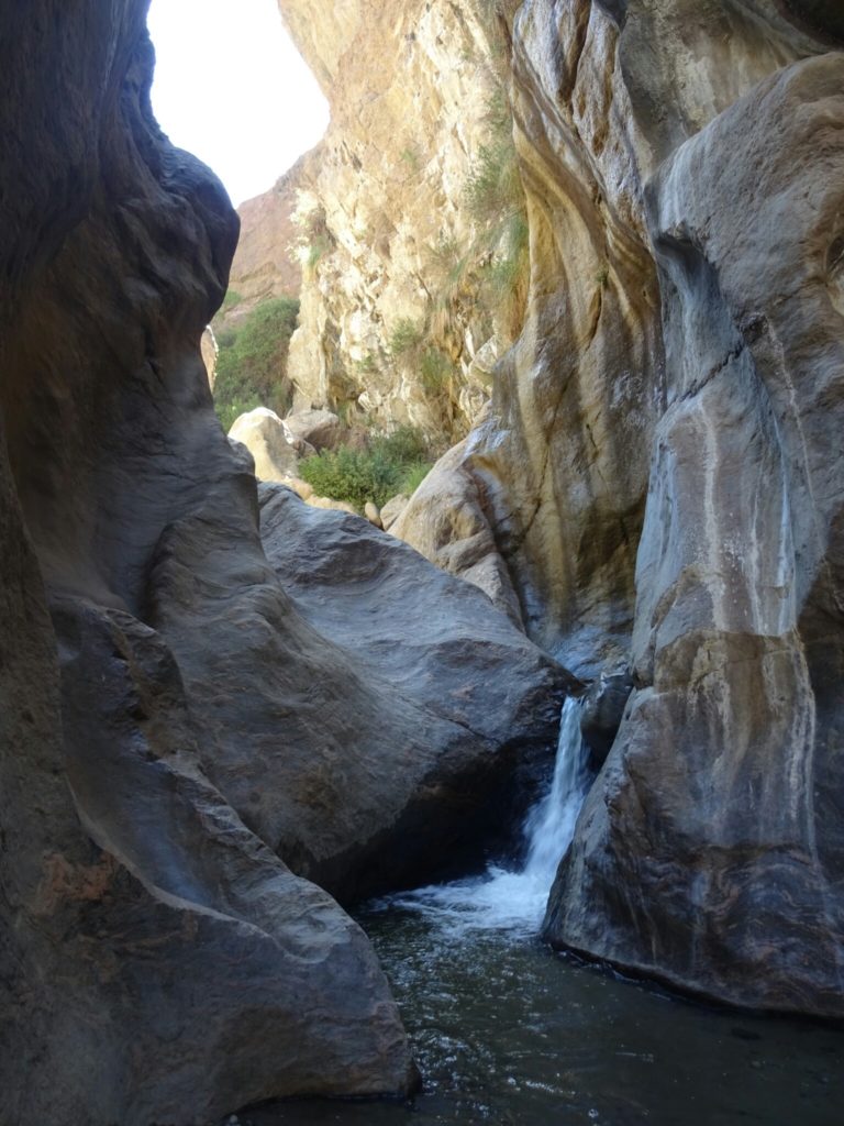
In Amaicha del Valle we spent the night and visited the Pachamama Museum, a showroom for the works of the local artist Hector Cruz, which also has exhibitions on the geological formation of the valley (Valle Calchaquies) as well as on the indigenous history of the area. The museum itself is already very artistic and definitely worth a visit. Almost next door is a little canyon with a nice waterfall – “El Remate”. We paid the entrance fee and got a private guide who took us to the waterfall.

Visiting the very artistic Pachamama Museum
The waterfall of El Ramate
The waterfall “El Ramate”

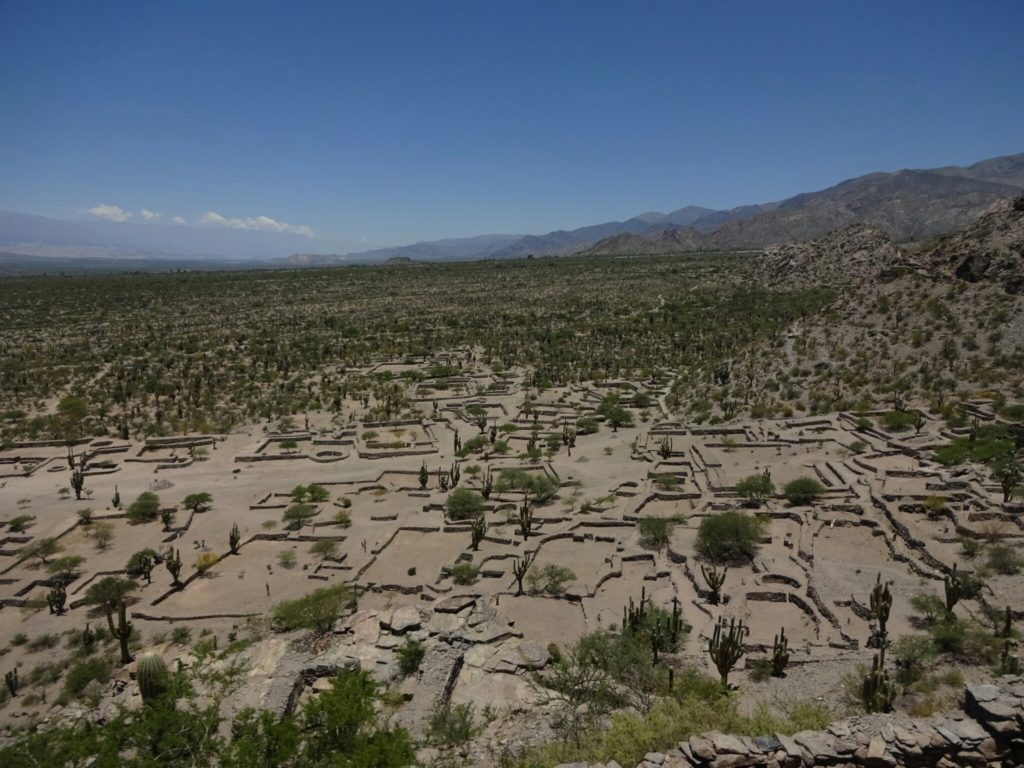
Further down the valley lies the ruin of the holy city Los Quilmes. It’s the remains of an old city, more than 1000 years old, that is believed to have had up to 5000 people living in it at its peak. The walls of the houses have been restored so that you can walk around and get an impression of how big the city was. Unfortunately none of the roofs were rebuilt, leaving it up to imagination how it looked like. (A few days later we visited other ruins, which had roofs.)

The ruins of the holy city of Quilmes
At Quilmes the landscape around us had turned into desert

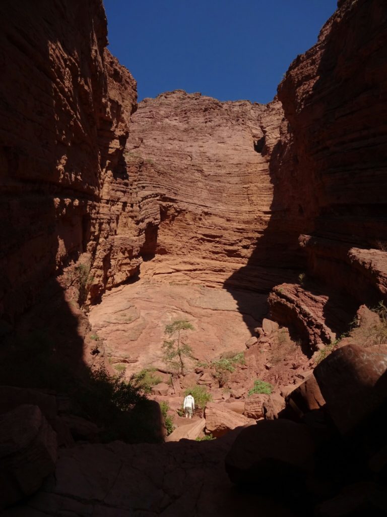
As we drove past Cafayate we were running low on gas. Luckily, the “Quebrada de las Conchas” started right outside the town and we wanted to visit it before it got dark. However, driving to the main attractions of the gorge, “El Anfiteatro” and “Garganta del Diablo”, was further than we had expected. The grandeur of the surrounding landscape was nevertheless worth the trip. Both, amphitheater and devil’s throat, are short canyons that lead to the main gorge. Their small entrance to a huge room flanked by tall red walls and the great acoustics are used by local artists.

Local artist using the acoustics of the natural Amphitheatre
Climbing into the "Garganta del Diablo"
Climbing into the “Garganta del Diablo”

Getting back to Cafayate was a bit more exciting than necessary, because by the time we reached the town we had done about 80 km on our empty tank. However, with Brice’s excellent driving skills we made it back in one piece without being stranded on the small roads through the gorge.

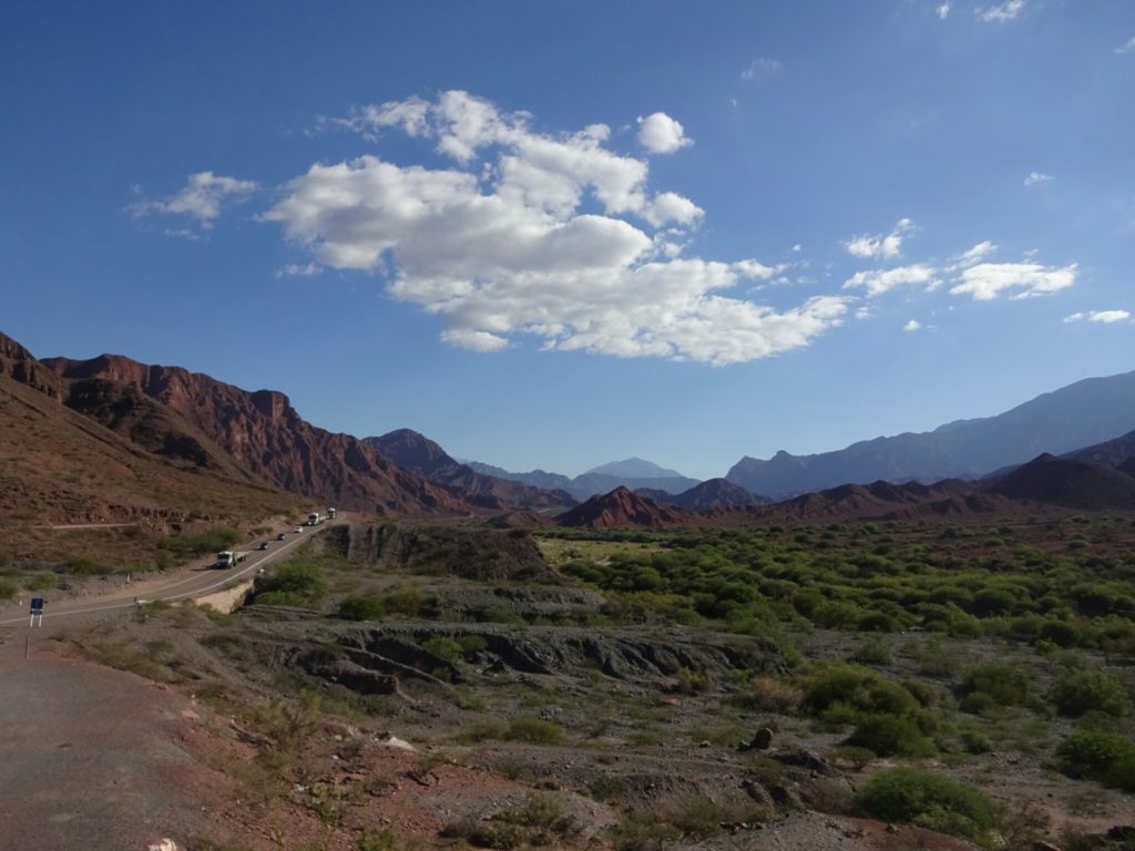
The Quebrada de las Conchas
The “Quebrada de las Conchas”

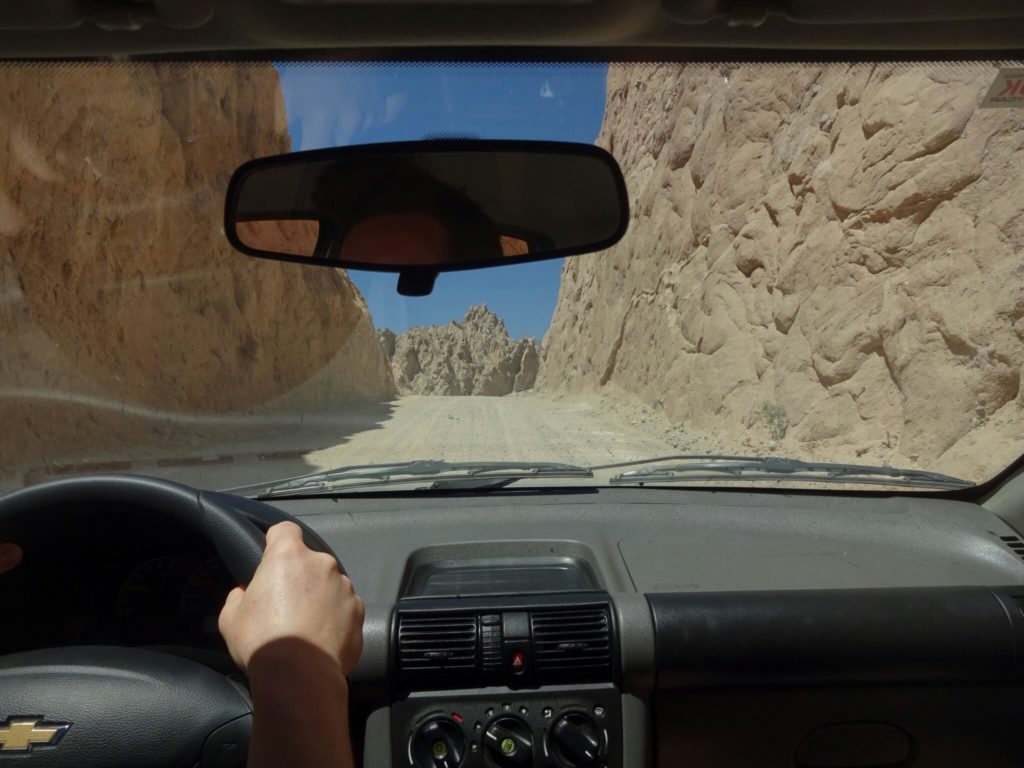
The next day we chose to take a section of the legendary “Ruta Nacional 40” (RN40), which runs from the southernmost point of Argentina in Tierra del Fuego all the way north to Bolivia. And if we had thought the road yesterday was small, we had to revise our definition of small: A gravel road, sometimes only wide enough for one car to pass, which is sufficient, because we only met a handful of cars during the whole day. This time we had a full tank and were ready to take on the adventure.

Driving on the RN 40

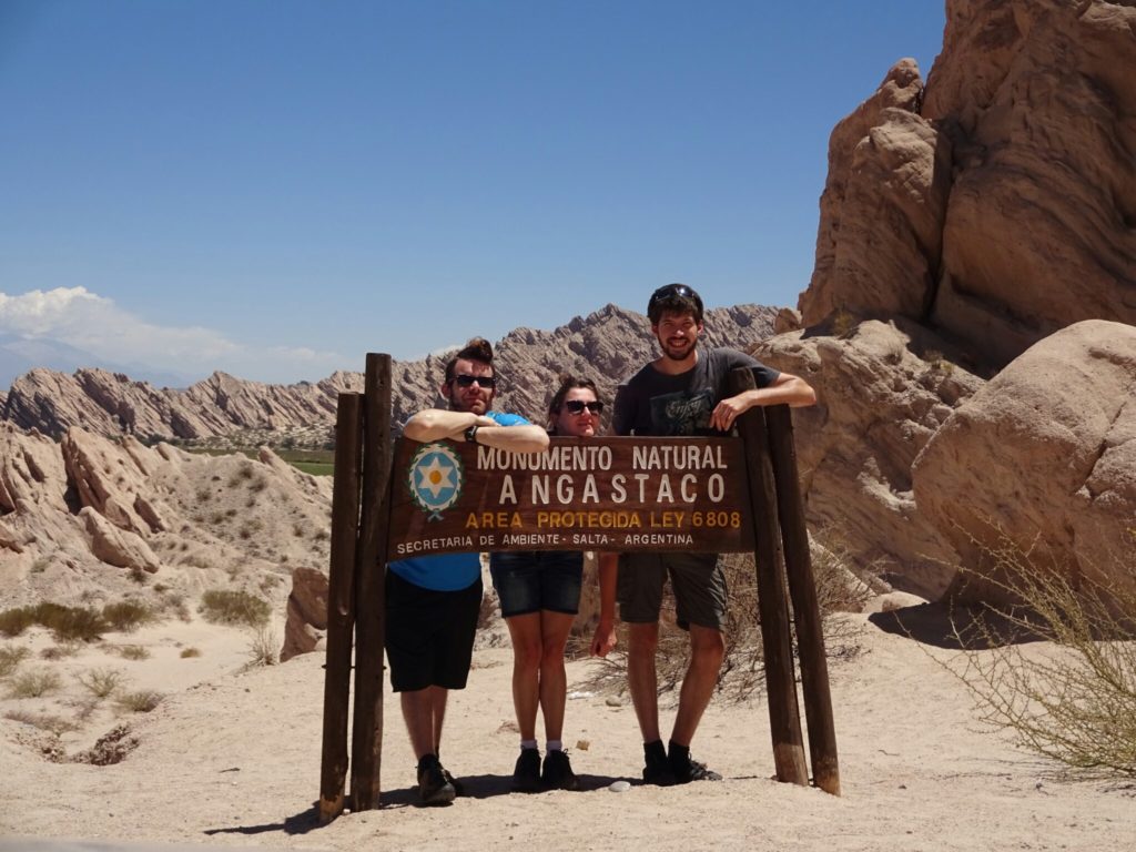
Driving through the “Quebrada de las Flechas” was an adventure by itself. Here, the color of the surrounding rocks was mostly light yellow to grey, a big contrast to yesterday’s red. The rocks were also very pointy, making the terrain look quite rough. We met a few people who had to use their spare wheel, but this time it wasn’t us.

The "Quebrada de las Flechas"
The “Quebrada de las Flechas”
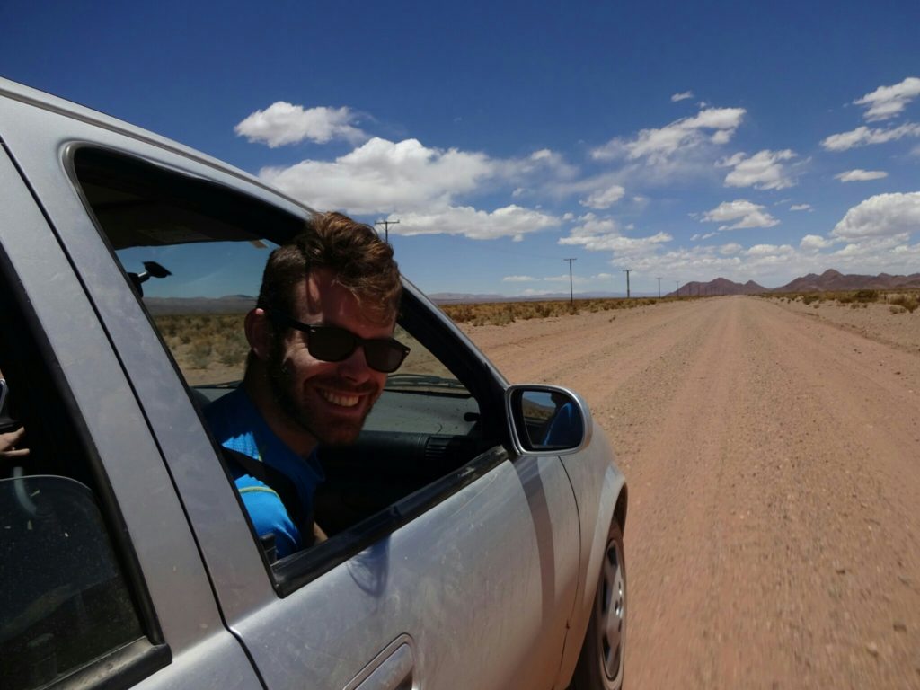
On the road with Brice and Elise

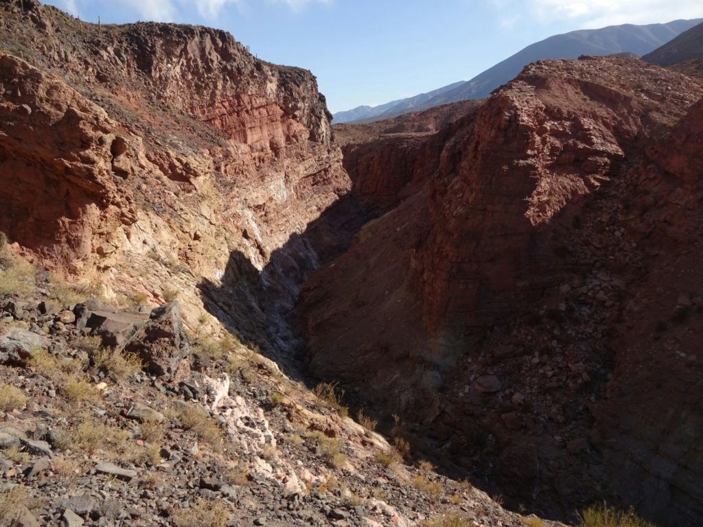
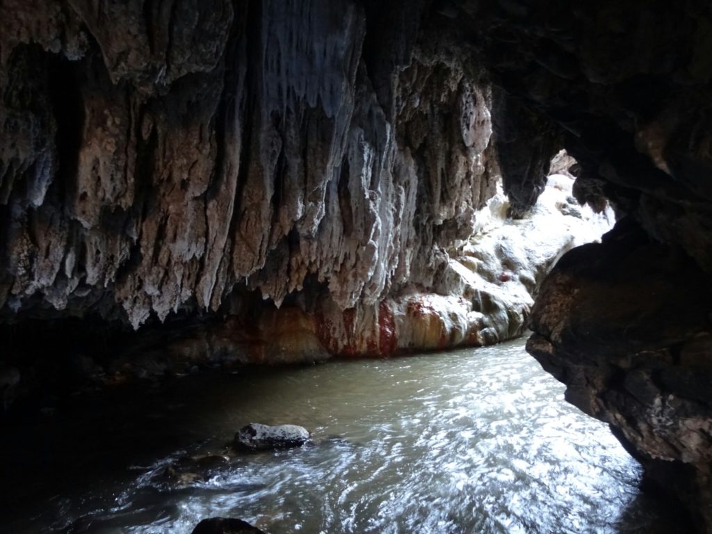
As the day continued we stopped in different places along the way, but the most exciting one coming up later in the day – the “Puente del Diablo”, the devil’s bridge. It’s a natural bridge over the river that we had been following the whole day. Here, the river flows through a small cave, where the entrance is only allowed with a local guide. If you don’t have one, you can still get some excitement wading through the knee-deep water underneath the natural bridge, which eventually leads to the cave.

The canyon at "Puente del Diablo"
The canyon at “Puente del Diablo”
The entrance to the real cave is a little further down the river

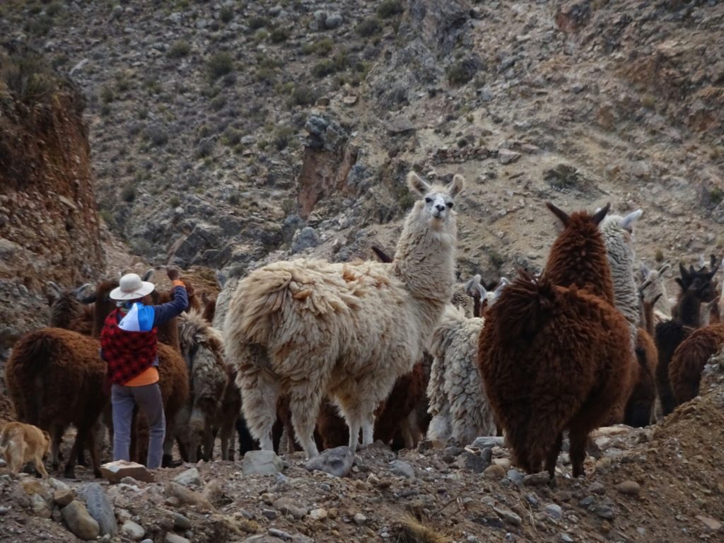
By now it was quite late in the day and we still had another 50 km left to San Antonio de los Cobres. This doesn’t seem like a lot, but it involved the passage of another mountain pass at almost 5000 m, which we didn’t know. We had expected to be high up in the mountains, but not that high. On the way we encountered a shepherd with his herd of lamas, who were blocking our way.

Driving up to the pass...
Driving up to the pass…
...we found our way blocked by a herd of llamas
…we found our way blocked by a herd of lamas

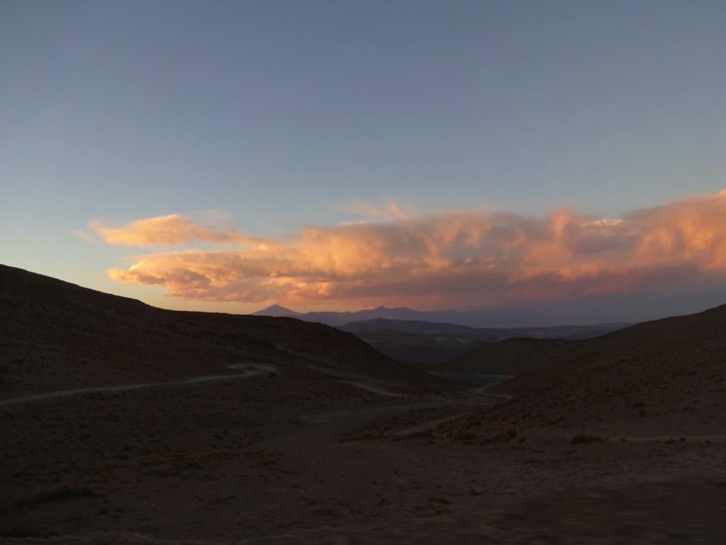
We reached the pass at sunset, where we got a spectacular view of the surrounding mountains. However, we did not stay for long, because it was cold, windy and the thin air made us feel a little dizzy. Additionally we didn’t want to drive down in complete darkness, which we managed quite well, because it only turned pitch black just outside of San Antonio de los Cobres. By the time we reached our accommodation “El Portal de los Andes”, we didn’t care if it was the portal to hell or out of it, we were just exhausted.

We almost reached 5000 m of altitude!
On the way down it was quickly getting dark.
On the way down it was quickly getting dark

Mega wat(ers)

Foz do Iguacu is the perfect location to explore the Brazilian side of the world famous waterfalls. As the river marks the border between Brazil and Argentina, there is also the Argentinean side to visit. But I’ve heard from friends that both sides are worth a visit. The former one is easily accessible by public transport, which takes you right to the entrance of the national park. From there it is necessary to take another bus inside the park to get you to the actual falls.

First sight of the waterfalls

The first sight of the falls is already impressive, as the water drops over the edge in several places – some with the full height of 84 meters, some with another level in-between. It is quite amazing when you look at it, wait a few minutes and notice that still the same amount of water is falling down every second. It is just so much water! And while you continue to walk along the edge, there are still more waterfalls you haven’t seen before.

{"total_draw_time":0,"uid":"256666d9-3e0d-416b-aaf3-e7c61020d8c5","layers_used":0,"effects_tried":0,"photos_added":0,"origin":"unknown","effects_applied":0,"brushes_used":0,"total_effects_time":0,"total_draw_actions":0,"total_editor_actions":{},"longitude":-1,"total_effects_actions":0,"latitude":-1,"tools_used":{},"fte_image_ids":[],"total_editor_time":2}
More waterfalls are to be discovered as you walk along the edge
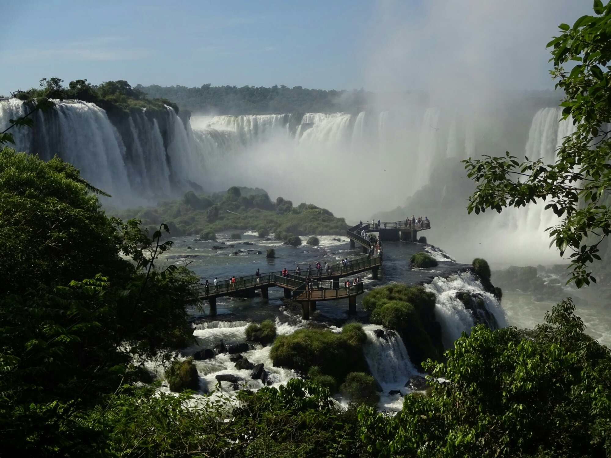
The main attraction on the Brazilian side is a boardwalk that takes you close to the center of the “Garganta del Diablo”, the throat of the devil, where you are sure to get wet just by looking at it. Or you can dare to look over the edge to see how the water must feel like just before dropping another 20 meters.

The view of the Brazilian boardwalk

{"total_draw_time":0,"uid":"149a08c5-5974-4718-9dda-4d85d726c9e3","layers_used":0,"effects_tried":0,"photos_added":0,"origin":"unknown","effects_applied":0,"brushes_used":0,"total_effects_time":0,"total_draw_actions":0,"total_editor_actions":{},"longitude":-1,"total_effects_actions":0,"latitude":-1,"tools_used":{},"fte_image_ids":[],"total_editor_time":2}
The look over the edge
But Foz do Iguacu has another attraction to offer – the world’s second largest hydroelectric dam, located on the Parana River on the border between Brazil and Paraguay. The dam and the company that manages it belong to neither country, but are part of a big national contract between the two countries. It generates enough power (14000 Mega watts) to cover nearly 20% of Brazil’s and 80% of Paraguay’s energy demand. The power plant was built in the 70s and began operating in 1984, with the last turbine being installed only in 2007, after the reservoir was completely filled.

{"total_draw_time":0,"uid":"629cc1f9-5a31-4643-8497-cb58e7c1890f","layers_used":0,"effects_tried":0,"photos_added":0,"origin":"unknown","effects_applied":0,"brushes_used":0,"total_effects_time":0,"total_draw_actions":0,"total_editor_actions":{},"longitude":-1,"total_effects_actions":0,"latitude":-1,"tools_used":{},"fte_image_ids":[],"total_editor_time":3}
The Itaipu dam
Going on the “special tour” also enables you to get a look behind the scenes – going inside the dam, looking at the control room, which is permanently vibrating under the force of the turbines and going all the way down to the generator rooms, where it is hot and noisy. And if you thought that the Iguacu Falls had a lot of water, think again, because the amount of water would only fill two of the 20 steel tubes that lead to the generators.

{"total_draw_time":0,"uid":"817b31fc-3360-4ce1-8111-9a72cfef3096","layers_used":0,"effects_tried":0,"photos_added":0,"origin":"unknown","effects_applied":0,"brushes_used":0,"total_effects_time":0,"total_draw_actions":0,"total_editor_actions":{},"longitude":-1,"total_effects_actions":0,"latitude":-1,"tools_used":{},"fte_image_ids":[],"total_editor_time":2}
The control room inside the dam
{"total_draw_time":0,"uid":"f53c4de9-fc21-41d9-9732-189f0a8943ce","layers_used":0,"effects_tried":0,"photos_added":0,"origin":"unknown","effects_applied":0,"brushes_used":0,"total_effects_time":0,"total_draw_actions":0,"total_editor_actions":{},"longitude":-1,"total_effects_actions":0,"latitude":-1,"tools_used":{},"fte_image_ids":[],"total_editor_time":2}
Two of the steel tubes carry the same amout of water as the Iguacu falls
After exploring both sights, I crossed the border into Argentina. Of course they have their own border-town, Puerto Iguazu (now with a z), mainly built for tourists visiting the falls. Again, local transport will bring you to the main entrance, but from there a little train will take you to the main attractions. Being on the first train of the day, I managed to get to the “Garganta del Diablo” ahead of everyone else, getting a superb view from the top of this large waterfall.

{"total_draw_time":0,"uid":"a502f975-9903-4af2-a89b-2363ffeea442","layers_used":0,"effects_tried":0,"photos_added":0,"origin":"unknown","effects_applied":0,"brushes_used":0,"total_effects_time":0,"total_draw_actions":0,"total_editor_actions":{},"longitude":-1,"total_effects_actions":0,"latitude":-1,"tools_used":{},"fte_image_ids":[],"total_editor_time":1}
The difference between being among the first ones at the “Garganta del Diablo”…
{"total_draw_time":0,"uid":"cd10d675-5fb9-415f-80e8-68dd5fba39d0","layers_used":0,"effects_tried":0,"photos_added":0,"origin":"unknown","effects_applied":0,"brushes_used":0,"total_effects_time":0,"total_draw_actions":0,"total_editor_actions":{},"longitude":-1,"total_effects_actions":0,"latitude":-1,"tools_used":{},"fte_image_ids":[],"total_editor_time":2}
…and arriving ten minutes later!
But the view from the “Upper circuit” was truly amazing, when you’re in line with the main section of the waterfall. When you look at it without camera, smartphone or tablet it will surely give you goosebumps! And if that’s not enough, there are cute and crazy coatis, wild toucans and even a waterfall to take a bath.

{"total_draw_time":0,"uid":"a54031e5-87c1-4287-9d03-f2f94e47a112","layers_used":0,"effects_tried":0,"photos_added":0,"origin":"unknown","effects_applied":0,"brushes_used":0,"total_effects_time":0,"total_draw_actions":0,"total_editor_actions":{},"longitude":-1,"total_effects_actions":0,"latitude":-1,"tools_used":{},"fte_image_ids":[],"total_editor_time":2}
Nothing short of magical
{"total_draw_time":0,"uid":"bca463a2-92c7-4f93-b530-f87d192ab280","layers_used":0,"effects_tried":0,"photos_added":0,"origin":"unknown","effects_applied":0,"brushes_used":0,"total_effects_time":0,"total_draw_actions":0,"total_editor_actions":{},"longitude":-1,"total_effects_actions":0,"latitude":-1,"tools_used":{},"fte_image_ids":[],"total_editor_time":2}
Crazy coati waiting for some food
{"total_draw_time":0,"uid":"08257cb5-952a-4f67-9df9-bd3f37d2b783","layers_used":0,"effects_tried":0,"photos_added":0,"origin":"unknown","effects_applied":0,"brushes_used":0,"total_effects_time":0,"total_draw_actions":0,"total_editor_actions":{},"longitude":-1,"total_effects_actions":0,"latitude":-1,"tools_used":{},"fte_image_ids":[],"total_editor_time":2}
Wild toucan enjoyong the quietness of the jungle
{"total_draw_time":0,"uid":"84f302e2-d553-4c25-9383-d588bff67dc2","layers_used":0,"effects_tried":0,"photos_added":0,"origin":"unknown","effects_applied":0,"brushes_used":0,"total_effects_time":0,"total_draw_actions":0,"total_editor_actions":{},"longitude":-1,"total_effects_actions":0,"latitude":-1,"tools_used":{},"fte_image_ids":[],"total_editor_time":4}
Taking a shower under one of the smaller waterfalls