
From the Atlantic coast we turned inland to visit the “Kejimkujik National Park”, which had been established before the land at the sea had been acquired. It consists of several larger lakes, which are connected by rivers. At the shore of the largest lake are also some indigenous petroglyphs, making it a site of national importance that led to the declaration as a “National Historic Site” at the same time.
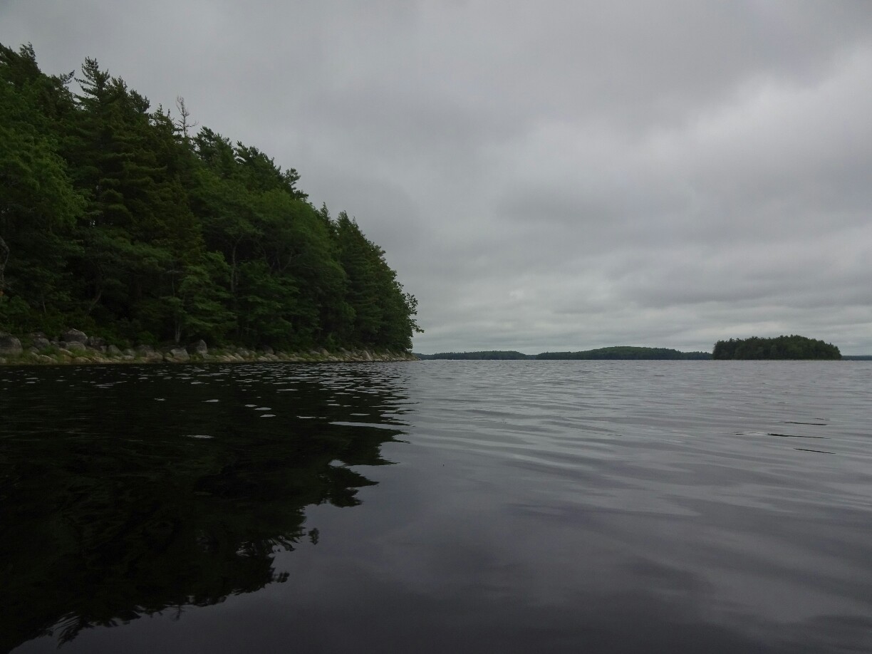

Unfortunately all the tours to the petroglyphs were booked out, so instead we decided to rent a kayak to explore the lake on our own. I was surprised well it worked, considering that I had cracked my clavicle just about a month ago. When we entered the lake we could hear nothing but the sound of the waves and the birds. We paddled around some little islands until we landed at a tiny beach and claimed “The Sisters”, a small and long stretched island, before heading back out.


In the afternoon we continued our journey north until we got to the shores of the Bay of Fundy, where the world’s highest tides can be experienced. The difference between high tide and low tide is more than 10m for most places around the bay, twice per day, everyday! But when we arrived at our campground in Whale Cove we couldn’t see anything through the thick fog. We had no choice but to hope for better weather for the next day.

The weather was still foggy when we got up the next morning. We decided to take the ferry to Long Island anyway, since the forecast promised the clearing of the clouds for midday. So when we got to the Tiverton lighthouse it was no surprise to hear the deafening sound of the fog horn about three times per minute, warning the incoming ships of the rocky coastline. We took our pictures as fast as we could and tried to get away again as soon as possible.


The main reason why we had come to this island was waiting for us at the next stop – the “Balancing Rock”. We had seen pictures of it and wanted to see it for ourselves. After a short hike we had reached the side of the island facing St. Marys Bay. A set of stairs took us down the cliffs, where a large basalt pillar was sitting on a protruding edge. It looked pretty neat with the blue sky, which had come out in the meantime, and the mist that was still hanging over the water.


After a quick lunch break back the car, we decided to hike out to the other side of the island facing the Bay of Fundy. Once again we were almost the only ones on this trail, which was covered with branches and a bit muddy. This time the silence was filled with the sound of dozens of mosquitos and horse flies that were buzzing around our heads. Luckily the breeze at the water was strong enough to keep the away while we were enjoying the view.

Back on the mainland we headed for Annapolis Royal. It’s one of the oldest towns in Canada and was founded by the French in the early 17th century as Port Royal. During its relatively long history it changed hands many times between French and British forces and used to be the capital of Acadia, mostly French settlements in what is now Nova Scotia and New Brunswick. Today the large fortified walls and the former barracks are a silent remainder of these troubled times.


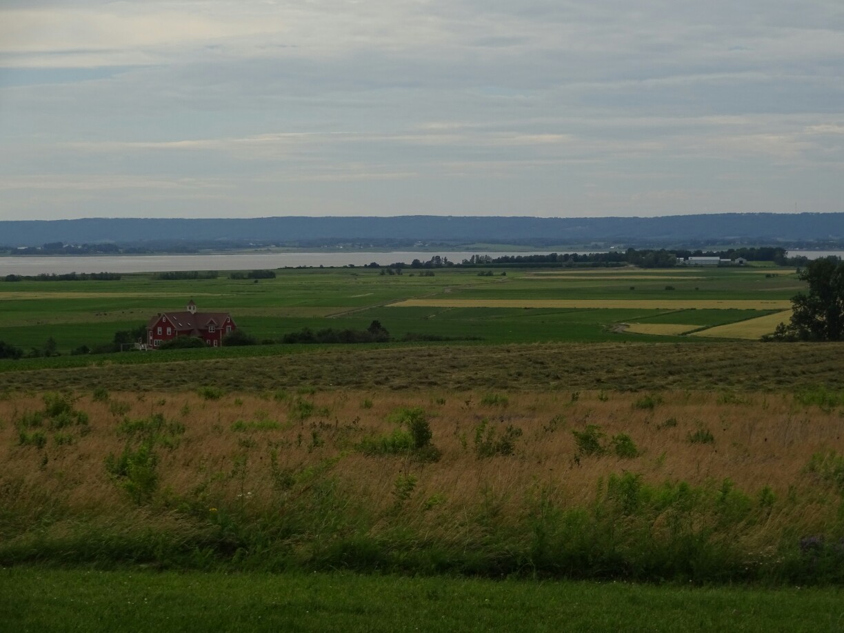
The next day we continued through the Annapolis Valley, where most of Nova Scotia’s fruit and vegetable farming takes place, which is why we stopped for strawberry picking and wine tasting along the way. Despite having a harsh winter, there are many vineyards in the area, most of them producing white wines. In 2012 a special appellation blend was created known as “Tidal Bay” using only grapes grown in Nova Scotia.

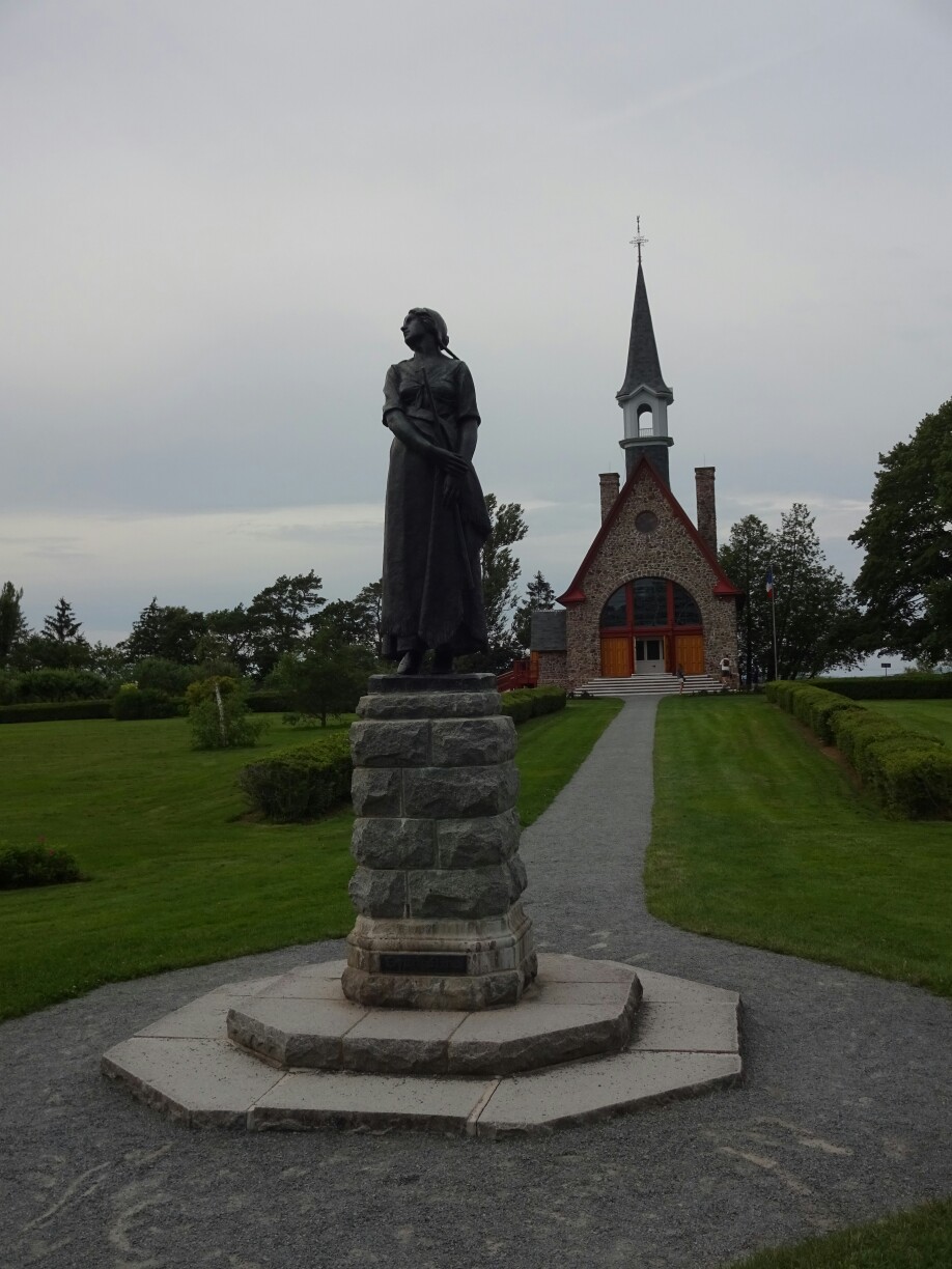
At the end of the valley we visited the “Grand Pré National Historic Site” commemorating the deportation of Acadians during the French and Indian wars in the late 18th century. The Acadians were neutral, but they were seen as a potential threat to the British, who had taken over Nova Scotia by that time. Anyone who didn’t swear allegiance to the British crown was forced to leave. An interesting display, a historically reenacted movie or self guided tour through the area provides more detailed information.
That night we found ourselves a campground high up on the cliffs of the “Blomidon Provincial Park”. We set up the tents and found a nice spot for dinner from where we could watch the beach and the red rocks, which seemed to be aglow during sunset. Afterwards we tried to chase the water of the Bay of Fundy, where we had to walk out quite far, as the water had receded at low tide to reveal a large sandy beach.

